
These spectacular NASA images remind us why we must save our planet


It's Earth Day today and there's no better way to celebrate it and our planet than to gaze at some of the most magnificent images of Earth and live footage from National Aeronautics and Space Administration (NASA).
Earth Day was first celebrated in 1970 in reaction to a huge oil spill in Santa Barbara. It was then marked by several initiatives to protect Earth and its environment. Earth Day is widely recognised as the beginning of the modern environmental movement.
This particular Earth Day becomes more significant as leaders from 160 countries will officially sign the Paris Climate Agreement.
Though everyday at NASA is a Earth Day, these beautiful images captured from space by the world's largest space agency serve as a reminder that making everyday Earth Day is of paramount importance.
Take a look at these magnificent and artistic photographs captured from space and enjoy planet Earth from a never-before-seen perspective:
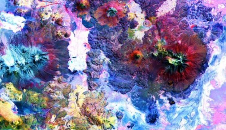
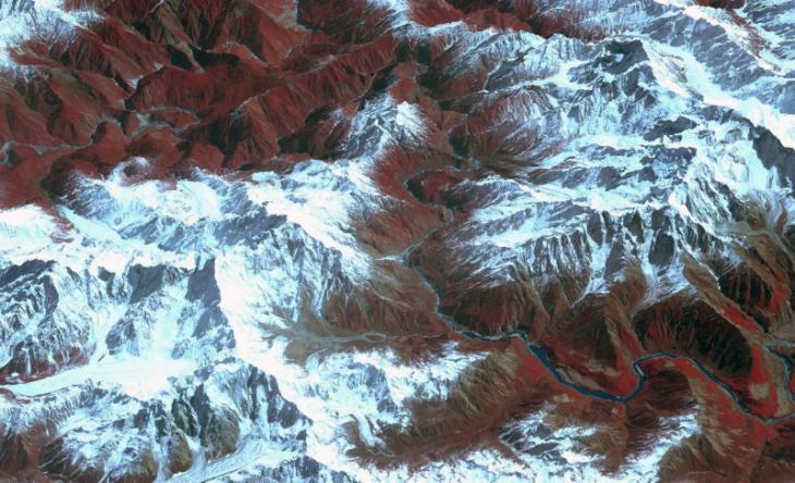
The Andes Mountains along the Chile-Bolivia border. The visible and infrared data have been computer enhanced to showcase the color variations in the different materials
(Photo Credit: NASA GSFC, MITI,ERSDAC, JAROS, and U.S./Japan ASTER Science Team)
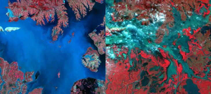
Evaporation of Poyang Lake in China between July 14, 1989 (left, Landsat image) and October 3, 2015 (right, ASTER image)
(Photo Credit: NASA GSFC, MITI, ERSDAC, JAROS, and U.S./Japan ASTER Science Team)
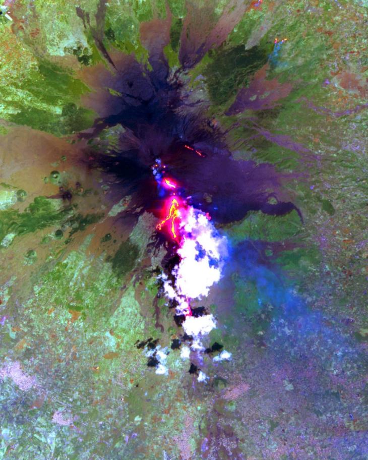
Lava pouring out of Mount Etna in Sicily during the summer of 2001
(Photo Credit: NASA GSFC, MITI, ERSDAC, JAROS, and U.S./Japan ASTER Science Team)
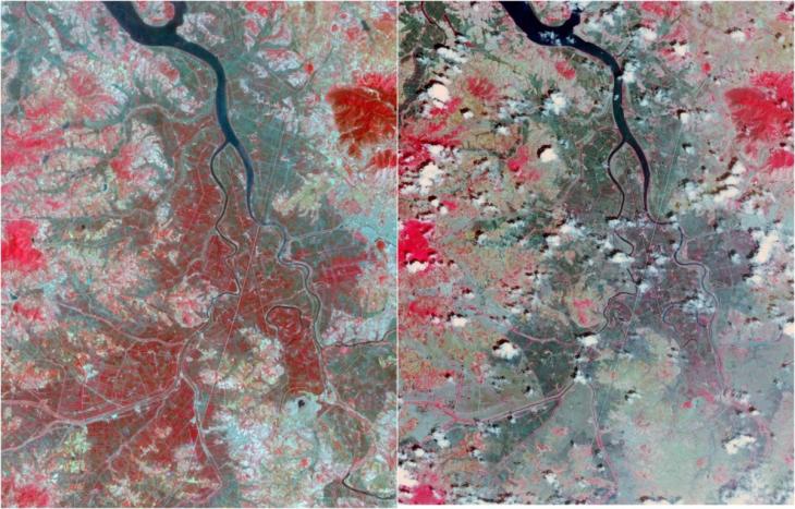
In 2015, Korea experienced its worst drought in 100 years. This image shows the levels of vegetation in red in 2015 (right) compared to 2002 (left)
(Photo Credit: NASA GSFC, MITI, ERSDAC, JAROS, and U.S./Japan ASTER Science Team)
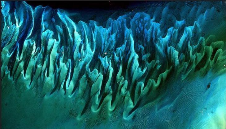
Ocean Sand, Bahamas. Though the above image may resemble a new age painting straight out of an art gallery in Venice Beach, California, it is in fact a satellite image of the sands and seaweed in the Bahamas.
(Photo credit: NASA Goddard Space Flight Center)
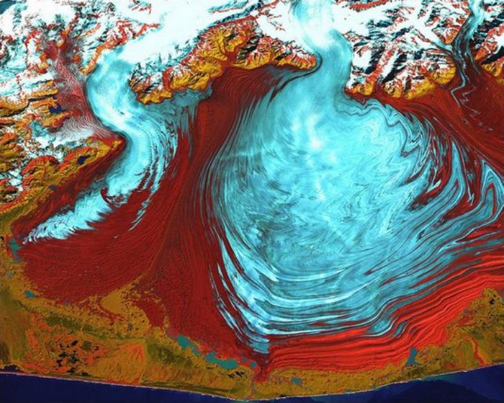
The tongue of the Malaspina Glacier, the largest glacier in Alaska, fills most of this image.
(Photo credit: NASA/Landsat)
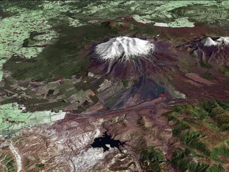
A towering, active stratovolcano (the classic cone-shaped volcano), snow-capped Ruapehu Volcano in New Zealand is pictured in this enhanced-color image.
(Photo credit: Landsat data provided courtesy of the University of Maryland Global Land Cover Facility)
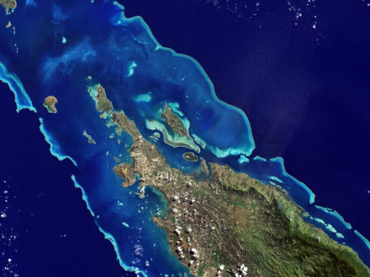
Lagoons and Reefs of New Caledonia
(Photo credit: NASA Goddard Photo/Flickr)
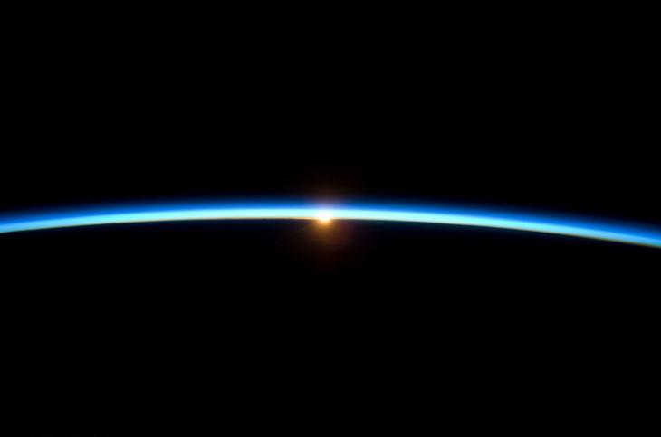
Sunset Over Earth NASA, International Space Station Science
(Photo credit: NASA's Marshall Space Flight Center/Flickr)
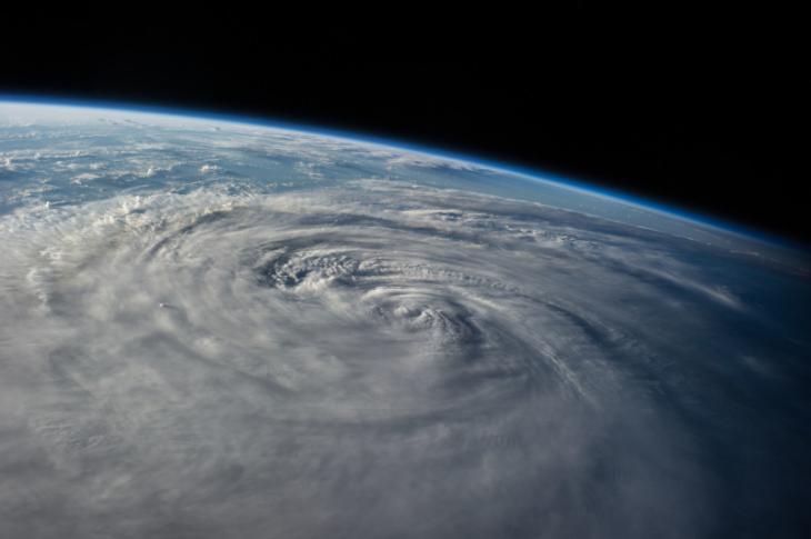
Typhoon Halong, NASA, International Space Station
(Photo credit: NASA's Marshall Space Flight Center/Flickr)
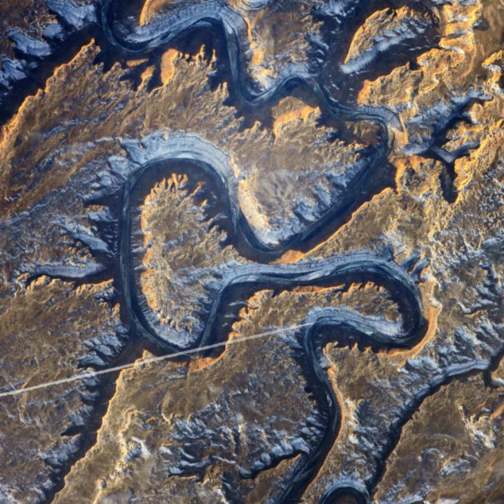
Bowknot Bend, Utah, NASA, International Space Station
(Photo credit: NASA's Marshall Space Flight Center/Flickr)
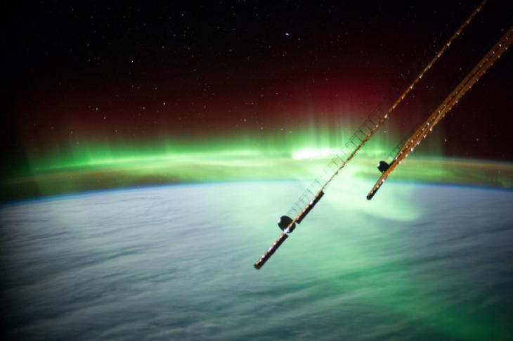
Aurora Near Australia, NASA, International Space Station
(Photo credit: NASA's Marshall Space Flight Center/Flickr)
The Yarlung Zangpo Grand Canyon (or Tsangpo Gorge) in Tibet is the deepest canyon in the world, and longer than the Grand Canyon.
(Photo credit: Universal History Archive/UIG)
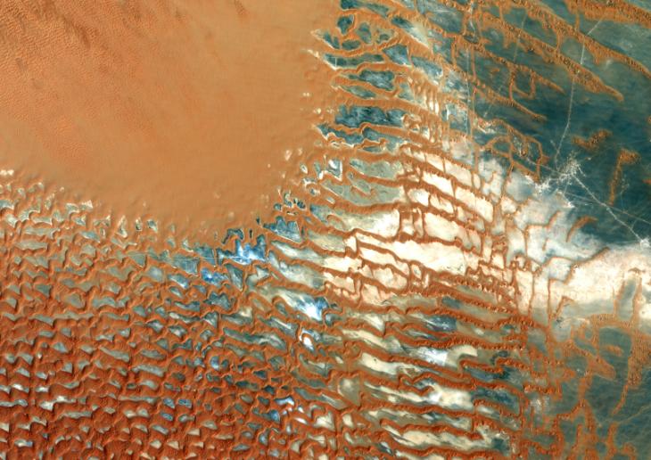
Rub Al Khali, a sand desert South East of Saudi Arabia ; sand dunes are sculptured and moved by the winds, in blue the argillakeeous subsoil, and in white the salt crusts left out by the oueds in the rainy season., Rub Al Khali Desert, Saudi Arabia, True Colour Satellite Image.
(Photo credit: Planet Observer/Universal Images Group)
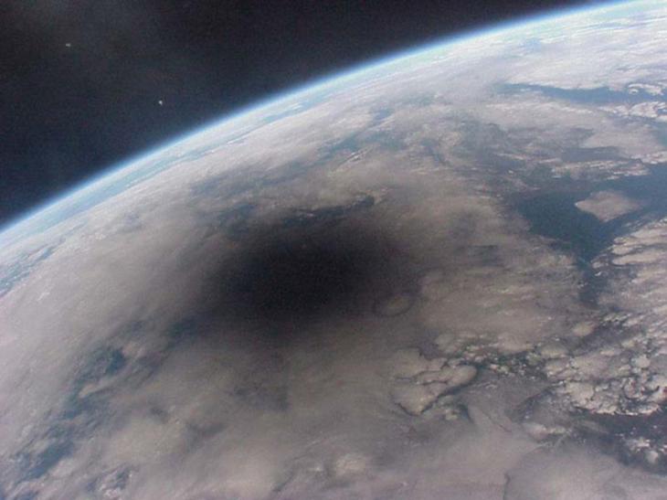
A view of the Earth during a solar eclipse. The shadow of the Moon can be seen darkening part of Earth. This shadow moves across the Earth at nearly 2,000 kilometers per hour. Only observers near the center of the dark circle see a total solar eclipse - others see a partial eclipse where only part of the Sun appears blocked by the Moon. This spectacular picture of the Aug. 11, 1999 solar eclipse was one of the last ever taken from the Mir space station. Mir was decommissioned after more than ten years of use.
(Photo credit: Centre National d'Etudes Spatiales, NASA/SSPL)
Happy Earth Day!
First published: 22 April 2016, 12:10 IST


![BJP's Kapil Mishra recreates Shankar Mahadevan’s ‘Breathless’ song to highlight Delhi pollution [WATCH]](http://images.catchnews.com/upload/2022/11/03/kapil-mishra_240884_300x172.png "BJP's Kapil Mishra recreates Shankar Mahadevan’s ‘Breathless’ song to highlight Delhi pollution [WATCH]")

![Anupam Kher shares pictures of his toned body on 67th birthday [MUST SEE]](http://images.catchnews.com/upload/2022/03/07/Anupam_kher_231145_300x172.jpg "Anupam Kher shares pictures of his toned body on 67th birthday [MUST SEE]")


