• Accueil
  • > Tourisme de montagne Atlas marocain

Middle Atlas with Yves and Catherine Biville (June 4-9, 2011)

Posté par Michael Peyron le 18 décembre 2011

Talk about short turn-around time! No sooner had we parted company in Marrakesh with Eric and Michel than this writer had to hunker down for a few days to recuperate, what with five grueling GTAM stages behind him and his cardiac rehabilitation plan into its 10th month.

There were indeed further Atlas walks just around the corner. Another team from the French Alps were due in Casablanca on June 2, and a formidable combination at that. No less than Yves Biville, late of the Chasseurs Alpins and an Atlas veteran backpacker in his own right, plus his nimble, easy-striding spouse, Cathou.

A pleasant social occasion linked the Zat-Ourika outing and the forthcoming Middle Atlas stint, when, on the evening of Friday, June 3, we wined and dined both parties (the more so as they were no strangers to each other) at our place in Rabat.

June 4th, 2011 Road to Khenifra

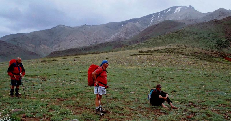
Next morning, in sunny weather, the present writer left for Khenifra with the Bivilles in a Citroen Berlingo van. Just beyond Meknes we had a kebab snack in Boufekrane. Kebab (brochettes in Fr.) snacks in Morocco are no longer what they used to be. Gone the days when one could indulge in memorable brochette stops, sampling tasty skewered meat at unpretentious little bistrots in Settat, Ben Guerir or Khemisset. With the coming of the motor-way and mass motor-travel, swanky eating places have proliferated, announcing a marked decline in quality. Nowadays, it’s usually a case of getting cheerfully ripped off and driving on with a sour taste in one’s mouth!

A long haul followed through the Adarouch pastures and Zaïan azaghar. Some 20 km short of Mrirt a collection of arid, steep-looking hills enabled us to work off our unsatisfactory lunch. For an hour or so we tramped the slopes past herds of sheep and goats beneath greying skies, while thunder growled far to the west.

It was time we were back on the road. The first rain-drops fell as we started off across the plateau S of Mrirt. By the time we were at El Borj it was really coming down in buckets, forcing us off the road for a few minutes till the downpour had spent its strength. Half an hour later, having earlier booked rooms by ‘phone, we were checking in at the “Atlas Zayane Hôtel” in Khenifra.

Middle Atlas with Yves and Catherine Biville (June 4-9, 2011)  dans General 05_khenifra-300x203

Hotel Zayane Khenifra

A strange, rambling building this, it comes within an ace of being a first-class hotel. This writer had never actually stayed there, but the Bivilles, who had been there before, said the place had been improved; largely thanks to a new wing, while the rooms had been re-done in fairly pleasant style. The reasonably welcoming ladies at the reception, however, would do well, when talking to guests, to tear their eyes away from the TV monitors on the wall behind their desk.

Full marks for the finely-appointed restaurant, with an unbeatable view over Khenifra town and cattle egrets winging home from distant, storm-beaten hills, expertly run by a personable young waitress-cum-maître d’. A brief exchange in Tamazight established that she was a tazayyit (woman from Zayan tribe), that our order would be honoured by the chef, and that palatable food would shortly be served. She proved as good as her word and a decent meal soon appeared, washed down with vino.

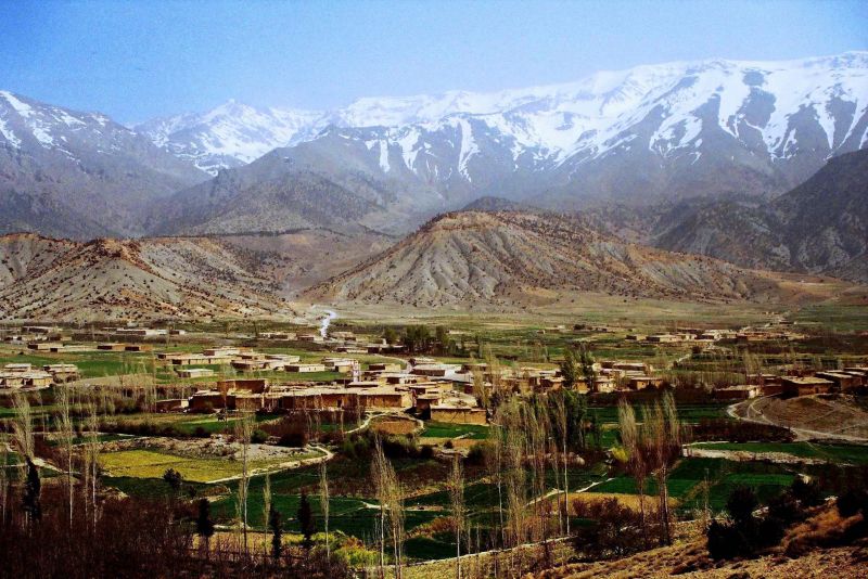
Two factors precluded early sleep: 1) the night-club which predictably and typically (50% of local hotels’ mark-up is accounted for by late drinking) did its worst, though luckily situated at the other end of the establishment; 2) a crowd of supporters who greeted with cheers each and every move of some foot-ball match in the TV lounge. Meanwhile, it rained most of the night, casting doubts over the morrow’s planned excursion to investigate the hill of El-Gara, some 10 miles E of Khenifra, and a potential Qala’at al-Mahdi site.

June 5th, 2011Visit to El-Gara

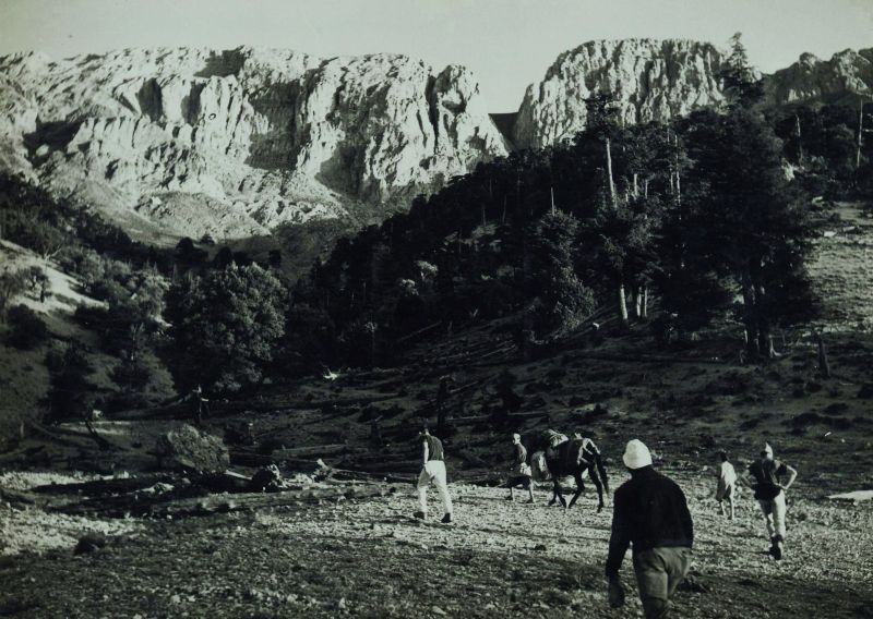
We need not have worried. A hearty breakfast soon sent us on our way under a cloudy sky, but at least the rain was holding off. On reaching Pt-1027 on the Agelmam Azigza road we parked the car on the soft shoulder and lost little stamping off down the muddy track. After a couple of hundred yards a huge puddle involved a detour through olive groves to the R. Past the cactus we went and down a tunnel-like path to cross Asif  Ayt Nuh, then upwards opposite through dispersed hamlet.

Luckily, we met a friendly Berber woman who, on being asked the way to El- Gara, took the trouble to escort us for ten minutes up the slope, before saying goodbye with a brief: “Keep on uphill left to the col, then turn right and you’ll see El-Gara ahead of you.”

We zigzagged upwards through oak and juniper forest into a gully below Aamira’s cliffs (apparently a nesting-site for Lesser kestrels), over a narrow, rocky col. El-Gara hill now in full view about one km to our right. Reaching it entailed negotiating a squelchy path down to the edge of forest; then across open expanse, skirting wheat-field to lone house with satellite dish and corrugated iron roof. A couple of Berber ladies confirmed we were on course.

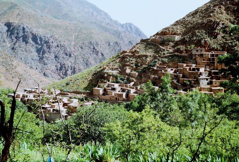
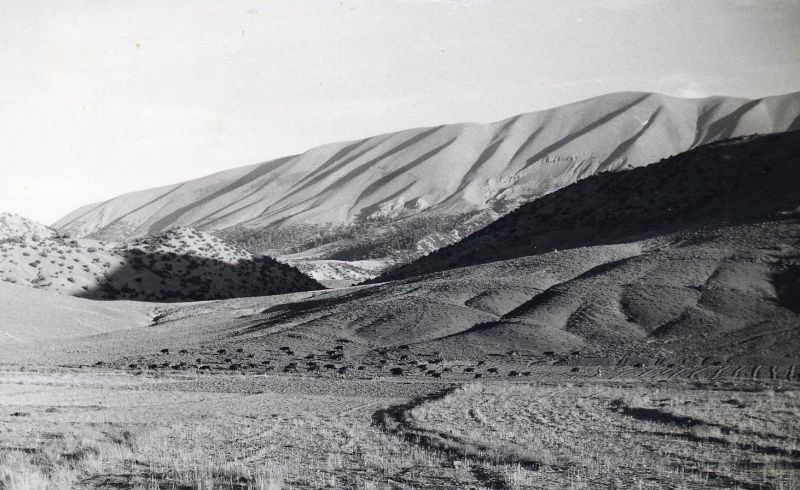
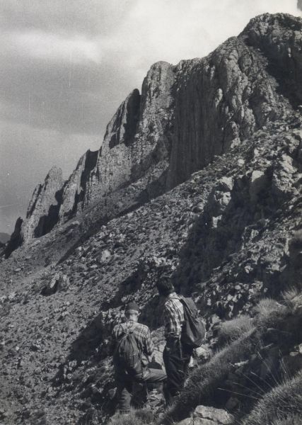
Now along a broad tree-lined track with wheat-fields to our right. Here we reached another house and were kept on course by a helpful local housewife who suggested we make a bee line for El-Gara, which entailed a downer and an upper across a grassy-steep-sided valley. There followed a thistly field. By now portions of ancient fortification were poking out of the evergreen oak mantle ahead. We had reached a rival Qala’at al-Mahdi site – rival, that is, to Zawyat Ifrane (visited four times by this writer) near Mrirt, and previously judged to be the genuine article.

13_El_Gara_detail_redan1-300x203 dans Tourisme de montagne Atlas marocain

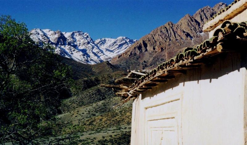
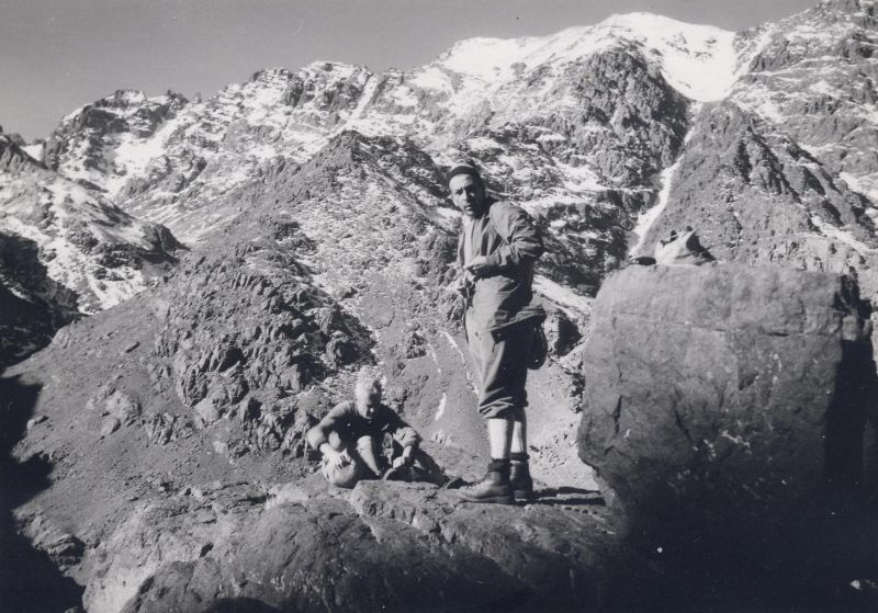
Part of El Gara fortifications

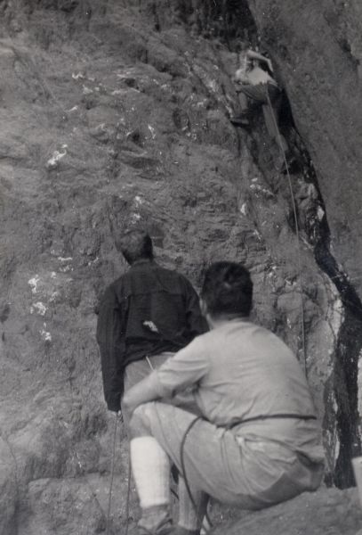
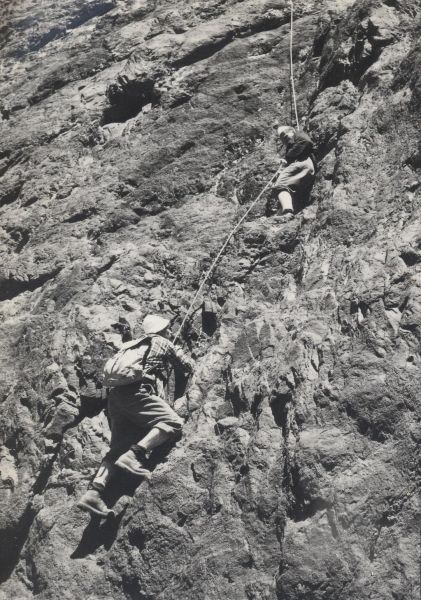
For the next hour we examined portions of a medieval wall, in places presenting signs of workmanship remarkable for the period, elsewhere in a sorry state of disrepair, especially where the locals had been helping themselves down the years to building material. It was clear that this fortified ensemble had, at one time, cordoned off the entire hill. The most impressive part was a sort of citadel, requiring some energetic scrambling to reach its top, with an almost vertical drop to Oued Chbouka below and a bird’s eye view of Agelmam Oumlil, the surrounding hills and Adekhsan plain to the W. While defences on the Chbouka side appeared impregnable, it was clear that a determined enemy could launch a decisive assault across wheat-fields on the W flank of the hill; which was probably the angle of attack chosen by the Almohads when they wrested this fortress from the Almoravids.


Or, at least, that is the version preferred by French researcher Arsène Roux, who (like this writer) judges that Zawyat Ifran and the Tisgdelt plateau (some 15 km NE of Mrirt) better fit historical descriptions of the Qala’at al-Mahdi site. According to Roux, El-Gara was merely a large Almoravid fortress built at a slightly later period than the 11th -century Qala’at al-Mahdi. However, Dumas, another Frenchman who visited in 2004 with local man Saïd Jaafar, is convinced that El-Gara is the genuine Qala’at site. Serious archeological investigations on both sites will obviously be required before the enigma can be unravelled.

Leaving El-Gara hill to its choughs, ravens, vipers, sheep and goats we struggled back down through the oak forest, and reversed that morning’s route across wheat-fields, walking at a slightly faster pace in an attempt to beat the rain. Making excellent time we nonetheless lost the race to king-size thunderheads that discharged their contents within 10 minutes of where we’d parked the car. Long enough to get well and truly soaked.

We managed to dry off in the car with the heater on and headed N for Azrou, where we’d booked rooms at the “Hôtel des Cèdres”. We shared the place with a few other tourists, including two middle-aged, visibly naughty-weekending French couples who dropped in for dinner at the downstairs restaurant. Then it was early to bed in centrally-heated rooms.

June 6th, 2011 From Azrou to Oued Zloul

As we left Azrou next morning white clouds were sailing past in a blue sky with the temperature down to 2°C. A first stop at Ougmès revealed an almost empty, castle-like Emirati Euro Camping ground. From the brochures handed out by local staff we gathered the establishment catered mostly for boozing, gut-bashing European senior citizens during the winter months; plenty of parking space for their camping cars, at any rate.

Driving on, we stopped at the “Green Door” in Ifran to purchase a couple of bottles of the local vintage as you never know when the vino can come in handy in this kind of freak spring weather! Sure enough, once we’d admired stilts and great-crested grebes at Dayet Awa, unwelcome clouds and the first rain-drops invited themselves to our picnic lunch near Oued Sebou.

Pushing on we arrived around 2pm at the house of our Berber friend Ayad Kerouach, near Oued Zloul at the foot of the Ahermoumou escarpment. Our initial plan to drive on up to the Taffert Hut went up the creek as Ayad talked us out of approaching Bou Iblan, given the present, unsettled weather and negative reports regarding condition of access road. Oh well, some you win, some you lose. You can’t win them all!

So we decided to ride out the unfavourable weather. In the meantime, to work up an, appetite for dinner, Ayad took us for a walk through the surrounding countryside. He seemed particularly heartened by signs that pressure from man and beast on the local vegetation appeared to have abated somewhat.

June 7th, 2011 Bou Iblan foothills

 Next day prospects were distinctly brighter with a cheerful combination of cloud and sunshine evenly distributed across the sky; so after breakfast we boarded the ‘Berlingo’ and made for the hills.

Rather than head off hell-bent for the main Bou Iblan range, Ayad suggested we attempt Ich Ramouz (2.365m), one of its NE outliers, via the Beni Sohan Forestry Hut and Mdawd village.

The subsequent outing developed into a classic, adapting-to-the-weather exercise. At first, all went smoothly. Reaching the Forestry Hut we kitted up and headed through the mixed growth forest towards Mdawd. En route we admired some wild boars frolicking behind a chicken-wire fence – apparently a game reserve of sorts where, for a consideration, wealthy “sportsmen” could come up from Fez and blast the living daylights out of the hapless local swine. Some “sportsmen”…

In fine fettle we strode energetically along the track, reaching a shallow col above Mdawd in less than half an hour. It was now 11:00. The sun was high and bright, everything seemed fine and dandy, while the present writer was apparently making light of the gradient. Beyond some isolated houses and gardens with a profusion of vine, cactus and fig, Ayad led the way up a rough trod over gradually steepening slopes to the left (ENE). Above us loomed Ich Ramouz. At that moment as they made for the heights, a small group of Berber muleteers overtook us, and we exchanged greetings. Ominous clouds were now gathering above. At 11:40 the first squall hit us. Visions of wandering, soaked and spirited, across the Ich Ramouz slopes rapidly convinced us that discretion was the better part of valour. Back down we went while the Berber muleteers disappeared above into the lowering cloud-base.

Rather than lamely descend to Mdawd, Ayad worked his way right till we hit the tree-line – actually a vast pine plantation clothing entire NE slope of Ich Ramouz. The upper portion consisted of Canary Island pine, the remainder of Aleppo pine. This part was fun? Wrapped up to the eyes in foul-weather gear we galloped downhill, twisting and turning through the trees. As a former forester Ayad had completely recovered his woodland feel and expertly guided us from spur to spur, across intervening ravines and forest paths, the ground comfortably carpeted with pine needles. Occasionally, we would stop and gaze back uphill to where the cloud-base had dropped even lower. “Good thing we weren’t caught back up there in those clouds!” Yves shrewdly observed.

Half an hour later, to conclude our “raiders of the pine forest” stunt, we emerged from a final stand of Canary Island pine onto wheat fields which we skirted till the dirt road (tufna < Fr. ‘tout venant’) was reached. The Forestry Hut was just beyond. Bunching together under a large pine tree to escape on-going drizzle we settled down to a well-earned picnic.

The meal over we pushed on along the tufna track to Beni Zehna, but rain and mist remained unrelenting. There was nothing for it but return tamely to Ayad’s house in the Zloul for more of his lavish hospitality, dry out by the fire-place and read a book till dinner.

June 8th, 2011 Tizi n-Tigoulmamin

Next day finally dawned fine. But after breakfast our, paths diverged: Ayad had to go down to Fez on business; we had been planning to make for Skoura n-Ayt Seghrouchen to check out a new lodge we’d heard about. On Ayad’s instructions we followed the narrow, winding Zloul road towards El Aderej, turned off right after a few miles and headed towards Oued Mddez. All plain sailing until the road became a track and we found, ourselves bumping down towards the river. After crossing the Mddez there was more dirt track before we found the tarmac of the Tazouta-Skoura road. Apparently all the fuss was connected with a dam-building project. Saw congregation of about 60 Black kites and Rough-legged buzzards along this stretch of road, seemingly attracted by some nearby carcasses.

Ahead of us, bathed in bright sunshine, rose the gaunt backbone of Jbel Tichchoukt as we sped along the road with hardly enough space to pass on-coming vehicles, of which there were mercifully few. We then drove through what has to be one of the densest concentrations of olive-groves in Morocco, till suddenly around noon, we were at the entrance to Skoura. Aiming to park somewhere near the Tadout plateau that overlooks Skoura, we turned sharp left up the slope, following the tarmac past the main square with its taxi rank. Then uphill again, noting for further reference a very steep track and signpost indicating “Gîte Skoura”, until a couple of km beyond Skoura we reached a turning in the road with plenty of parking space on the right, near entrance to track leading to Tadout Forestry Hut.

After a brief picnic we kitted up and looking beyond thinly wooded slopes to Tichchoukt main ridge, noticed a likely-looking notch standing out proudly against the azure sky, at the point where it declined to the E, actually Tizi n-Tigoulmamin. This, we decided, would be our afternoon objective.

After an initially uninspiring boxwood gully, open fields lying fallow and an occasional sheep or two in the distance, we zigzagged up gentle slopes sparsely strewn with evergreen oak. Plenty of grass about, though, actually increasing as we gained altitude. Above the tree-line, the slope evened off, ushering us onto a spacious grassy bowl with several herds of sheep and goats grazing in the vicinity.

Tizi n-Tigoulmamin derives its name from the tarns that adorn it – one of them still filled with water on this occasion, and a sign that it had been a rainy spring. After saluting some friendly young shepherds and their surprisingly mild-mannered dogs, we crossed the pasture and followed an obvious trod trending right at the S end of the pass. Half way up the slope we crossed some rocks and emerged onto the ridge proper. We’d been walking a couple of hours or so – quite enough for that day. Before returning we admired the stupendous view, this being the first truly fine day in a week! Tichchoukt continued SW and up into the blue; we could see to the N the arid Mddez plain; due E to cloud-veiled Bou Iblan and S to El Mers, towards which snaked the ribbon of road we’d followed on foot back in 1984, when it was still a track. The times they are indeed a-changin’!

We retraced our steps uneventfully across the pass, past a few scrawny trees and eventually to the car left unattended by the roadside. Nobody had touched it. Now to see what this new Skoura lodge was like. Off we went down towards the village. In no time we were confronted with the aforementioned signpost and an uncompromisingly steep, stony track. Launching our plucky little ‘Berlingo’ uphill we climbed with some trepidation for about half a mile until we were just below the edge of a cliff, down which spattered a sizeable waterfall.

We now discovered a small, red-brown, Kasbah-like building – recognizable as the gîte from photos seen on the Internet. Despite the unprepossessing track we had made it to home base with no apparent damage to our vehicle. Parking space, however, is at a premium, not that this gîte could handle more than three car-loads of guests at any one time! As it was about 5pm we decided to unload our things, looking forward to an early dinner and quickly to bed.

June 8th, 2011 (evening), Skoura gîte

Wrong address for that kind of expectation, I’m afraid; the situation took time, a lot of time to unwind. In fact, the whole operation was handled in a delightfully casual, informal manner, so much so, that we felt we were dealing with out-and-out amateurs who’d suddenly decided to go in for inn-keeping.

We had booked by ‘phone, someone whom we’ll call Mostafa handling our call. Naturally expecting to meet the aforesaid Mostafa we climbed up to the lodge, only to find it empty. After a few minutes a middle-aged Berber woman, Rkia by name, appeared and informed us that Lhoussein would soon arrive. That worthy put in an appearance another five minutes later and friendly conversation in Tamazight ensued. Yes, of course, we could settle in; and early dinner, no meat, just vegetables or eggs? Why, of course, no problem, ur illi ca n muckil! A youth now appeared and he introduced him us to as: han u-tada nu, “this is my milk-brother”; all nice, informal and friendly.

From the terrace of the lodge, dodging occasional spray from the waterfall, we gazed uphill at steep slopes, terraced fields, hill villages and the Tichchoukt main ridge. Lhoussein waxed eloquent: “You’re only spending one night? What a pity! Come back next year and we’ll visit these hills together!” Shortly afterwards he disappeared, promising that we’d have dinner well before 8 pm – and we never saw him again – not that we ever got round to seeing the elusive Mostafa, either!

Lhoussein had gone and left u-tada holding the baby. So we relaxed on the plush cushions and carpets of the main guest-chamber. Well, after dark, around 8 pm, we strolled upstairs to the kitchen and discovered that a quite unexpected cooking staff – u-tada, his hijab-wearing fiancée and a handsome, swarthy middle-aged lady – were preparing a totally different dinner from what we had ordered.

Well, to cut a long story short, we eventually dined quite nicely around 9:30 pm and then repaired to bed. The bed-room, compared with the amateurish fumbling of the staff, was all that tired back-packers could have hoped for. Curtained windows, wall-to-wall carpets, comfy little rug-covered beds – a real gem! A lot of thought had obviously gone into designing this lodge, as we noticed when visiting the bath-room. Flushing toilets, efficiently-working taps and wash-basins, purpose-built showers with ablution stools, the sanitary arrangements couldn’t be faulted. In fact, we sensed that the whole operation must be master-minded by some big-city Moroccans with a bent for the wilds and who visited occasionally with their friends and/or families. It was just a pity the local staff were so dilatory in their approach to inn-keeping.

June 9th 2011 Return to Rabat

After an excellent night’s sleep u-tada served us a perfectly adequate breakfast, we paid the bill (about DH 300,- per head), loaded up the car and left by mid-morning. A picnic lunch in the Ifran cedar forest was our last taste of the middle Atlas before we settled down to the long, hot drive back down to Rabat, which we reached around 5 pm.


michael.peyron@voila.fr


Publié dans General, Tourisme de montagne Atlas marocain | Pas de Commentaire »

Tour Operator Watch n° 14: May-June 2011

Posté par Michael Peyron le 19 juillet 2011

Tour Operator Watch n° 14: May 2011 

After a brief stint around Midelt and Khenifra in mid-April, not to mention various walks through the Middle Atlas (cf. Tour Operator watch n° 13), the spring of 2011 afforded further opportunities to grasp various facets of the on-going tourism scene in Morocco. While a dire drop in actual number of tourists following the Marrakesh bombing had been feared, things didn’t turn out quite as bad as expected. All the same, we felt we had to try and beat the bombers by carrying on undaunted with Atlas mountain-walking. 

So we went out and did just that.

Midelt-Imilchil-Bilouidane, Eastern & Central High Atlas May 13-16 

Our outward bound party of four people in two cars made a first stop in Azrou. No tourists in sight. At the terrace to the Hôtel des Cèdres, however, we met an elderly Frenchman, claiming to have married a Moroccan woman who told us he had opened a gîte under the sign of Chez Ali Baba, at Souk el Had, half way between Azrou and Khenifra.

  alibabasoukelhad.jpg 

    Address of guest-house in Souk el Had (between Azrou and Mrirt) run by retired Frenchman.

Near Timhadit we met a couple of 4×4 heading north. Later, a handful of foreign bikers were spotted, half a dozen in all, though there were none at Auberge Ja’afar. According to proprietor, however, plenty of Americans and New-Zealanders around the previous night; he even claimed the inn was full. 

We passed through sun-baked Rich shortly before lunch-time as temperatures soared above 30°. Found the place undergoing full-scale transformation of its downtown; pushed on as rapidly as possible to reasonably shaded riverside picnic site near Ammouguer. Onward progress revealed frequent places where gravel and small rocks deposited on tarmac: conditions which are meat and drink to the trucks, mini-vans and 4×4 that habitually frequent this run. Come August, however, with the Imilchil Moussem in the offing, the local Travaux Publics will have to catch up on their road maintenance to facilitate access by  run-of-the-mill visitors in saloon cars.

 r001032.jpg

  K. Mertz, with wife Dagmar, back on scene of long-past photographic exploits, Ayt ‘Ammer, May 14, 2011 (photo: M. Peyron) 

Accompanying us was veteran photographer Klaus Mertz indulging in a nostalgic return visit to Imilchil Moussem site at Ayt ‘Ammer for the first time in over 40 years! Back in 1967, his superb black and white studies of Ayt Hadiddou brides-to-be, shot with a Pentacon 6×6 camera, had adorned the Royal Air Maroc calendar. Today’s visit proved something of a come-down beneath lowering grey skies, barely lighting up the deserted spot, though enough to show that cupola and doors to shrine of Sidi Hmad Lmeghni had been re-painted blue-green (Could this be Darqawi influence?).

  r001033.jpg  

   Repainted shrine of Sidi Hmad Oulmeghni, Ayt Aâmar, May 14, 2011 (photo: M. Peyron)

A few more European-registered 4×4 vehicles (one French, two Brits, two Dutch) seen between Rich and Imilchil. Just beyond latter town a brace of camping-cars belonging to senior citizens had found a berth at Tizlit auberge. 

After a short walk around Imilchil, we spent the night at Bassou’s immaculate little inn.  Only one other guests were a French couple. No backpackers around. Room satisfactory with shower and comfy bed looking out onto fields back of hotel. However, wise to avoid room near front of building because of early morning shindig from cement-mixer and trucks. Dinner and breakfast up to par; all in all a bargain at DH 170,- per head for half-pension.

  r001031.jpg

   Bassou’s lodge on the edge of Imilchil, May 15, 2011 (photo: M. Peyron)

Also checked out a likely-looking, budget-priced stopping-place just across the way: hotel de l’Avenir. On leaving Imilchil en route for lake Tizlit our attention was attracted by a panel advertising local tour leaders’ association (APAME), surprisingly adorned with now rarely seen GTAM mountain/palm-tree logo.

 r001028.jpg

  Publicity for local tour leaders, Imilchil, May 15, 2011 (photo: M. Peyron)

 Got in a wee bit of walking around Tizlit. Perfect weather. The lake was a joy to see, water being at a much higher level than in recent years; cedar plantations doing surprisingly well along SW shore; coots, ducks and grebes out in force.

   r001023.jpg

    Lake Tizlit showing high water-level and cedar saplings in foreground, May 15, 2011 (photo: M. Peyron)

 In this connection a nearby signpost proclaims existence of Eastern High Atlas national Park, southern limit of cedar forest, presence of fossils and likelihood of observing Barbary Sheep, though for that it’s best to work one’s way further east, towards Tirghist and/or Ou Terbat.


 r001027.jpg

  Signpost advertising Eastern High Atlas National Park, Tizlit (photo: M. Peyron)

 Less than satisfactory, however, was the sight of a derelict lakeside building recently used by indelicate picnickers. If packaging anything to go by, culprits would again appear to belong to the Iberian fraternity. A timely reminder that local authorities would do well to remove eyesores such as these, and address problem of waste disposal, as previously recommended by one of our Moroccan colleagues.

 r001008.jpg

   Spring in full bloom, roadside field between Naour and Larbaâ n-Ouqebli, May 15, 2011 (photo: M. Peyron)

 Moved on into a quiet Atlas backwater: the road from Naour to Taguelft (tigleft) past Larbaâ n-Ouqebli. Pleasant exchanges in Berber with locals. Roadside fields a riot of colour: thistles, poppies, green poplars, weeping willows. Tarmac put in only a few years back but due to defective maintenance is already heavily potholed; fortunately, however, traffic pretty light along here.  After crossing sparsely wooded plateau, came a succession of steep gradients and hairpin turns on descent to Oued Laabid affording distant views of Bilouidane lake and Central High Atlas summits. Sky turned overcast as on previous days, but no rain as such. 

Where to stay: Bilouidane 

If you happen to be rolling in lolly or have just won the jackpot, then the Widiane hotel is the place for you. Completed only last year (2010) on the strength of a possible economic upturn, this de luxe facility appears to be having a mild problem netting clients. No wonder. With accommodation at DH 2600,- a night, Thai massage at 400,- and  breakfast at 120,- it’s definitely not targeting the hoi polloi. Management are, however, thinking in terms of weekend promotional stays at 18% discount.

  r001004widianehotelbilouidane.jpg 

De luxe water-hole: Widiane hotel at Bilouidane, May 15, 2011 (photo: M. Peyron)

Contrariwise, the Little Morocco « Chez les Berbers » gîte d’étape, next-door to up-market Chems du Lac hotel, apparently operating in conjunction with a local Moroccan Berber family, appears to be successfully exploiting the budget-priced, low-impact camping niche.

   r001003.jpg

  Put up at « Chez les Berbers » if you’re out-of-pocket, May 15, 2011 (photo: M. Peyron)

As luck would have it our party settled for medium-priced, refurbished hotel Bin El Ouidane, situated next to Cantarel’s marina housing estate. Set well back from the lake, boasting own swimming-pool, it does have outlet to aquatic sports, though activities,  including kayaking and quad biking, do extend to trekking.


 r001007.jpg

  Quad bike line-up outisde  hotel Bin el Ouidane, May 15, 2011 (photo: M. Peyron)

A riad-style room (similar to that at Ouzoud) was available for DH 600,- including breakfast. AC available and recommended, with temperatures at around 30°. Though unsollicited, a young lady did attempt to access our room in the small hours! For dinner (including vino), served in well-appointed upstairs restaurant avec vue sur le lac, we had to pay extra, of course. Berber-speaking maître d’, however, is a credit to the establishment.   

r001001.jpg 

 Breakfast-room at Bin el Ouidane hotel, May 16, 2011 (photo: M. Peyron)

Zat-Ourika region, Marrakesh High Atlas May 21-26 

Five days with two French companions (Michel Morgenthaler and Eric Hatt) on a classic leg of the GTAM through a relatively unspoiled High Atlas region, carrying 7-8kg packs and with a locally recruited unqualified guide. Almost like old times. Actually guide’s name was Aomar from Afrah village, son of old acquaintance Ahmed n-Ayt Boulman. Blue skies greeted us for a mid-morning, 2-hour ride in a Trans Almou coach from Bab Doukkala in Marrakesh to Taddert, which used to be this writer’s base camp during his early mountaineering days in the 1960-70s with Maurice Forseilles.

As it was just past noon, we treated ourselves to  Ahmed Bokar’s excellent tajines and kebab at Le Jardin, just across the street from the coach stop. Three or four European guests at other tables.  Lunch over, we made relatively short work of the gradients to Afrah village (1h30 out from Taddert), where we bumped into Ahmed n-Ayt Boulman in the middle of the path as he was trying to get a signal (rizzu) on his mobile. This worthy, quite a mountaineer in his day, had accompanied us up nearby peaks forty years before, when he had had us in fits because of his bare-footed antics on snowslopes! There ensued a cheerful reunion-cum-photo-occasion with Ahmed’s grand-daughters joining in for good measure. 

  06.jpg

   Family shot with Ahmed n-Ayt Boulman, Afrah village, May 21, 2011 (photo: M. Peyron)

This follow-through of a portion of the GTAM showed, even more than on a previous visit in 1999, to what extent secondary paths, especially those serving side-valleys, have fallen into disuse, the emphasis now being on deep penetration pistes for 4×4 vehicles following main valley bottom wherever possible. As in Upper Zat as far as Imerguen. A development that  serves both market-bound hillmen and TOs, and will probably soon make the baggage-mule redundant, except with animals earmarked for use by commercial caravans on high-level routes. 

  18imadsen.jpg

  « Short-cut » path (L) on approach to Imadsen, Zat valley, May 22, 2011 (photo: M. Peyron)

It was certainly the case regarding our hopefully time-saving “short-cut” from Asats to Imadsen via Asaka-Hangir and Tizi n-Wakal. Of reasonable viability between Asats and Tizi n-Wakal, beyond the col the eroded path became quite hairy in places. On the long drawn-out flanking descent to Imadsen at times it was quite easy to lose the trail, requiring skilled navigation and sturdy ankles. In the end, it proved an exhausting, totally pointless exercise. 

  25turnbackfromtizinteinant.jpg

   E. Hatt & M. Morgenthaler after aborting attempt on Tizi n-Teinant, May 23, 2011 (photo: M. Peyron)

For similar reasons we were compelled to abort a bid on Tizi n-Teinant. After an energetic early morning footslog up path from Imerguen to Ansa, then completing lengthy detour along stream-beds and irrigation ditches, we reverted to main valley and tried to follow riverside path that skirted walnut trees up past some ‘azib-s. Everything looked hunky-dory. We seemed all set for Tizi n-Teinant. 


It was not to be. A few hundred yards up-valley the trail simply petered out half-way over a boulder slope scoured by erosion runnels. Proving that what a Berber woman had told me minutes earlier was only too true: “išqa fell-ak. ibbey uġarass s-unzar d-iselliwn!” (“It’s too difficult for you. The path has been destroyed by rain- and stone-fall!”). 

  29ansa.jpg

   Ansa village, upper Zat valley; note satellite dishes, May 23, 2011 (photo: M. Peyron)

 Barely recovered from boulder indigestion, we ambled back  and were surprised to see a few iris (susban), coloured a bold blue, edging some vegetable patches near Ansa, contrary to previous recollections of a flower usually at its best around end-March. Later, entire fields dedicated to this plant (sometimes sharing space with cherry trees) were seen at Ouarzazt up on Yagour plateau. Local Berbers have taken to cultivating this plant because of demand from Moroccan pharmaceutical trade. 

   48irispatch.jpg

    Beyond the yellow flowers a field of iris, Yagour, May 24, 2011 (photo: M. Peyron)

   41ouarzaztyagour.jpg

     Ouarzazt village, 3/4 empty before summer arrival of massed herds, May 24, 2011 (photo: M. Peyron)

The Ouarzazt hamlet, which this writer put on the trekking map back in 1976 while reconnoitring the Bougemmaz-Oukaimedden leg of the GTAM, has since developed out of all proportions. From unprepossessing, temporary ‘azib-s the locals have graduated to handsome and comfortable symmetrical houses of dry stone, with roofs a medley of poplar cross-beams and sandstone slabs. The village is actually only fully lived in from late-June to end-September when flocks arrive en masse.

  49muhmadshouseouarzazt.jpg

   Typical dry-stone house on Yagour plateau, May 25, 2011 (photo: M. Peyron)

Fields of wheat, ripening and undulating in the breeze, monopolize most of the flat ground over scores of acres across the neighbouring plateau.  During the last two days of our little traverse, the weather took a decided turn for the worse. In fact, it rained practically all night (May 24-25).

Next morning we were off by 9am after donning foul weather gear. In the intermittent rain the vast green expanses of the Yagour appeared at their best. In places grass and other vegetation were two feet high. At least seven varieties of flower observed, while three species of mushroom grew in profusion. A lone toad, some 6” long, and several tree frogs were seen lurking by small tarn known as Dayet n-Ifferd – a particularly fine spot, with the snow-streaked peak of Meldsen mirrored in its waters. 

     60toad.jpg

      No Mrs Tittlemouse around! Jackson the toad skulking in pond-side vegetation, Dayet n-Ifferd, May 25, 2011 (photo: M. Peyron)

Two commercial caravans were met on Yagour plateau: the first near Dayet n-Ifferd and its famous site of prehistoric rock carvings. This party was led by two apparently competent, serious-looking Moroccan guides with seven-eight tourists (mostly French), all humping light day packs. 

  57commercialcaravanyagour.jpg

  TO group at Dayet n-Ifferd, Yagour plateau, May 25, 2011 (photo: M. Peyron)

An hour down the trail we met another very laid-back  group headed by leader Brahim from Ayt Bougemmaz, in company with another Moroccan and six French tourists gallivanting along the path: four boys, hands in pockets; two girls with couple of day packs. In each case standard arrangement of unimpeded trekkers with luggage  and camping equipment following on back-up mules.

    652ndtogroupcopie.jpg

    Leisurely backpacking on Yagour plateau, our laidback « guide » in foreground, 2nd TO group, May 25, 2011 (photo: M. Peyron)

Serious backpacking, however, as still practiced by yours faithfully on this particular trip, appears to be on the way out! Just to set the record straight, however, the next day, while descending from Wigrane village to Sti Fatma, we were passed by a private party of three youthful Frenchmen with backpacks; former Marrakshi residents revisiting old haunts. Welcome news since it showed that mountain-walkers were not allowing the post Marrakesh bombing atmosphere to interfere overmuch with their travel plans. 

   66.jpg

   Serious backpacking: M. Morgenthaler & E. Hatt at Tizi n-Ghellis with footsore « guide », Meltsen in background, May 25, 2011 (photo: M. Peyron)

Forsaking the standard descent down past awesome waterfalls and Annamer’s irrigated terraces, our guide led us left at the trail-fork along another extended flanking traverse through clumps of asphodel. There were impressive views down over terraced Ayt Oucheg villages, and beyond the Ourika valley to where snow-capped Tougroudaden and Anghomar loomed out of the thunderclouds. 

  69abovewigranourika.jpg

   Tougroudaden (L) and Anghomar in middle distance from above Wigran village, May 25, 2011 (photo: M. Peyron)

 Penultimate section of our 5-day traverse entailed negotiating a twisting, stony path down to Wigran village after a pretty good day (8 hours on trail). Aomar managed to find first-class accommodation in house where middle-aged couple were living with married son and his cheerful young wife. Peaceful night.

Following morning after breakfast the final stretch into the Ourika valley took us less than two hours and, after crossing the hanging bridge over the raging torrent, we paid off our « guide ». All in all  a friendly, good-natured chappie, but next time he might choose suitable footwear to guarantee a smoother walk!

As light drizzle was developing into a full-sized downpour we put our best foot forward in the direction of Sti Fatma to find a taxi. There was hardly a soul in sight, except for a couple of French backpackers kitted out in water-proofs and, not to be outdone by the rain, sturdily striding along the tarmac. Just then a taxi hove into sight, we clinched an almost instant deal in Berber, and minutes later were speeding towards Marrakesh. Several minibuses and a 50-seater coach or two seen en route proved yet again that tourist-wise the Arghana café bombing had not yet brought things to a standstill. Lunch at hotel Ali rounded off a far from unsatisfactory trip.

Touch of nostalgia tinged with regret, however, for this little stint along the old GTAM underscored the fact that, given the pace of change in the backpacking world, the number of individual footsloggers was declining in the face of unfair competition from commercial caravans.

Grenoble, July 18, 2011 

The Lone Backpacker 

michael.peyron@voila.fr 

Publié dans Tour Operator Watch | Pas de Commentaire »

Tour Operator Watch n° 13 End-April 2011

Posté par Michael Peyron le 5 mai 2011

Tour Operator Watch n° 13 

End-April 2011 

Introduction 

It was bound to happen sooner or later. The boom recently enjoyed by Morocco’s thriving tourism industry, the envy of less fortunate lands, was perhaps too good to last. For some months, even years, ever since the 2003 Casablanca bombings, radio-trottoir (as the local rumour-mill is sometimes called) had entertained fears of similar, Al-Qaeda-inspired outrages on tourist “soft” targets in Morocco. 

Now, true to form, despicable terrorists have left their mark. The Café Argana, a popular favourite with visitors to Jemaa el Fna square, Marrakesh, was hit on Thursday, April 28 with fatal results. The death toll stands at 17, with a score or more wounded. Universal indignation and condemnation was clearly and justifiably voiced almost immediately afterwards when hundreds of Marrakshis took to the streets. King Mohammed VI (agellid-nneġ) was also quick to visit the blighted spot to express concern and sympathy. 

To a long-term European resident in Morocco, who feels more than a little affection for the country and its people, such an event is particularly sad, even tragic, striking as it does a grievous blow at the heart of its ancient, iconic capital city. The very target-name is significant. Argana, a large village at the end of the Western High Atlas, stands for the hard-working ašelḥiy community, many of whom depend on tourism for their livelihood. Argana is also traditionally famous for its large collective bee-hive, evocative of the sweetness associated with true tament (‘honey’) – not the industrial, sugar-added variety, but the authentic tabeldiyt  product. 

Such a dire event will lead more than one to eat humble pie. Even the present writer who, holding out for small private parties visiting either on their own or through Morocco-based agencies, guides and lodges, is well-known for his critical views on foreign, TO-supported saturation tourism. In the present circumstances, while sharing the grief of those who lost loved ones, and regretting that some visitors may shelve their travel plans in the immediate future, we can but hope that there will be a speedy return to normal. With – no doubt a pipe dream – small groups of well-informed, environmentally-motivated visitors continuing without any let-up to tramp Morocco’s hills. Bear in mind that “small is beautiful” and environment-friendly.   

What became of those Iberian cohorts? 

While early-April usually witnesses the arrival en masse of Iberian off-road vehicles and assorted trail-bikes, they have been conspicuously absent this spring. With the shining exception of a convoy of a dozen Portuguese 4 x 4 enthusiasts on the motorway near Oued Beht on April 15, their national flag proudly fluttering in the breeze, as if in defiance of proposed EU economic bail-out! Not to mention several vehicles with French number plates seen near Marrakech over the April 23-24 (Easter) weekend.

But that still didn’t explain where the Spanish contingent had gone to.  Two weeks earlier there had indeed been long faces in Midelt. “The Spaniards are broke. They just can’t afford Morocco this year!” we were told at the half-deserted parking lot outside the Auberge Itto Ja’afar. 

However, if the Spanish off-roaders are apparently taking time out in the pollution game, they are being replaced by others. On April 12, when we returned to a certain neck of the woods in the ‘Ayyachi foothills (desecrated by Malaga mountain-bikers in late-March of 2010; cf. Tour Operator Watch n° 10) it was interesting to compare this year’s pollution samples with those of 2010. As visible evidence of Spanish absenteeism, sardine-can wrappers and other junk were mostly in French, some in Arabic, suggesting locally purchased items.      

  r001006.jpg               

      Pollution samples, Mitkane crossroads, Apr 12, 2011 (photo: M. Peyron)   

Who then, were the culprits this time around? Our hunch: either French 4-WD exponents, or Moroccan workmen employed on the local forestry development project who didn’t bother to clean up after their picnic lunch. Significantly, however, use of Mitkane crossroads (Bou Ouddi) as a rubbish tip, continues unabated a year later. Such blatant disrespect for a choice woodland site is somehow at variance with the much-publicised Tounfit area development project!    The present writer may be guilty of over-reacting, but he and the now threatened cedars of the Mitkane crossroads go back a long way. That’s where he came through in July 1967 on an early visit to the area, while in April 1974 he reached it on ski from the Mitkane Forestry Hut and, as he waited for his companions, even had time to shave with a blunt razor, some toilet soap and melt-water from a snowball. It was also the spot chosen by our vehicle back-up team to collect us after a first Ayyachi circuit (“le Tour de l’Ayyachi”) in August 1976. The place was rubbish-free at the time – probably because to get there you had to brave a bumpy rutted track. Since 2009, tarmac (gudrun as the Berbers call it), in connection with the Tamalout dam project, has become the thin end of the wedge. The results are all too plain to see.   

 Snowcover on ‘Ayyachi 

  00ayyachi28mai19721.jpg  

    Snowclad N slopes of  ’Ayyachi, May 28 1972 (photo: M. Peyron)  

Snowcover on ‘Ayyachi continues to recede year after year, no doubt due to climate change. By all accounts the winter of 2010-2011 was a pretty dry one. The accompanying photos of ‘Ayyachi would certainly appear to argue in favour of a marked shortfall in snowcover, especially compared to conditions in the early 1970s, memories of which are recalled as if belonging to a Golden Age!  

 imtchimenendmarch2010.jpg     

  ‘Ayyachi N slopes from Imtchimen, March 28, 2010 (photo: M. Peyron)

 r001011.jpg      Largely snowfree N slopes of ‘Ayyachi from Imtchimen, Apr 12, 2011 (photo: M. Peyron)

Hotels, gîtes, etc.

1) Ouzoud waterfalls 

riyad1.jpg  

Largely spoiled by excessive development this once attractive site boasts several places to spend the night at varying prices. Comfortable, twin-bed accommodation provided at Riad Cascades d’Ouzoud will put you back some DH 700,- Breakfast, however not quite up to high standard of room; could definitely have been better (sampled on morning of March 30, 2010). Probably something to do with fact that the patron was absent. When the cat is away…

2) More on the Ourthane eco-lodge at Zaouit ech-Cheikh 

 ourthanegte2.jpg

  ourthanegte1.jpg  


 Situated a few miles SW of Zaouit ech-Cheikh and just off the main Marrakech-Fez road, the Ourthane lodge is something of a pioneer in terms of a user- and environment-friendly lodge geared to the requirements of small groups. Especially those with specialist interest (environment, ornithology, history, ethnology, Amazigh lore, etc.)

 3)    Update on Midelt hotels: In a previous article we came to the rescue of Midelt’s hotels which had been taking something of a bashing, mostly on trip.advisor.com. Herewith miscellaneous details and pictures on the topic.    

r001001.jpg  

      Auberge Itto Ja’afar, sporting a new SE wing, April 11, 2011 (photo: M. Peyron) 

 The Auberge Itto Ja’afar continues to provide comfortable beds and good food, and Saïd the owner is as friendly and hospitable as ever. However, do check your restaurant bill carefully; the Maître d’ has been known to overcharge. If you want to have a hot shower, allow the water to run for 3-4 minutes. 


caro7.jpg     

   Keeping the competition on its toes, Midelt, Apr 13, 2011 (photo: M. Peyron)  

Some friendly street-corner competition appears to be raging between the classic Hotel El Ayachi and the new Riad Villa Midelt guest house, if these signposts are anything to go by (compare with « Hotel Wars, 2001″, pictured elsewhere on this website).          caro8.jpg                      

             Hotel Taddart, Midelt, Apr 13, 2011 (photo: M. Peyron)    

The new de luxe Hotel Taddart is a rambling, imitation Kasbah, but a fine looking building for all that. It is situated outside of town, on the left as you arrive from Meknes. Appeared to all intents and purposes empty on the morning of April 14. In fact they’ll probably have a job filling it up, unless they can book mammoth groups.  But they’ll have to encourage parties to use it as an excursion-base, and that’ll entail developing local expertise in guide-training, then reconnoitring worthwhile nearby sites for visitors.

4)    Azrou: the Hotel Restaurant des Cèdres, with its period furniture and reasonably clean rooms, one of which actually boasts a shower (complete with hot-water), remains excellent value for money. The restaurant serves palatable food.  We warmly recommend this facility, either as a staging-point on a long trip, or as a local excursion-base.    azrou2.jpg       

   Hotel-restaurant des Cèdres, Azrou, Apr 15, 2011 (photo: M. Peyron)

5)    Where to stay in Marrakesh    

mkech2.jpg             

   Hotel El Andalous, Marrakesh, Apr 22, 2011 (photo: M. Peyron) 

A posh, up-market sort of place, the Hotel El Andalous, boasts an attractive, tree-lined swimming-pool with constant over-flight by bulbuls, pigeons, sparrows and house buntings. Beds are comfortable, nocturnal rowdiness almost non-existent, especially in rooms on the higher floors. The now classic buffet breakfast is user-friendly, and ranges from standard Continental fare with French rolls and coffee, to full slap-up grub including eggs, cereals and what-have-you. A basement restaurant that also serves as a sort of night-club, with dimmed lights (don’t forget your specs if you want to study the menu!), will put you out of pocket to the tune of DH 180,- for a 37-cl bottle of local Sahari wine, bread and olives for starters, and a plate of cheese-flavoured pasta as main course.  However, it’s well worth it and the staff are polite and attentive.

  mkech9.jpg      

      Easter weekend tourists outside Hotel Ali, Apr 24, 2011 (photo: M. Peyron)   

Far more basic, the good old Hotel Ali, just 50 yards from Jamaa el Fnaa, provides accommodation in the DH 200-320 price bracket (see full report on this establishment elsewhere on this website). 

Marrakesh: the bubble has burst 

Predictably, in the wake of serious trouble across the MENA area in February of this year, and even before the  cowardly April 28th bombing of the Argana Café, on Jemaa el Fna square, real estate prices in and around Marrakesh had come tumbling down. It was bound to happen sooner or later; the riad craze couldn’t last indefinitely. In early April 2011 the going price for riads, in particular, had significantly declined – in some instances by as much as 30 %! 

As he leaves the ramparts of the Red City and heads towards the Ourika valley the traveller cannot fail to notice the cranes standing idle at umpteen empty building sites. Supply had arguably been outpacing demand, anyway, with potentially negative repercussions on the local aquifer. The only positive angle to the present slow-down that one can possibly find is that it will bring some measure of relief to common-or-garden drinking-water – a much-abused resource; a fact of life to which silent sprinklers, jaded jacuzis and half-finished swimming-pools of de luxe housing estates bear mute testimony. What with drought in Morocco just round the corner, at least it will give the water-table a rest. 

However, as we shall see in the subsequent paragraph, before the April 28th explosion, Marrakesh had been weathering the on-going politico-economic storm reasonably well. It is only to be hoped that there will be no further terrorist outrages so that the return to normality may occur as soon as possible.

Short-lived Easter weekend bonanza  While the ranks of tourists had been thinning somewhat around the country in general, it was clear that Marrakech was acting as a heaven-sent alternative destination to all those potential visitors to Tunisian beaches and Egypt’s pyramids. In March and early-April of 2011 reports from the Red City spoke of scarce hotel vacancies. When we visited over the Easter weekend there certainly seemed to be no dearth of tour buses; Jemaa el Fna, that famous square, was literally crawling with foreign visitors. Horse-drawn carriages did appear to be awaiting customers; otherwise story-tellers, dancers, and snake-charmers were doing a roaring trade; nearby restaurants were packed. Numerous Easter holiday vacationers from Europe had obviously been taking advantage of cheap package tickets, and were much in evidence en famille. A kind of mini-boom was under way.

   craters8.jpg      

       Bikers cruising pas Agelmam n-Tghalouine, Middle Atlas, Apr 18, 2011 (photo: M. Peyron)

But it was the bikers, mostly from Britain, France and Germany, that seemed to be spear-heading this mini-invasion. Along roads leading to and from Marrakech they were surging along, their headlamps on; often as many as 15 bikes together. Nor were they absent from the Rabat-Meknes motorway and Ifrane/Azrou area. Some even roared past in a cloud of dust along a forest track as we were backpacking on April 18 south of the Michliffen resort (Middle Atlas).

This dynamic presence raises hopes for the coming months. We somehow feel that the bikers, as personifications of mobility and liberty, will find it hard to neglect Morocco’s wide open reaches. Wishful thinking? Perhaps not. Anyway, only time can tell.

Conclusion

And now, in the aftermath of the Marrakesh bombing, hopes may have been temporarily dashed. Yet is this not the time to come out of one’s corner fighting? Though it is still too early to evaluate fall-out from the Café Argana outrage, it is hard to believe that the flow of Morocco-bound visitors is going to dry up overnight simply because of that one event. That tourist intake will be curtailed there is little doubt. As a knock-on effect, hotel, lodge and guest-house bookings may not pick up before autumn of 2011. This writer, however, while monitoring the situation closely, and displaying some caution, will definitely not stay away from the Atlas Mountains. Even better, he will encourage his backpacking friends and acquaintances to do likewise. Don’t let a splinter-group of misguided killjoys govern your lives! 

michael.peyron@voila

Publié dans Tourisme de montagne Atlas marocain | Pas de Commentaire »

A la recherche d’un imaginaire : cas du Maroc touristique

Posté par Michael Peyron le 4 mai 2011

A la recherche d’un imaginaire : cas du Maroc touristique

Il est avéré que les touristes européens et/ou américains, avertis ou non, qui visitent le Maroc depuis une dizaine d’années, sont en quête d’un imaginaire façonné par leur propre esprit, et en fonction des représentations souvent factices dont ils se gargarisent à l’égard du pays. Aidé en cela par une certaine lecture de l’histoire, influencée depuis des lustres par un Orientalisme facile et tenace, sans parler des sites web, des médias prompts à la surenchère, de certains auteurs à la mode traitant du monde maghrébin. En fait, les gens – autant d’egos qui se trimbalent et qui veulent satisfaire leurs petites envies – se contrebalancent de la vérité, de la réalité des choses. Actuellement, on est de plus en plus en empathie envers son environnement social, voire naturel, ce qui génère un égo-centrisme forcené que l’on veut satisfaire à tout prix. Peu importe la non-vérité qui voit alors le jour, pourvu qu’il y ait ivresse des sens et de l’esprit ! 

Que représente la destination Maroc pour le visiteur étranger ?

L’idée qu’il se fait du pays, et en partie des monts de l’Atlas et du Grand Sud, est basée sur une mythologie (voire d’une vulgate), toute en trompe l’œil, soigneusement entretenue par les voyagistes. Imaginaire peuplé d’êtres aux contours parfois flous : le cavalier de fantasia, le nomade chamelier, l’Homme bleu, le Touarègue, le Berbère, ou Amazigh (‘homme libre’) que l’on assaisonne à toutes les sauces. Sans parler d’un petit brin de Saint-Exupéry qui flotte dans l’air, mythe de l’Aéro-Postale oblige. Curieusement, aussi, Laurence d’Arabie figure au sein de cet improbable Panthéon en tant qu’invité surprise ! Jusqu’à un hôtel marrakchi qui portera son nom.  Lui qui n’a jamais mis les pieds au Maroc, si ce n’est que par Peter O’Toole interposé… 

À cette overdose d’esbroufe, à ces personnages de légende s’ajoutent des espaces privilégiés : les cascades d’Ouzoud transformées en parc d’attraction ; le Toubkal (4167m) culminant et ses satellites d’un accès facile ; le puissant Mgoun aux rédibitoires pierriers qu’arpentent des norias de trekkeurs en juillet-août; le pays Ayt Bouguemmez devenu « Vallée Heureuse » avec ses gîtes dits « de charme »; les roches peintes de l’Anti-Atlas ; les somptueux paysages d’Ouarzazat, dignes d’un film à la James Bond ; les dunes de Merzouga sur lesquelles planent l’ombre de Paul Bowles, grâce au film Un thé au Sahara (alias The Sheltering Sky – in Anglish in ze texte), et où évoluent des colporteurs travestis en Sahariens soucieux de proposer bijoux touarègues et kilims berbères garantis d’origine ! Ce qui se pratique depuis belle lurette au Moussem d’Imilchil, autre évènement phare de l’année touristique. Interrogé in situ en Tamazight par nos soins, l’un de ces fameux « Touarègues » au chèche bleu a avoué venir tout simplement de Tamtettoucht sur le versant sud du Haut Atlas ! Ben voyons… Car les locaux ont vite compris que les vacanciers venaient chez eux appréhender non pas la stricte réalité, mais (histoire de nourrir leurs phantasmes) une certaine dimension légendaire du pays… Pourquoi alors ne pas en rajouter au besoin ? 

C’est de bonne guerre.

Aussi, afin de mieux vivre son trip aux ambitions sahariennes, afin de se fondre dans la masse en goguette, convient-il au « Package tourist » de se déguiser en Homme bleu. Cela devient quasi-obsessionnel. Mieux, le visiteur est ouvertement encouragé à s’accoutrer ainsi. « Pour   faire authentique », lui dira-t-on.  Alors que cela relève du plus pur « bidon » !

Seulement voilà. Petit problème. Les dunes de Merzouga ou les replats de M’hamid, perçus comme espace saharien par excellence, sont au Diable Vauvert par rapport à la Ville Rouge. Alors, aux portes mêmes de la capitale du sud, du côté de Lalla Takerkoust, il a fallu a créer de toutes pièces un ersatz, un succédané : le désert marrakshi (ou d’Agafay).

   dsertdagafay2.jpg

Là, en pleine cambrousse aride, à quelques minutes d’hélico du centre ville, on propose pour environ € 3650 par personne un weekend « en plein désert », en logeant sous la toujours très « authentique » kheima berbère (avec tente lounge attenante et vins fins à discrétion), animée par des soirées avec danses, non moins « berbères » elles aussi ; le tout agrémenté de journées en quad, à cheval, à dromadaire, ou en 4 x 4. Histoire de se la jouer en s’offrant un petit « Dakar » sur mesure ! Ou bien, satisfaire une certaine soif d’idéalisme romantique nomade censée sommeiller chez tout cadre supérieur stressé. 

Normal, non ? Il l’aura lu dans des bouquins ou les journaux ; vu à la télé, surtout. A présent, son trip, il va le réaliser !

On l’aura compris, envisagé sous cet angle, le droit de s’éclater, de se mettre dans la peau d’un baroudeur du désert, ne serait-ce que 48 heures, demeure pour les TO une ressource quasiment inépuisable, éminemment monnayable. D’autant plus que le consommateur de ce genre de prestation peut se rassurer à l’idée qu’il contribue à l’éco-tourisme, notion à la mode, tant il est facile de s’auto-convaincre que l’on fait ainsi œuvre utile. Guère besoin, d’ailleurs, de forcer la main à notre candidat à l’évasion. Les publicistes des TO jouent sur du velours. Grâce à quoi, rassurons-nous, nos chers voyagistes ont encore devant eux de beaux jours à fignoler des produits toujours plus alléchants.

Rabat, le 25/04/2011

michael.peyron@voila.fr

PS – Note « pondue » suite à une conversation à Midelt avec Carolina Mackenzie. Pour en savoir plus sur ce sujet passionnant, nous renvoyons le lecteur à l’analyse très fine de Jean-Didier Urbain, L’idiot du voyage, Histoire de touristes, Payot, 1993.

Publié dans Tourisme de montagne Atlas marocain | Pas de Commentaire »

Tour Operator Watch n° 12: Midelt hotels and commercial caravans in Morocco’s Eastern High Atlas (+ miscellaneous items)

Posté par Michael Peyron le 28 janvier 2011

Tour Operator Watch n° 12: Midelt hotels and commercial caravans in Morocco’s Eastern High Atlas  (+ miscellaneous items)   

Introduction   

As readers may well recall, three or so years back our “Tour Operator watch” series carried a feature on out-of-the-way reaches of the Atlas, such as Bou Iblan and ‘Ayyachi, in which we highlighted the small number of TOs that programmed these destinations. In the interval the message appears to have been received loud and clear, as a brace of big-name overseas TOs eager to make a killing, together with several local agencies and guides, now target these areas. Also, in n° 6 of the same series we published a short, critical piece on hotels in Midelt, an ideal  base camp for forays into these massifs and the major jumping-off  point for parties tackling the GTAM. 

Our purpose in this article is, first, to take up the cudgels on behalf of Midelt hotels, which have recently been coming in for more than their fair share of flak; second, to focuss on TO websites with a view to exposing and correcting some of the inevitable inaccuracies that creep into their on-line discourse.  TOs should not take this amiss as they definitely stand to gain by projecting an image of efficiency and accuracy, rather than the sloppy, “anything goes” impression their brochure talk may at times convey. In fact, one wonders how certain agents can keep a straight face the way they continue publishing the same titbits of pure twaddle, year in, year out!  As usual, of course,we also hope to convince individual backpackers to dispense with the service of TOs, glean as much information as possible from books and web, and ultimately do their own thing, possibly recruiting their own guides and/or porters on the spot. 

Are Midelt hotels really that bad? 

If anything, reports on Midelt hotels have worsened over the past three years. Of the three best-known contenders, Kasbah Asmaa, Auberge Itto Ja’afar and Hôtel El Ayachi are classified in that order, from least bad downwards, according to traveller review ratings published by www.tripadvisor.com. Even the brand-new (fall 2010) Hôtel Taddart, just outside town on the west side, registered one shockingly poor report; three, however, were more positive. Meanwhile, a less well-known facility, Villa Riad, had quietly netted only one review, yet a positive one at that.

Although not actually sited near Midelt, but right out in the countryside closer to Zeida, some 20 km up the road towards Azrou, is the road-side Auberge Timnay. This well-appointed establishment goes in for the full range of travellers, whether down- or up-market and is a very pleasant place to stay at. Run by Youssef Ait Lemkadem, it organizes hybrid tours (4×4 + walks) in the Eastern High Atlas region, prioritizing an environment-friendly approach to Berber  culture.


But it’s among the above-listed “big three” that ratings have been consistently bad to average. El Ayachi, which comes across as Heath-Robinson, old-fashioned and dirty, is placed firmly at the bottom of the list; not one reviewer would recommend the place to a friend! And yet travelwizard.com, a California-based consultant who goes in for Luxury Travel Packages, would appear to differ. In its “Jaffar-Ayachi vacation” description this firm publishes a statement that is less than accurate: “The efficiently run Hôtel Ayachi is an ideal base for excursions to the Cirque of Jaffar and Jebel Ayachi”.

   hotelelayachiinfobelgavoyagesbe.jpg  

       How to hoodwink customers; picture of some other hotel purporting to illustrate Hôtel El Ayachi (photo: info@belgavoyages.be   

As for Belga Voyages (from Belgium) they not only publish a totally false picture of the El Ayachi hôtel (the one depicted above is of another establishment), but wax unnecessarily eloquent: “Une adresse de référence… Souci du détail jusqu’aux poignées de portes (…) ambiance cosy (…) une halte poétique pour nomade de luxe ” !! Another consultant (annuaires.phpbb-seo.com) publishes an equally favourable report. Surely, the truth must lie somewhere between these misleading items of info and the findings of www.tripadvisor.com

   hotelayachimideltjp.jpg

   What Hôtel El Ayachi actually looks like (from the hôtel brochure, circa 2004)

In actual fact it does and this writer, who has known the place for upwards of forty years, will now go out and bat for the El Ayachi side. Admittedly, the hotel is antiquated, slightly run-down and guilty at times of slipshod management. Yet, the bed-rooms are comfortable. There may not always be hot water, but put in an inquiry at the desk and you’ll probably get results. The last time we were there (night of Jan 21-22, 2011) there was scalding water on tap! If the room’s freezing, get the staff to set up an electric heater. Indeed, the people at the hotel (especially Ali, the manager) are generally friendly, hospitable, and anxious to please, while the quality of the food is above-average by local standards. It probably has something to do with the fact that the place has specialized for the last twenty years in luncheons for tourist coaches on the Fez-Erfoud run, now served in a comfortable, refurbished veranda restaurant. Furthermore, the surrounding gardens are as likely a spot to enjoy a sun-downer as you could wish for; the breakfasts, which may be served on the terrace depending on season, are generally wholesome and adequate – you can get a fry-up if you ask for one.

The other two of the better-known establishments, the Kasba Asmaa and Auberge Itto Ja’afar, share almost equal ratings. The former, sited outside town on the road to Rich, is readily accessible, hospitable and generally adequate for overnighters. Lots of groups stop there. Our own experience is that the beds are comfortable, the food palatable; as for the urinals in the ground-floor toilets, complete with a Madame Pipi, they are kept spotlessly clean. However, the place tends to be criticized for its tired-looking appearance, dusty carpets, poor plumbing and dubious-looking swimming-pool. As one French reviewer wisecracks, referring to Kasbah Asmaa: “Moyen… comme l’Atlas”! 

000037.jpg

  The Auberge Itto Ja’afar, outside Midelt, May 2008 (photo: M. Peyron)

The Auberge Itto Ja’afar, way out of town at the foot of Jbel ‘Ayyachi, has been taken to task as a “random fake castle experience”, a definition that actually comes dangerously close to describing other establishments in town. Some travellers have also criticicized its poor cuisine.  They have a point, mind you, as meals can be iffy. For example: one evening in March 2010 we sampled an absolutely scrumptious cous-cous; the next we attempted to dine off leathery brochettes and half cooked vegetables. Which is perhaps why one report says: “Luckily we stayed just one night only”.  By and large, however, our experience at this inn over the past 10 years (practically since it was founded) is that board and lodging are reasonably good. In fact, a more sensible reviewer proved quite ecstatic: “I loved the place for its ramshackle authenticness. (…) Now you’re in Africa!”

Which perhaps sums up the way one should approach these Midelt hotels.  It’s all about being a nomade, but not necessarily a  de luxe one! “You’re in Africa!” means that certain uptight tourists should let themselves go; give up their spoiled-brat, consumer-inspired expectations of spit-and-polish-cum-air-conditioning, and face up with humour, tempered by fortitude, to novel situations. Then, when confronted with the miscellaneous yet on the whole adequate accommodation that Midelt can provide, they’ll come to see that they’re not so badly done by, after all. 

 Commercial caravans in the Eastern High Atlas   

maaskeroct61973.jpg

 Evening view of Jbel Ma’asker from 3 km SW of Tounfit, as the cows come home, Oct. 1973 (photo: M. Peyron)

While tourists coming in through Fez  have a distinct advantage as regards the drive to base camp (only 4 hours by road), the length of the Saïs airport runway has so far precluded landings by wide-bodied jets, thus limiting passenger intake. And keeping activity definitely small-time. Conversely, the one snag that has badgered TOs attempting to set up Eastern High Atlas tours from Marrakech has for long been the sheer distance involved in getting there (7-8 hours by road). Not to mention the long haul back on the last day from somewhere high up in the Ta’ara’art valley. Especially when most prospective trekkers are investing in a one-week package. As a result, air traffic through Fez remains minimal, with only one locally operating Moroccan guide, the lion’s share of the market going to Marrakech-based agencies. 

What destinations are on offer? The favourite, and by far, is Jbel ‘Ayyachi (also Djebel Ayachi, à la française),  an iconic summit programmed in various combinations from all points of the compass, with the basic Tounfit-Imilchil trek (or vice-versa) coming a close second. 

  06tizinaytbrahimmay1998.jpg

    H. Daoudi & C. Mackenzie near top of Tizi n-Ayt Brahim, Tounfit-Imilchil traverse, May 1998 (photo: M. Peyron)

Of the local agencies, Périple au Sud, run by an obviously knowledgable, unnamed Frenchwoman, has programmed a kind of hybrid tour. Instead of a straight, 8-hour road-bash Marrakech to Imilchil, the party sensibly makes a southern detour, camping en route, via the Dades and Todgha gorges to reach lake Tislit. From there begins a 5-day trek to Ja’afar, visiting Tirghist and Agoudim on the way, ‘Ayyachi being scaled by its southern flank from the Ta’ara’art valley. In all, a potentially attractive tour that takes up some 11 days. 

Other local agencies will take you up ‘Ayyachi from Tounfit via Ta’ara’art, such as Trekking Holidays in Morocco, within an 8-day tour (choice of airports between Fez and Marrakech); some programme themselves out of Marrakech (Nature Trekking Morocco, Toubkal Rando, etc.), and another outfit from Agadir (Maroc Horizon d’Aventure), though the last-named actually offer trips through Marrakech.  From Fez, Marrakech or Casablanca, Moulay ‘Abdellah Lharizi of Moyen Atlas Trekking offers ‘Ayyachi summit on a 5-day trek taking in Tounfit, the Ta’ara’art valley and Ja’afar.  Abdeltizi, a Fez-based operator, organises a 10-day Imlilchil-Ja’afar trek culminating with an ascent of ‘Ayyachi from Ayt Ouchen. Azul Travel prove highly innovative, offering a 15-day tour out of Casblanca taking in Ja’afar-Ayt Ouchen-Ta’ara’art-Tizi n-Mawtfoud-Zaoui Sidi Hamza. They do a postscriptum including the much-frequented Merzouga sand-dunes.  The most comprehensive coverage of ‘Ayyachi, however, including a Midelt-Zaouiat Sidi Hamza traverse, is provided by a Marrakech-based operation calling itself Marocco Tours and Excursion, on www.wanderingadventurestrip.moonfruit.com. If their English is somewhat slapdash their approach is commendably sensitive and insightful.

01ayyachifromneartagountnov1971.jpg

 View from E end of Ma’asker: Amkaidou (L) & ‘Ayyachi main ridge in distance (centre R), Tagount (R) , separating Asif Toura n-Ayt Moussa from Toura n-Ayt Bou ‘Arbi, Nov. 1967 (photo: M. Peyron)

Variations on the Tounfit-Imilchil route are popular. Aziz Rando and Abdeltizi offer the basic 8-day tour. Local guide Mohammed Daghoghi, now based in southern Spain and whom we strongly recommend, will accompany you on a 7-day trek from Imilchil to Midelt via Tounfit between January and June. As for Caravane du Sud, Zagora, they plan a 29-day traverse from Jbel Ma’asker to Tizi n-Tichka which follows the Tounfit-Imilchil route for 3 days.   

  118mountainarchitecturetissektntemdafromiboukhennanimiclhil.jpg

   Highland Berber fortress near Imlilchil, March 2002 (photo: M. Peyron)

International TOs in the area are far from numerous. In fact, there are just four of them: Celtic Trekking Ltd, a French, Nepal-based trekking agency that has recently branched out to Morocco, with a certain Aziz, apparently operating out of Marrakech, as their representative; also Allibert from Savoy, and their twin, Azur Ever. These two are pioneering a 20-day Ja’afar-Megdaz traverse, claiming that “le Haut Atlas oriental (a été) absent jusqu’ici des brochures d’agence” (at best a half-truth), and highlighting “Ayachi, mythique point culminant du Haut Atlas oriental, sommet peu gravi…”. Atlas Sahara Tours are a Spanish outfit operating in Morocco who do an 8-day trek taking in Ayachi.

Celtic Trekking, one of the many agencies who need to do some work on their website, have programmed a choice between an 8-day and a 15-day tour from Imilchil, exploring what they strangely define as “le Moyen-Atlas méconnu… le massif Maaskar où s’élève le sommet Ayachi à 3747m”.  Toguna voyages, for their part, contradict this by claiming that ‘Ayyachi is a well-known summit. This kind of haziness is typical anyway of Marrakech-based operators for whom any mountain east of Bougemmaz belongs to the Middle Atlas! 

Jbel Ma’asker: a much abused summit

 11jbelmaasker.jpg

   Jbel Ma’asker seen from due N, Anfif gully on R, March 1986 (photo:M. Peyron)

In fact, while trawling the net it came home strongly to this writer that some peoples’ ignorance of Atlas Mountain terminology is abysmal. Examples abound, too numerous to be itemized, where visitors confuse the High and Middle Atlas. But dwelling on these  would border on the absurd as we tend to favour a positive approach. Some errors, however, deserve to be highlighted, such as the puzzling confusion between ‘Ayyachi and Ma’asker. This emerges from the following description: “Around the Maaskar culminating at 3747m in a splendid world of virgin and undisclosed country, you discover scenic lakes, cedars and oak forests…” (cf. Moroccan Skies, another Marrakech-based TO). Actually, Ma’asker (and we won’t quarrel over the spelling!) is only 3257m high. This sort of mix-up is unfortunate as it will end up confusing not only readers but backpackers who actually visit the area.    

      djebelayachiboulbs12740139221.jpg  

      maaskerlabelledasayachiimg5373.jpg    

 Pics of Ma’asker purporting to illustrate ‘Ayyachi (photos: F. Boulbès, top,  &  Trekking Atlas Berber Morocco, bottom).  

 Even stranger,  French travel consultant François Boulbès and local guide Zaïd Oukda (cf. above) both publish photos, purportedly of ‘Ayyachi, but actually showing Ma’asker! Wow! Somebody at the office must have messed things up. They ought to get their act together, though, as no fewer than 16 outfits actually offer the summit and we believe that their customers are entitled to a genuine view of this prestigious mountain (cf. full article on ‘Ayyachi elsewhere on this website).  

wwwits4youtourscomagadirrifterredauthenticite.jpg 

Another offender : our friend www.its4youtours  who use the above perfectly good picture of Ma’asker to illustrate the description of a tour to the Rif mountains, of all places! Well, it’s over 300 kilometres from Ma’asker to the Rif as the crow flies, and anyway the two have precious little in commmon. By looking carefully you can even make out the town of Tounfit at the bottom left-hand corner of the photograph. (Rather like using a shot of Lochnagar to illustrate Snowdon.) If they get the captions to their website pics wrong, how are these people going to perform on the actual trip? Come on, gentlemen, try and get your act together!

Cleaning up brochure talk 

It is obvious from the above that many of the local agencies have work to do on their websites. Those that take the trouble to word their descriptions in English should avoid dropping too many bricks regarding idiom and lexicon, and this applies especially to our previously mentioned friends on www.wanderingadventurestrip.moonfruit.com. There are also too many fanciful spellings of place-names, faulty captions to photographs, misleading pieces of information and other minor inaccuracies that cannot avoid casting doubt as to the serious nature of an agency’s activities in the field. A typical example: a consultant called Travel in Morocco has a webpage devoted to the Eastern High Atlas with a description that goes like this: “ Situé à l’Est, c’est le massif marno-calcaire de Midelt à Imilchil, aux vastes plateaux d’altitude que borde en versant nord la cédraie primitive. Il culmine à l’Ayachi à 3747m.” Fair enough. Three illustrations are then provided; one of them shows the village of Oul-Ghazi situated several miles beyond Imilchil, well to the west, therefore out of the area referred to. Agreed, our remarks may be dismissed as niggling, and, let’s face it, these mistakes are probably not committed by the actual guides who go out into the field, but by ill-informed pen-pushers at home base. All the same, none of this carelessness looks good on paper and it lays the agency’s professionalism open to question.   

Regarding inaccuracies, these Marrakchi blokes operating out-of-area far to the east appear to have a spot of trouble registering local place-names. Here are a few examples:-  Imtchim for Imtchimen; Aboulkhir for Tiboulkheyrin (‘wild boars’, sing./plur. confusion);  Oued n-ouaqa, for Aqqa n-Ouyyad, ˂ aqqa n-uyyiḍ (‘river of the night’); Imi n-Tkhant for Imi n-Tkhamt (place-name at foot of ‘Ayyachi N slope meaning ‘tent entrance’); Tizi n-Bou Lassen for Tizi n-Bou Igoulassen (‘pass of the ripe barley’), a col between Tounfit and Assaka; Akhbalou n-Assaka, for Aghbalou n-Oussaka, (a mistake that argues ignorance of Berber grammar); Jbel Bou Eljallaber (sounding like a famous French cyclist and sports commentator, Jalabert!), for Jbel Bou Ijellaben. 

171aasakajuly196822.jpg

 E face of  Jbel Bou Ijellaben overlooks Tatrout gorge near Assaka village, July 1968 (photo: M. Peyron)

 There are also some faulty statements:-  Talking of climbers attempting ‘Ayyachi from Ja’afar one operator (Travelwizard) claims : “Early risers in good physical shape can climb to the top of the ridgeback (3737m/11,958ft) in about a two days’ hike”. Actually it takes about 5hr to reach the top; another 3-4hr to climb back down again. So, plan ahead for one day on the mountain, not two!


The spring of Inzar n-Oufounass is not on “Oued Ait Bou Arbi”, but several miles away to the West on Asif Toura n-Ayt Moussa! (Toguna Voyages).  Now consider the inaccurate description of a river-side picnic: “Déjeuner au bord de l’oued Mellouya qui prend sa source dans le Haut Atlas central à Zaouit Ahansal” (Aziz Rando & Tichka Trek). Actually not « Mellouya »  but Asif Toura n-Ayt Moussa, a headwater tributary of Ansegmir, which eventually flows into the Melwiya  ; furthermore, the Melwiya springs are situated between Tounfit and Aghbala in the Eastern High Atlas, whereas Zaouit Ahansal lies some 100 kilometres to the SW. Talk about shaky geography!

Conclusion

Because of indifferent accommodation, Midelt has unfortunately got itself a bad name over the years. Hardly anybody stays a second night there, anyway, because of its reputation as a town where there’s nothing to do. As a result it tends to be used as a whistle-stop for tourist coaches, or by over-nighters with off-road vehicles fresh from the pistes of the Deep South or Grand Atlas. Our answer to that is that Midelt’s pronounced frontier town atmosphere, together with the terrific sourrounding scenery of high steppe and snow-capped mountains more than make up for this. Also, plenty can be found on the spot, in terms of cool mountain air, artisans and mineral vendors, tasty apples to sample, or excursions in the vicinity, to keep the visitor happy. And as for the picturesque hotels, take them in your stride; make polite requests if you need service and try to retain fond memories of interesting, entertaining experiences to look back on later. Back from the trip, regale your guests at the inevitable after-dinner slideshow, with a « When I was in Midelt… », for curtain-raiser!

The Eastern High Atlas with ‘Ayyachi and the Imilchil Lakes as chief attractions has aroused interest among TOs over recent years. The Marrakech-based agencies, however, with their sketchy area knowledge, approximate brochure descriptions and somewhat supercilious attitude to the region, which they dismiss as the « Middle Atlas », do not deserve their present strangle-hold on the local market. Bearing in mind the tiresome 8-hour drive getting there if they choose Marrakech, visitors stand to gain by arriving through Fez and making arrangements with local guides and/or muleteers to take them up ‘Ayyachi, or through the cedar country between Tounfit and the Lakes Plateau. That, in fact, should become the rule of thumb, when approaching any of these out-of-the-way areas: always rely on the local lads to see you safely up the mountain and down the other side!

Miscellaneous items

   611fc.jpg

    Front cover of Des Clark’s guidebook (photo: nomadic.morocco)

   1)  The above guidebook to the High Atlas by Des Clark, who has been living in Morocco for several years, is apparently now available, although actual availability status is not quite clear. The book deals with the winter ascents of Atlas summits (on foot or with snow-shoes) and as such will be a welcome source of information for a sizeable chunk of the mountaineering fraternity. Indeed, more and more people are attracted to the High Atlas in winter, when snow conditions pose an additional challenge, while weatherwise such trips usually prove far more rewarding than in summer in terms of clear skies and ideal light for photography.

   gteourthane1.jpg

   gteourthane2.jpg

    2) This eco-lodge run by Houssa Yakobi and his wife Michèle, situated among olive groves just outside Zawit ech-Cheikh, is ideally situated for motorists converging from Casablanca and/or Marrakech, who can put up here for the night en route for the Eastern High Atlas. Its quiet foothill location, friendly atmosphere and wholesome cuisine (mostly organic food) are highly recommended. Ourthane is an ideal base for bird-watching; also for excursions to the forested hill of Boumrar, to the pleasingly green, fertile expanses of Tit n-Zegza, or investigating interesting historical vestiges of the once powerful Ayt Yummur tribe in Aqqa n-Ibouhha. We warmly recommend this gîte.

    terrassekasbasberbres1.jpg

    3) Henri Terrasse’s classic late-1930s book on Berber kasbahs of the Atlas and Deep South has recently (September 2010) been re-published by the Rabat-based Centre Jacques Berque and the French publishers Actes Sud. Architect and anthropologist Salima Naji, herself a Moroccan specialist of Berber vernacular architecture, has penned a scholarly and informative preface placing Terrasse’s work in its historical context. The result is a pleasing, 190-page volume profusely illustrated with fine sepia prints from the author’s personal collection, not to mention various other contributors, including line drawings by Théophile Jean-Delaye. A book to scan by the fireplace; a must for any « old Morocco hand »!

  Lone Backpacker

  michael.peyron@voila.fr

Publié dans Tour Operator Watch, Tourisme de montagne Atlas marocain | Pas de Commentaire »

Michael PEYRON: curriculum vitae

Posté par Michael Peyron le 11 décembre 2010

Michael PEYRON:  Curriculum vitae 


                                                                     Part I 

This web site contains biographical information on this researcher, of mixed Franco-Scots descente, specialized in Morocco’s Atlas mountains and Berber history and culture, together with a full list of his publications covering mountain exploration and field-work undertaken since 1964, not to mention his contribution to Berber studies and Atlas Mountain tourism through participation in various conferences and otherwise.

Address: 43, rue Thiers, 38000, Grenoble, France (michael.peyron@voila.fr).

Born: April 12, 1935, Cannes, Alpes Maritimes.

Parents: Frédéric Aimé Peyron of Hyères (Var) and Fiona Margaret MacIver from London, UK.

Married: to Josiane Yvette Maria FOLLET of Amiens (Picardy).

Children: Caroline Marthe, born June 20, 1970; Margaret Fiona, born July 12, 1972.

Education:

Ecole Nouvelle, Lausanne, Switzerland, 1942

Heysham pre-Preparatory school, Hampstead, UK, 1943

St Neot’s Preparatory school, Hants, UK, 1944-48

Clayesmore Public school, Dorset, UK, 1948-52

Institut Commercial du Maroc, Casablanca, Morocco, 1953-54

 Faculté des Lettres, Pessac, Bordeaux, France, 1966-72   Institut de Géographie Alpine, Genoble, France, 1972-75

copiedepeyroncirca1983lmerri.jpg    

   Michael Peyron at Lmerri village, E. High Atlas, Morocco, circa 1983 (photo: M. Barbaud)       

 Diplomas 

 GCE exam: ‘O’ level pass in English; ‘AO’ in Latin, ‘A’ level passes in History & French, July 1952.    

Anglais militaire 2e degree , Meknès, 1957.

 Maîtrise d’Anglais, Bordeaux, July 1971.(Agrégation d’Anglais, Paris, July 1972).  Doctorat 3e cycle, Géographie humaine & rurale, IGA, Grenoble, 1975.

 Academic career:   English teacher, Berlitz School, Casablanca, 1964-70

English teacher, Centre Pratique Audio-Visuel, Casablanca 1970-72

Teacher/trainee at Centre Pédagogique Régional, Grenoble, 1972-73

Lecturer in English, Faculty of Letters, Rabat, 1973-88

Lecturer in English, LCM Champollion & Université STENDHAL, Grenoble III, 1988-95

Visiting professor, King Fahd Advanced school of Translation, Tangier, 1992-2001.

Visiting professor, University Al-Akhawayn in Ifrane (AUI), 1996-2009

Academic activities:

 Member, AFEMAM, 1989-98.Organiser, Oral Literature workshop, Faculty of Letters, Rabat, 1984-88Contributor, Encyclopédie Berbère, LAPMO, Aix-en-Provence, 1985-Contributor, Littérature orale Arabo-Berbère, UPR 414/CNRS, 1988-95Contributor, Etudes & Documents Berbères, Paris, 1990-Contributor, AWAL, Cahier d’études berbères, Paris, 1995-Associate researcher, IREMAM, Aix-en-Provence, 1998-At Al-Akhawayn University in Ifrane, taught a 5-week module, « Introduction to Amazighpoetry », April-may 1999; organised « Berber study days », on May 30, 2000, April 29, 2002& on March 17-18, 2003; co-organised a « Middle-Atlas cultural week », in April 2001 & an »Arabo-Berber Poetry Night », October 17, 2002; currently in charge of Amazigh-related activities & teaching BRB 1310 – a course in Berber History & Culture + COM 3323, Writing for the media (in French).

Mountaineering Activities:  An undistinguished career as mountain-plodder and ski-tourer, involving among other   Non-technical ascents in the Alps :- Le Rateau, les Bans, le Gioberney (Oisans), les Courtes(Mont Blanc), Brec de l’Homme,Pointe Joanne, (Queyras), Puy Gris, Rocher Blanc, Dent du Praz, Rogner, GrandsMoulins, Grand Charnier, Pic de la Belle Etoile, Croix de Belledonne (Belledonne range),L’Obiou, le Grand Veymont, (Dévoluy), etc..Has participated in some alpine ski outings :- Vallée Blanche (Chamonix) on two occasions, two stages of Chamonix-Zermatt ‘Haute Route’, Cime de la Jasse (Belledonne), Taillefer on three occasions, Combe Ratin,
(Plateau de Bure, Dévoluy), Parpaillon & Tour du Brec de Chambeyron (Queyras), etc.

In the Moroccan Atlas :- Several PD-AD climbing routes on Angour, Ighzer Tamda (Akswal), WSW ridge of Toubkal,  NE couloir Ras Wanoukrim, Wanoukrim Clochetons Traverse, Tazaghart snow couloir (all in Toubkal massif) ; Erdouz traverse, N face Jbel Ikkis, Ras Moulay Ali (Seksawa) ; Meldsen, Isk n-Yahya, Bou Wghyoul (Zat/ Ourika massif); Waougoulzat, Ighil Mgoun (Central HighAtlas). 

  Ski outings include Lépiney/Neltner traverse, Bou Igenwan (Toubkal massif); Azurki on three occasions, Zawiya Tamga/Anergui traverse via Jbel Taytriqt, Jbel Mouriq from Tasraft (Central High Atlas); Msedrid on two occasions & Isswal (Lakes Plateau, Imilchil); Azgaw, Ma’asker and ‘Ayyachi, each on several occasions via a variety of routesEastern High Atlas); Hayyan, Tichchoukt, Bou Iblan, last-named half a dozen times via different routes (Middle Atlas).Has been successively, President, French Alpine Club (C.A.F.), Rabat, 1975-85; also member, Alpine Club of London, 1994-  & member, « Les Amis du Refuge du Toubkal », 2000- Also other outings too numerous and varied to be recorded here.

Conference participation:

“L’évolution des rapports villes-campagnes”, Faculty of Letters, Rabat, 13-15 December, 1984. Colloque du Grand Meknès, Faculty of Letters, Meknes, October, 1985. “Trente années de recherché universitaire au Maroc”, Faculty of Letters, Rabat, October & December 1986.

Union of International Alpine Associations (UIAA), Marrakech, October 1987. 

AFEMAM Conference, Baume-lès-Aix, 26-28 June 1989. AFEMAM Conference, INALCO, Paris, July 1990. AFEMAM Conference, Urbama, Tours, July 1991.AFEMAM Conference, Toulouse-Le Mirail University, July 1992.EURAMES Conference, University of Warwick, UK, 8-11 July, 1993.« Fête de la Transhumance », Die, 17-26 June, 1994. AFEMAM Conference, Strasbourg, 30 June-3 July, 1994. « Peuples Berbères », 17th Douarnenez Film Festival, 21-28 August, 1994. « Table-ronde sur les etudes berbères », Faculty of Letters, Meknes, December 1994. « Fête de la Transhumance », Die, 17-25 June, 1995. Tafsut Imazighen, 25 March-6 April, 1996, Grenoble. AFEMAM Conference, Aix-en-Provence, July 1997. Tafsut Imazighen, 22 March-5 April, 1997, Grenoble.  Conference on sustainable development, Faculty of Letters, Marrakech, October 1997. AFEMAM Conference, Université Lumière-Lyon II, 2-4 July, 1998. « Estivales du Trièves », Monestier-du-Percy, 25 July, 1998. « Sustainable development in Sefrou province », Sefrou, September, 1998. « Berber Culture Festival », Rasa, Utrecht, Netherlands, 5-8 November, 1998. « Les couleurs de l’échange: du Maroc à l’Orient », Toulouse, July 1999.Sefrou colloqium (to honour Clifford Geertz), 4-6 May 2000. « Fête de la Transhumance », Die, June 2000. CERMOSEM Conference, Pradel, Ardèche, 18-20 September, 2000. « Political Discourse, theories of Colonialism & Post-Colonialism », British Council (Churchill Club), Casablanca, 12-14 April 2001.Sustainable Tourism workshop, British Days in Morocco, AUI (Ifrane), 5-6 March, 2002.First World Congress for Middle Eastern Studies, University of Mainz, Germany, September 8-13, 2002.“Les manuscrits berbères au Maghreb et dans les collections européennes”, Manumed/IREMAM, Aix-en-Provence, 9-10 December, 2002.


 Presentations:


  « Great Atlas Traverse », slide-lecture, American School, Rabat, April 1976. « Les Berbères du Haut Atlas marocain », Musée Dauphinois, Grenoble, March 1989. « La poésie berbère du Moyen-Atlas », Baume-lès-Aix, June 26, 1989. Colloque de Sefrou, Sefrou, April 9-11, 1992. « Poésies pastorales des transhumants du Moyen-Atlas marocain », Die, June 24, 1994.« De la Berbérie au 7e ciel : un poème épique marocain », Valcroissant Abbey, Die, June 23, 1995.« Proverbs of the Moroccan Atlas », Faculty of Letters, Meknes, March 1, 1996.  Hmad (Hammou) ou Namir », AUI, March 4,1996.« Middle Atlas poetry : past and present », Faculty of Letters, Meknes, February 28, 1997. « Analyse du poème Hammou Namir (tachelhiyt) » (AFEMAM, Atelier n° 65), Aix-en-Provence, July 1997.« The Moroccan mountaineer’s environmental perception », lecture given at Faculty of Letters in Marakech (August 29, 1997) & Faculty of Letters, Rabat (September 2, 1997) + at AUI, October 17, 1997.   “Orality & literacy, introduction”, AUI, HUM 5358 class, January 1998.“Communicative strategies in oral literature: Gaelic-inspired language & devices”, AUI, HUM 5358 class, January 1998. “The marks of orality in the Goddodin”, AUI, HUM 5358 class, February 1998. “Markers in oral tales: taŠelhit & warayni dialect”, AUI, HUM 5358 class, March 1998.(+ lectures on Finn MacCumhail, “Cattle raid of Cooley” & the tale of Deirdre, “Kulwch & Olwen”, “Beowulf”, Icelandic sagas, the Gilgamesh legend, etc., AUI, HUM 5358, spring 1998).« An introduction to Berber culture » for visiting students & faculty from University of Austin, Texas (UTA), AUI, end-May 1998. (A presentation repeated for the benefit of other UTA visitors in 1999, 2001 & 2002).« Moyen-Atlas & Haut Atlas oriental : une région uniforme », Sefrou, September 7,1998. « Culture shock & mountain tourism in the Moroccan Atlas », Capstone students, AUI, April 27, 1999.« Habitat rural & citadin au Maroc », Temps du Maroc, Grenoble, October 13, 1999. « Le Haut Atlas marocain », Fontaine en Montagne Cultural Festival, Fontaine, October 22, 1999 ;slide-lecture later repeated elsewhere in Grenoble area at « Autres Horizons », Seysssins, November 9, & at « Centre des Arts », Meylan, December 20, 1999.“Moroccan High Atlas”, slide-lecture, Trinity College, Oxford, UK, December 3, 1999. « Histoire & culture berbère », Musée Dauphinois, December 16, 1999.« The Ayt Yahya of Tounfit (Central Morocco) », Capstone students, AUI, February 3, 2000. « Amdyaz, the wandering bard of Berber culture « , AUI, April 3, 2000.“Self-taught Tamazight for a non-Moroccan”, AUI, May 30, 2000.“Poésies religieuses berbères”, Die, June 2000. « Poésie et religion chez les Berbères marocains », for Gilles Keppel and Sciences-Po (Paris) students, AUI, February 6, 2001.“Amazigh Poets of the Middle Atlas”, Churchill Club, Casablanca, April 2001. “From Jbal Fazaz to Middle Atlas; from boondocks to boom towns”, AUI, November 2001.« Rural tourism in the Moroccan Atlas », AUI, March 6, 2002. « Langue et culture amazighe : la problématique actuelle », Faculty of Letters, Beni Mellal, March 11, 2002.« Lectures de poesies amazighes », ENS Takkadoum, Rabat, March 26, 2002.« Contributions by a Franco-Scots student of Tamazight », AUI, April 29, 2002.« Berbers of the Moroccan Atlas », CNAC presentation, AUI, June 5, 2002. « Le classement des archives du fonds Roux « , IREMAM, Aix-en-Provence, December 9, 2002. « From Tazigzaout battle to Green March », AUI, « Amazigh Days », March 18, 2003.« Poésie amazighe dans le Moyen Atlas », CCF de Fès (April 25, 2003) & CCF de Meknès (April 26, 2003).

  Publications: a) Books

Tounfit et le pays Aït Yahia, Doctoral dissertation in geography, IGA, Grenoble, September 1975.

De l’Ayachi au Koucer: randonnées dans le Haut Atlas, French Alpine Club, Rabat, 1977.

La Grande Traversée de l’Atlas marocain (G.T.A.M.), Rabat: Imprimatlas, 1988 (1984).

Great Atlas Traverse Morocco, vol.1 Moussa gorges to Ayt Bou Wgemmaz, Goring: West Col, 1989.

Great Atlas Traverse Morocco, vol. 2 Ayt Bu Wgemmaz to Midelt including Middle Atlas and Saghro massif, Goring: West Col,1990.

Isaffen Ghbanin/ Rivières Profondes, poésies du Moyen-Atlas Marocain traduites et annotées, Casablanca: Wallada, 1993.

Vercors-Dévoluy: mountains and landscapes, Goring: West Col, 1994.

Provence: mountains and landscapes, Goring: West Col, 1998.Annotated Berber Bibliography, AUI, 2000. Poésies berbères de l’époque héroïque, Maroc central (1908-1932), Aix-en-Provence: Edisud, 2002.

Guide de trekking, Maroc, coffret Nathan, 2002.  

As co-author with H. Stroomer & C. Brenier-Estrine, Catalogue des archives berbères du fonds “Arsène Roux”, Köppe-Vogel RKVK, 2003.

Women braver than men: Berber heroines of the Moroccan Middle Atlas, AUI, 2003.

Hills of Defiance, a detailed history of the Berbers of the Moroccan Atlas (in preparation).

zi ti n dzizawt ar tawada tazizawt, Middle-Atlas Berber poetry 1932-1975 (in preparation). 

   b) Articles

 « Les massifs peu connus du Maroc », La montagne & alpinisme, April 1970: 262-268.« Le ski de haute montagne au Maroc », La montagne & alpinisme, February 1971: 19-28. « Autour du Jebel Masker », La montagne & alpinisme, 2/1973: 61-66. « Habitat rural dans le Haut Atlas de Midelt », revue de géographie alpine, 2/1976: 327-363.« La grande traversée de l’Atlas marocain », La montagne & alpinisme, 1/1977: 18-29.« Les chutes de neige dans l’Atlas marocain », revue de géographie alpine, 3/1980 : 237-254.

« A pas feutrés dans le Haut Atlas », La montagne & alpinisme, 1/1981: 78-85.

« Contribution à l’histoire du Haut Atlas oriental: les Ayt Yafelman », R.O.M.M., 38/1984-2: 117-135.

« Une forme dynamique de poésie orale: les izlan & timawayin du Moyen-Atlas (Maroc) », Langues & Littératures, Fac. des Lettres, Rabat, IV/1985: 161-185.

« D’Aghbala à Bab Bou Idir: la traversée du Moyen Atlas », La montagne & alpinisme, 4/1985: 38-41.

« An unusual case of bride quest: the Maghrebian ‘Lunja’ tale and its place in universal folklore », Langues & Littératures, Fac. des Lettres, Rabat, V/1986: 49-66. « Le rapports ville-campagne au Maroc: le cas des massifs orientaux de l’Atlas », L’évolution des rapports villes-campagnes au Maghreb, Rabat: Fac. des Lettres, Colloques & séminaires, n°10/1988: 157-163.« Poésie lyrique du Moyen-Atlas marocain », Petit Florilège du Moyen et Grand Atlas, (J.-F. Pierrier & Jenifer Payne, eds.), UIAA, 1988 : 9-12/40-42.« La poésies orales du Moyen-Atlas, fruste ou courtoise? », Actes du colloque du Grand Meknes, Meknes: Faculty of Letters, 1988: 413-419.« Un regard nouveau sur le combat du Msedrid (1er mai 1933) », Hespéris-Tamuda, Rabat: Faculty of Letters, vol.XXVI-XXVII, 1988-89: 197-206.« Spatialité et lexicologie dans la poésie amazigh », Langue et société au Maghreb, Rabat: Faculty of Letters, Colloques & séminaires n°13/1989: 71-81.« Chronique orale sur la vie des Ayt Merghad (1920-40), L.O.A.B., 21/1990: 93-102.« Procédés de mémorisation dans la poésie lyrique du Moyen-Atlas marocain », Les Etudes Littéraires Universitaires au Maroc, Rabat: Faculty of Letters, Colloques & séminaires n°18/1991: 9-16.« Deux contes berbères dans le parler des Ayt Ali ou Brahim de Tounfit (Haut Atlas marocain) », E.D.B., n°8/1991: 53-62.« Proverbes de l’Atlas marocain de Taza à Azilal », E.D.B., n°9/1992: 73-92.« Mutation en cours dans le mode de vie des Ayt Yafelman (Haut Atlas marocain) », Les cahiers d’URBAMA, n°7/1992: 81-98.« Une version berbère d’un conte des 1001 Nuits: 3emmi Lemerrakci », Langues & Littératures, Rabat: Faculty of Letters, vol. XI/1993:

« Continuité et changement dans une zone de transition au Maroc: la Haute-Moulouya et le Haut Atlas de Midelt », Les régions de piémont au Maghreb: ressources & aménagement, Tours: Les cahiers d’URBAMA, 18/1994: 71-79.

« Tradition orale et résistance armée: la bataille des Ayt Yâqoub (Haut-Atlas, 1929) », E.D.B., 12/1994: 5-16.

« Notes concernant l’agencement des timawayin (strophes) du Moyen-Atlas marocain », L.O.A.B., 1995/22-23: 53-60.

« Middle Atlas Berber poetry », The Alpine Journal, London, vol.10/n°344, 1995: 96-99.

« En marge de la GTAM : réflexions sur certains aspects du tourisme sportif dans l’Atlas marocain », Actes du colloque international : Quel avenir pour le tourisme en montagne au Maroc, Marrakech, 18-21 November 1995, Royal Air Maroc :107-114.

« La poésie tamazight du Moyen-Atlas marocain. Discours identitaire ou identité affirmée », Sociétés et cultures musulmanes d’hier et d’aujourd’hui, Paris: AFEMAM, 1996: 29-32.

« Les bardes berbères face à la pénétration militaire française: Maroc central (1914-1933), AWAL, 14/1996: 47-73.

« L’école Roi Fahd de traduction », Tanger au miroir d’elle-même, Toulouse: Horizons maghrébins, 31/32, printemps 1996: 218-221.

« Ernest Gellner and the studies on Berber societies », L’Astrolabe: le semestre de l’AFEMAM, Aix-en-Provence, 1996: 60-62.

« La saga des Aït Bou Slama », E.D.B., n°14/1996: 75-95.

« La mujer tamazight del Marruecos central », El Vigia de Tierra, Melilla, 1996/97 : 139-151.

« Further research on ‘timawayin’ from Central Morocco », J.N.A.S., n°1 (Summer 1997) pp.72-80.

« Combattants du Maroc central: une résistance morcelée (1912-33) », AWAL, 16/1997: 25-41.

« Les montagnards de l’Atlas marocain et leur perception du milieu naturel », Montagnes Méditerranéennes, 7/1998: 139-142.

« Entre haine & amour: officiers des A.I. et tribus dissidentes (Atlas marocain, 1914-56) », in AWAL, 19/1999: 9-18. « Le mariage chez les Ayt Yafelman du Haut Atlas marocain », E.D.B., n°17/1999: 165-173.« Poésies de résistance (Maroc central, 1908-1933) », in La Revue des Deux Rives, n°2/2001 : 139-154.« Les inadéquations entre savoir & développement: le cas du Moyen-Atlas marocain », Montagnes Méditeranéennes, 12/2000: 49-52.« Les couleurs dans l’oralité des Imazighen du Maroc central », Horizons Maghrébins, Toulouse, 42/2000 : 118-124.« Amazigh poetry of the resistance period (Central Morocco), J.N.A.S., n°1(Spring 2000) pp.109-120. « Qala’at al-Mahdi: place-forte des hérétiques Barghawata dans le Moyen-Atlas marocain (XIe siècle) », AWAL, 25/2002: 105-110.« Qala’at al-Mahdi : a pre-Almoravid fortress in the Moroccan Middle-Atlas », J.N.A.S., Summer 2003. « French actions in the Algerian revolution were necessary as part of a wider crusade against Communism « ,(16a) History in Dispute series, (David Lesch ed., in the press). “Classifying North Africa as primarily Arab tends to ignore the cultural, social and political influence of the Berbers”, (67b) History in Dispute series (David Lesch ed., in the press).  

 c) Book reviews

 D. M. Hart, Dadda ‘Atta & his forty grandsons, in R.O.M.M., 1982-2: 149-150. M. Taifi, Dictionnaire tamazight-français & E. Laoust, Noces berbères (C. Lefébure, éd.), in Prologues, n°3/1994 : 52-54. J. Borgé & N. Viasnoff, Archives du Maroc + M. Williams & G. Watterson, An anthology of Moroccan short stories, in Annuaire de l’Afrique du Nord, XXXIV, 1995: 1013,1140. A. Bounfour, Le noeud de la langue, Edisud: Aix-en-Provence, 1994, in AWAL, 14/1996: 147-150. D.M. Hart, Emilio Blanco Izaga, Coronel en el Rif, Melilla, 1995, in AWAL, 14/1996: 150-163. « Graphie berbère: Pour qui? Pour quoi faire? », in AWAL, 14/1996: 156. U.K. Hart, Behind the Courtyard Door, & M. Williams & G. Waterson, An Anthology of Moroccan Short Stories, in J.N.A.S., vol.1, n°3, Winter 1996: 312-313. J. Podeur, Textes berbères des Aït Souab: Anti-Atlas, Maroc, (N. Van Boogert & H. Stroomer eds.), in AWAL, 15/1997: 108-110. H. Jouad, Le calcul de l’inconscient de l’improvisation: poésie berbère, rythme, nombre et sens, Paris & Louvain, Peeters, 1995 in AWAL, 15/1997: 110-112. M. Courtney-Clarke & G. Brooks, Imazighen: the vanishing traditions of Berber women, in Morocco: the Journal of the Society for Moroccan studies, London, n°2/1997: 92-93.

M.R. Olsen, Chants & danses de l’Atlas (Maroc), in AWAL, 17/1998 : 140-142.

D.M. Hart, Estructuras tribales precoloniales en Marruecos bereber, 1860-1933 : une reconstruccion etnografica en perspectiva historica ; M. Quitout, Grammaire berbère (rifain, tamazight, chleuh, kabyle) ; N. Van den Boogert, « La révélation des énigmes ». Lexiques arabo-berbères des XVIIe & XVIIIe siècles ; AWAL, 19/1999 : 151-157.

M. Gershovich, French Military Rule in Morocco : Colonialism & its consequences, London: Frank Cass, 2000, in AWAL, 24/2001: 122-123. D.M. Hart, Tribe & Society in Rural Morocco, London: Frank Cass, 2000, in AWAL , 24/2001: 124-125.

P. Galand-Pernet, Littérature berbère : des voix et des lettres, Paris: P.U.F., 1998, + M.P. Rauzier ; C. Tréal, J-M. Ruiz, Tableaux du Haut Atlas marocain, Paris: Arthaud, 1998, in La Revue des Deux Rives, n°2/2001: 169-172 & 173-176.

D. Rivet, Le Maroc de Lyautey à Mohammed V: le double visage du Protectorat, Paris: Denöel, 1999, in AWAL, 25/2002: 122-129. 

 d) Entries in Encyclopédie berbère (Aix-en-Provence):-

 A182. Amazan, IV/1987: 561-562.

 A335. ‘Ayyachi, Jbel (Aari n-ou ‘Ayyach), VIII/1990: 1200-1204.

 B55. Belgassem Ngadi, IX/1991: 1434-1435.

 B56. Ben Barakat, ‘Ali (Ou-Barka ‘Ali), IX/1991: 1435-1436.

 B96. Bou Zert (Bni, Ayt Warayn – aperçu linguistique), X/1991: 1579-1584.

 C42. Chants – Chants berbères du Maroc, XII/1993: 1862-1869.

 D10. Danse – domaine berbère marocain, XIV/1994: 2204-2213.

 D36. Derkaoua, XV/1995: 2279-2283.

 D39. Devinettes du domaine berbère marocain, XV/1995: 2287-2289.

 D50. Dila’, XV/1995: 2340-2345.D57.

 Djalut, XVI/1995: 2375-2376.D57.

 Djich, XVI/1995: 2466-2468.

 D93. Dromadaire (domaine montagnard marocain), XVII/1996: 2547-2550.

 F4. Fantasia, XVIII/1997: 2721-2727.F10. Fazaz (Jbel), XVIII: 2745-2747. G56. Glaoui/Glaoua, XXI/1999: 3151-3160 ; + Greniers de falaise, XXI/1999: 3219-3220.H6. Hadiddou (Ayt), XXI/1999: 3278-3283.H42. Hérisson – dans la littérature orale du Maroc, XXII/2000: 3448-3451.H48. Hibou (Atlas marocain), XXII/2000: 3458-3459. I 15. Ichqern, XXIII/2000: 3612-3617.

I 48. Imhiwach, XXIV/2001: 3694-3703.

Izli, XXV, (in the press)  


 PART II     2003-2010


This updates that part of the present CV that appears above on my website (which was valid up to and including early 2003), and includes some late-published material.  


 Publications : 

 a) Books :

H. Stroomer & M. Peyron, Catalogue des Archives berbères du « Fonds Arsène Roux », Köln, Rüdiger Köppe Verlag, 2003.


 Amazigh Days at Al Akhawayn University : paving the way for Tifinagh, (Michael Peyron ed.), Ifrane AUI Press, 2004.
 

The Amazigh Studies Reader, (Michael Peyron, ed.), Ifrane, AUI Press, 2006.
 

Journée amazighe à l’Université Al-Akhawayn, Colloque : « Sites de mémoire et tradition orale amazighe », M. Peyron (éd.), Ifrane, AUI Press, 2007.
 

Tassawt Voices, M. n-Ayt Attiq & R. Euloge, (M. Peyron, trans.), Ifrane, AUI Press, 2008. 

Birds at Al Akhawayn, Ifrane : Al Akhawayn University Press, 2010. 

Berber Odes: Poetry from the Mountains of Morocco, London, Eland Books, 2010.

b) Articles :


“Le mariage chez les Ayt Yafelman de l’Atlas marocain”, E.D.B., n°17/1999 : 153-174.
 “Amdyaz, the wandering bard of Berber poetry”, E.D.B., n°18/2000: 104-110.
“Izli”, Encyclopédie Berbère, (S. Chaker éd.), Aix-en-P., Édisud, XXV, 2003 : 3828-3832.

“From Tazizgzaout battle to Green March”, Amazigh Days at AUI, Ifrane, AUI Press, 2004: 103-112.

“Langue poétique littéraire : enjeux et mutations chez les poètes du Maroc central”, La littérature amazighe : oralité et écriture, spécificités et perspectives, Rabat, I.R.C.A.M., 2004 : 191-199.

“L’éco-tourisme comme levier de développement des ressources territoriales: le cas des massifs orientaux de l’Atlas marocain”, Montagnes Méditerranéennes, 2004, n°20 : 187-194.

 “Bringing Berber literature out of the academic wilderness”, Expressions maghrébines, Universistat de Barcelona & Florida State University, (Marta Segarra, ed.), Vol.4, n°1, summer 2005: 15-33.

“Khénifra”, Encylcopédie Berbère, (S. Chaker éd.), Aix-en-P., Édisud, XXVII, 2005 : 4236-4239.

“Le paysage imaginaire de la poésie amazighe du Moyen-Atlas”, Linguistique amazighe : les nouveaux horizons, (A. Allati, éd.), Tétouan, Fac. des Lettres, 2006 : 224-236.

“Barghawata et résistance”, La résistance marocaine à travers l’histoire, ou le Maroc des résistances, Rabat, I.R.C.A.M., 2005 : 165-181.


“Oralité et résistance: dits poétiques et non poétiques ayant pour thème le siège du Tazizaout (Haut Atlas marocain, 1932)”, E.D.B., n°25-26/2007 : 307-316.


“Women and water management and water-related issues in the Atlas mountains”, Proceedings of the International Workshop on Women in Water management, Ifrane, AUI, 2007.


“From Jbel Fazaz to Middle Atlas: from boondocks to boom towns; the past as key to the present”, North African Mosaic: a cultural reappraisal of ethnic and religious minorities, (N. Boudraa & J. Krause, eds.), Newcastle, Cambridge Scholars Publishing, 2007: 258-268.


“Kousser”, Encyclopédie Berbère (S. Chaker éd.), XXVIII (2008). 

 « Tazizaout : une bataille oubliée », La bataille de Tazizaout – 1932 – entre écrits et oralité, OCADD, Cahier n°1/2008 : 3-8  

« Emprunts, manipulations et confusion des genres izli, tamawayt, tayffart, et tamdyazt dans la poésie tamazighte épique : le cas de Tazizaout », Les types poétiques amazighes traditionnels, Rabat : IRCAM, 2009 : 75-86. 

« Hostilités académiques: approches conflictuelles à propos de Imazighen du Maroc central », IRCAM conference proceedings, Fès, May 2009 (in the press).

« Recent cases of incomplete academic research on Morocco’s Berbers », JNAS, vol.  15, issue 2, June 2010: 157-171.

«Wild life conservation in Morocco’s Eastern Atlas ranges », Maroc: tourisme et développement local,(M. G. Luica & H. Ramou, éds.), Paris & Torino : L’Harmattan, 2010 : 270-286.

c) Book reviews :


Chantal de la Véronne, Yaghmurasen. Premier souverain de la dynastie berbère des Abd-el-Wadides de Tlemcen, Saint-Denis, Bouchène, 2002.Abdelaziz Allati, Diachronie tamazighte ou berbère, Tétouan, Université Abdelmalek Essaâdi, 2002. Fatima Sadiqi and Moha Ennaji, A Grammar of Amazigh, Fès, Dhar El Mehraz, 2004, in AWAL, Cahier d’Études berbères, n°31/2005: 139-148.
Salima Naji, Greniers collectives de l’Atlas: patrimoines du Sud marocain, Casablanca, La Croisée des Chemins/Édisud, 2006, in AWAL, Cahier d’Études berbères (sous presse).


 d) Presentations:


“Issues which Middle Atlas women have to face”, Dr. J. Shoup’s social anthropology class, AUI, April 19, 2006.
 
 “Les femmes du Moyen-Atlas”, Atlas Tiwtmin’s Day, AUI, 05/03/2007.
“Poésie amazighe”, Atlas Tiwtmin’s Day, AUI, 05/03/2008. 

  »Amazigh history and culture », AUI, for students visiting from Harvard University (USA), 22/03/2010.

Lectures on « Amazigh History & Culture » to US students at AMIDEAST, Rabat, spring semester 2009 - 


e)

Conference participation:


Colloque sur la poésie amazighe, I.R.C.A.M., Rabat, 23-25 octobre 2003.
Colloque sur la résistance amazighe, I.R.C.A.M., Rabat, novembre 2003.
Colloque « la notion de ressource territoriale », CERMOSEM, Le Pradel, 14-15 octobre 2004.
Linguistique amazighe : les nouveaux horizons, colloque à la Faculté des Lettres de Tétouan, 17-19 février 2005.
“Le rôle politico-social des imdyazn du Haut Atlas oriental”, Atelier sur le Patrimoine National Oral, sous la direction de Mostafa El-Chadli, Marrakech, 25 février, 2005.
 
  Popular Cultures Conference, jointly organised by Oxford University and AUI,
April, 2006.


 “Amazigh Day” conference, Ifrane AUI, April 2006.

 “Journée sur la bataille de Tazizaout”, Faculté des Lettres, Beni Mellal, 19 mars,
2007.

Mountain tourism workshop, Al-Akhawayn University, Ifrane, April 17, 2007.

“Les almu-s et agdal-s de l’Atlas oriental: état des lieux”, Conférence International, mai 2007, Marrakech.
 

 Instructor at Berber Summer Institute, Corwallis, Oregon State University, USA, June  24-July 10, 2007.  

 “Choreography in MiddleAtlas aḥidus dancing”, Amazigh Day 2008, Ifrane, AUI, April 2008.   

 Two lectures on Amazigh culture, at Middle East Studies centre, St. Anthony’s, Oxford, UK, Oct. 2008.

Symposium Sport/Nature :  »Colloqe sur  les pratiques innovantes dans le tourisme », CERMOSEM, Le Pradel,  Ardèche, Nov. 2008.
 

Amazigh Day , AUI, March 25, 2009. « Atlas Mountains: Space and Spciety ».  Conference in honor of Professor Michael Peyron, jointly organised by the SHSS/AUI & IRCAM at Al Akhawayn University, Ifrane, April 8-9, 2010.

michael.peyron@voila.fr

Publié dans General | Pas de Commentaire »

Tour Operator Watch N° 11: 22-day Great Atlas Traverse

Posté par Michael Peyron le 7 décembre 2010

Tour Operator Watch N° 11: 22-day Great Atlas Traverse

by Michael PEYRON

Up to now most information under the « Tour Operator Watch » heading has been in English. However, as some readers have pointed out that there is a slight imbalance on this website in favour of English, for a change, we thought we might resort to the French language.

77aimilchilregionoct97.jpg,

Imilchil, ssuq es-sebt, oct. 1997 (photo : M. Peyron)

 Cette rubrique, qui compte déjà 10 parutions, s’est donnée comme but d’éclairer d’un coup de projecteur ce qui se passe sur la planète Tour-Operators/Atlas-marocain ; de suivre les tendances du marché, de façon à informer là clientèle montagnarde ; de la mettre en garde, le cas échéant, contre les supercheries toujours possibles. Chercher aussi, à démonter le discours des TO, à en exposer les failles, les demi-vérités et les pittoresques approximations de façon à amener le randonneur à y voir claire dans cette approche mercantiliste du Haut Atlas ;  à disséquer le produit qui lui est proposé.  En fin de compte, si ce n’est pas trop présomptueux de notre part, l’amener à faire son choix en toute équité. Eventuellement, à se prendre en charge lui-même, de monter son affaire avec quelques amis triés sur le volet, de recourir le cas échéant à un accompagnateur ou gîteur local, afin de mieux vivre son aventure marocaine en harmonie avec les populations amazighes de ces montagnes.

Si tel est notre souhait c’est que nous constatons, au fil des années, une dégradation progressive des sites de l’Atlas marocain qui subissent des atteintes répétées, du fait du tourisme de masse auxquels ils se trouvent exposés, processus auto-destructeur qui est en passe de gâcher irrémédiablement certaines destinations ayant jusque-là fait le bonheur des visiteurs. En effet,  le pasage répété de « petits » groupes de 12-16 touristes provoque de la pollution environnementale (Tizlit), des graffiti (Toubkal), l’éffondrement de l’architecture traditionnelle (Imilchil, Telouet, Aremd), l’abandon de certains champs et chemins de traverse (Zat-Ourika), un phénomène de masse (Toubkal), joint à  l’acculturation et l’ altération de l’hospitalité traditionnelle (quasiment toutes les régions),  enlève son charme aux bourgs et contrées, décourage les visiteurs.

   tafrawtnaytabdiapril1984.jpg

   Tafrawt n-Ayt  ’Abdi, avr. 1984 (photo : M. Peyron)

 On peut, sans se tromper, prétendre que le Haut Atlas est devenu un produit commercial à multiples facettes. Les agences ont puisé sans vergogne dans divers ouvrages publiés sur les montagnes du Maroc, dont la Grande Traversée de l’Atlas Marocain (GTAM) de Michael Peyron (éditions 1984 & 1988). Elles se sont inspirées largement les unes des autres, et, au terme d’une trentaine d’années, ont mis au point les destinations phares qui ornent leurs catalogues. Parmi celles-ci, une tendance très nette se dessine depuis deux ou trois ans : la « Grande Traversée du Haut Atlas » (GTHA) des Bouguemez à Imlil en 22 jours. Un numéro hors série de Trek Magazine (2009) y a puissamment contribué ; dans une moindre mesure, sans doute, une lettre circulaire des années 1980, ébauchant le parcours en question, précisément en 22 jours, que l’auteur avait rédigé en réponse à des demandes d’information alors qu’il était Président du CAF de Rabat.


 Une étude approfondie du dossier nous a permis de constater qu’au moins 24 agences visent ce créneau des 22 jours pour une traversée axiale de l’Atlas. Il s’agit, pour une écrasante majorité, de TO français (Visages, Grand Angle, etc.), à côté de quelques britanniques (Kendal Adventure, Classic Journeys, etc.), ainsi que d’une poignée d’agences locales (Azul Travel, Maroc-Vert, etc.), qui, quant à elles, prévoient 21 jours. Constatation qui appelle quelques remarques. 

131mountainarchitectureshrineofsidialioulhasseynjbelkoussermarch2002.jpg 

 Aghembo n-Chinzar (massif du Kousser) vu depuis Anergui, fév. 2002 (photo : M. Peyron)

  1)    Il s’agit, à proprement parler d’un phénomène de saturation, liée à une banalisation pure et simple du produit GTHA, surtout lorsqu’on sait que les voyages ainsi programmés sont censés connaître plusieurs rotations par saison. Avec autant d’agences sur les rangs, chacune soucieuse de préserver sa part du marché, on va trouver un peu de tout dans le lot : de bons prestataires de service ; des moins bons, aussi. C’est dire que la médiocrité risque de faire son apparition, si ce n’est pas déjà le cas. Faire preuve de manque de professionnalisme, c’est bien là l’ultime tare pour un voyagiste. En effet à force de relever les bourdes, voire les attrape-nigauds qui émaillent les catalogues des agences on peut valablement s’interroger quant à leur sérieux sur le terrain. Quelques exemples : illustrer l’Ayyachi par une photo d’Oul Ghazi, dans l’Asif Melloul (!), ou le damier de champs des Ayt Bougemmaz par une vue des gorges du Haut Dadès (!) ; l’orthographe fantaisiste (Yagourt pour Yagour) ; les coquilles (Mgnou pour Mgoun/ Armed pour Aremd) ; les inexactitudes (situer Zawit Ahansal dans le Moyen Atlas) ;  ainsi que d’autres lacunes (parler de Megdaz sans évoquer les Chants de la Tassaout). Certains catalogues et/ou sites web, c’est du « n’importe-quoi » !

 2)    Si les agences semblent être d’accord sur la pointure de 22 jours pour la GTHA, on distingue des nuances quant aux parcours. Heureusement qu’elles ne suivent pas toutes le même itinéraire ! Cinq d’entre elles programment Imilchil-Telouet ; une Toufghyn-Telouet en 15 jours; 17 prévoient Bouguemmez-Imlil en y ajoutant l’ascension des sommets du Mgoun et du Toubkal (parfois aussi l’Inghomar), périple souvent annoncé comme « combiné Mgoun-Toubkal », ou « Raid Mgoun-Toubkal ».

3)    En revanche, à prévoir grosso modo le même itinéraire, le système garantit une certaine uniformité mêlée de souplesse. En cas d’entente entres agences (la solidarité inter-TO semble exister), si tel voyage ne compte que peu d’inscrits chez l’agence A, on va les faire basculer chez des collègues plus chanceux en partance pour la même destination. Ainsi chacun y trouvera son compte. Ce serait le cas, notamment, de certaines agences lyonnaises et savoyardes qui, à la lecture de leurs programmes, semblent assurer une forme d’interchangeabilité.

4)    Du point de vue du seuil de rentabilité, il existe parfois un minimum exigé, disons 8-10 participants.  Les clients souhaitant partir en sous-nombre peuvent se voir pénalisés à hauteur de € 150 environ par tête. Du reste, certaines agences proposent d’emblée un forfait pour petit groupe d’amis, car tout le monde n’aime pas forcément se promener en compagnie d’inconnus à la fois illustres et nombreux. D’autres voyagistes, flairant là un créneau porteur, se mettent en quatre pour ces petits groupes, allant jusqu’à les inviter à formuler leur propre budget. Ou alors, on annoncera que les groupes seront limités à 10 participants. Signe révélateur d’un marché hautement concurrentiel, voire en crise.

5)    On retiendra qu’en fin d’exercice la part du gâteau revient très nettement aux TO, alors que les locaux (accompagnateurs, gîteurs, et muletiers) sont les grands perdants dans cette affaire. Une étude toute récente par deux géographes marocains, en poste à l’IRCAM, ne laisse aucun doute à ce sujet. [cf. M. Ait Hamza, & H. Ramou, « Le tourisme en milieu rural et le développement local », Marocco : turismo e sviluppo locale, (M. G. Lucia & H. Ramou, éds.), Paris, L’Harmattan, 2010 : 177-196]. En somme, les locaux continuent à se faire exploiter à distance par des acteurs étrangers, situation déjà dénoncée par l’auteur il y a 30 ans.

6)    Il ne faut pas croire, non plus, que tous les voyages programmés aboutissent sur le terrain. Assurer le remplissage sur une destination n’est pas toujours aussi évident qu’il y paraît ; l’Atlas marocain est une destination privilégiée, mais il suffit d’une menace d’attentat pour tout remettre en cause, si ce n’est la baisse du pouvoir d’achat lié à la crise économique. Le déchet serait même assez élevé, bien que nous ne disposons d’aucune donnée chiffrée là-dessus.

7) Une minorité d’agences se distingue, par rapport à cette GTHA en 22 jours, en introduisant des formules différenciées, et c’est tout en leur honneur. La Balaguère, par example, prévoit 15 jours pour sa « mosaïque berbère » sur Imilchil-Bouguemmez ; pour la même durée elle programme un Toubkal-Essaouira via Tinmel, l’Aghbar, le Tichka, et le Seksawa. Le voyagiste Club Aventure, quant à lui, annonce un Imilchil-Bouguemmez en 15 jours.

96rasmoulayalifromighilmellenapr198612.jpg

 Ras Moulay ‘Ali et village d’Ighilmellen, Haut Seksawa, avr. 1987 (photo : M. Peyron)

Autre tendance que nous observons actuellement : certaines agences font le forcing publicitaire sur des créneaux de 8 jours : les quatre 4.000 du Toubkal ; traversée N-S du Mgoun ; séjour multi-activités dans l’Atlas de Marrakech avec notamment de l’accroc-branche chez un gîteur local. Ou alors c’est la rando océane qui est proposée, si ce n’est le très alléchant binôme dunes-dromadaires dans le Grand Sud…

A scruter la liste des voyagistes on constate que certains, autrefois présents sur ces créneaux, manquent à l’appel ; sans doute en raison de la crise ont-ils dû « boire le bouillon ». Dure loi de l’offre et de la demande sur un marché hautement compétitif à la déontologie impitoyable. D’autres encore, et c’est le cas des britanniques Sherpa Travel et Exodus, semblent abandonner cette GTHA sans doute jugée hyper-fréquentée, banalisée, préférant se déployer sur des créneaux plus porteurs comme le Toubkal en hiver, le tourisme côtier ou oasien. 

 11ahautatlascentral.jpg

  Couple chez les Igliwa, région de Telouet, oct. 1975 (photo : M. Peyron)

Car, à lire les blogs d’usagers, il apparaît que l’on repproche aux TO de faire preuve de manque de créativité et d’imagination. Surtout dans leur façon de suivre d’une année sur l’autre des itinéraires identiques. Si tout le monde fréquente les mêmes sentiers en même temps la saturation risque, à la longue, de dégoûter les usagers. On sait que le randonneur grenoblois ou savoisien n’aime pas se retrouver seul, mais, tout de même, de là à jouer des coudes avec une foultitude de ses semblables en des bivouacs collectifs comme les Neltner ou le camp de base du Mgoun, c’est une autre paire de manches. A ce moment-là pourquoi chercher à tout prix le dépaysement au Maroc si c’est pour y retrouver la même ambiance qu’un Dimanche de Pentecôte en haut du Taillefer ou de la Tournette ?

Les TO, sensibles à ce genre de critique, répondent par une mesure de souplesse : à l’intérieur d’un trek comptant une quinzaine de participants, on créé deux, voire trois sous-groupes selon des critères d’affinité. Chaque composante du groupe va désormais progresser à un rythme qui lui est propre ; emprunter éventuellement des variantes d’itinéraire, quitte à se retrouver en un campement commun un jour sur deux.

Autre tendance relevée, les limonadiers de l’aventure qui proposent la GTHA en 22 jours se targuent de pratiquer une forme de « Tourisme responsable », voire « durable » : formule floue, fourre-tout qui sert à donner à ces agences bonne conscience, à rassurer leurs clients, sans que l’on sache vraiment de quoi il s’agit. Esbroufe et faux-fuyants; nous pensons que tout cela flaire l’effet d’annonce plutôt qu’autre chose ! Cela va surtout permettre aux voyagistes de continuer impunément à mettre à mal les dernières destinations encore intactes, ou ayant conservé un résiduel brin de charme.

Donc, en définitive, si vous voulez randonner en paix dans les monts de l’Atlas marocain, préparez sérieusement votre affaire, documentez-vous à fond, impregnez-vous du Maroc par la lecture, car ce genre de voyage se mérite. Munissez-vous de la carte Michelin du Maroc, fort utile pour toute planification de périple ; éventuellement du Routard (du Rough Guide ou LPG si vous êtes anglophone). Puis allez-y en voyage individuel avec 2-3 amis de votre choix ; sur place faites-vous accompagner par quelqu’un du pays, et à l’étape essayer de loger chez l’habitant. Adoptez une attitude ouverte, sympa, sans misérabilisme aucun. C’est la meilleure formule pour aborder le monde amazighe (berbère). L’auteur de ces lignes ne fait pas autrement depuis 45 ans.

Lone Backpacker

michael.peyron@voila.fr

Publié dans Tour Operator Watch | Pas de Commentaire »

Varappes modestes et courses de neige faciles dans le Haut Atlas Atlas marocain

Posté par Michael Peyron le 6 décembre 2010

Varappes modestes et courses de neige

faciles dans le Haut Atlas marocain

de Michael Peyron

  seksawapeaks33.jpg

    Vue générale depuis Tizi n-Tebgourt, Haut Seksawa, Awlim/Tinergwet (à dr) mars 1967 (photo prise dans le scrapbook de M. Peyron)

   Plusieurs chapitres rédigés pour la plupart en langue anglaise et concernant l’histoire et la culture berbère, ainsi que certains aspects du tourisme de montagne dans l’ Atlas marocain, figurent déjà dans ce site web. Dans le cas présent il s’agit d’ascensions effectuées principalement dans les années 1960 et 1970. Les sommets de l’Atlas se prêtent, en effet assez bien à des courses de neige peu techniques en hiver, à des escalades faciles en période sèche.  Que l’on n’y cherche point, par conséquent, des descriptifs de grimpettes pointues dans les gorges du Todgha ou les environs de Zawit Ahansal, actuels « spots » à la mode attirant tout ce que le pays compte comme visiteurs motivés par le VI+, sinon rien !

Le Toubkal et ses environs immédiats

 A tout seigneur, tout honneur ; une bonne partie de ces courses se situe dans le massif du Toubkal, reprenant là de nombreuses classiques consignées naguère par Dresch et Lépiney dans leur premier guide des années 1930. La roche, mélange de rhyolite et d’andésite, offre rarement des faces en bon rocher, exception faite pour les Clochetons de l’Wanoukrim et l’Angour. Le plus souvent c’est du rocher pourri – l’une des raisons pour lesquelles le massif n’a jamais eu vraiment bonne presse auprès des grimpeurs internationaux.

24necouloirrasnwanoukrim.jpg

RProton au pied du couloir NE du Ras n-Wankrim; au fond, le Toubkal, avr. 1969 (photo : M. Peyron)

  Troisième sommet du Maroc avec ses 4.083 mètres, le Ras n-Wanoukrim se remarque de fort loin alors que l’on gravit le vallon du Neltner, surtout son couloir NE, profonde zébrure qui barre toute la face et conserve la neige jusque tard en saison. Fin-avril/ début-mai les conditions sont bonnes, du moment que le gel nocturne aura fait son travail pour assurer une surface dans laquelle crampons et piolets vont mordre correctement. Le couloir se redresse à mi-parcours jusqu’à 40° ; c’est un bon exercice, même assez grisant, permettant au débutant de dominer la pente, de vaincre une légère appréhension. Cependant, il s’agit d’une course totalement dépassée à l’époque actuelle ; le couloir NE du Ras se descend désormais à ski !

 04toubkalvudurasnwanoukrim.jpg

    Toubkal vu du sommet du Ras n-Wanoukrim, avec Lahcen Tenzing, avr. 1969 (photo: M. Peyron)

   L’ascension du couloir étant terminée, c’est la pause au sommet. A gauche on discerne à peine le bob blanc de René Proton, fidèle compagnon de courses innombrables, avec, debout à côté de lui, le célèbre Lahcen « Tenzing », une grande figure parmi les montagnards d’Imlil. Au fond, le sommet du Toubkal, pyramide applatie que cerne déjà la mer de nuages montée du nord. Il va falloir, du reste, se hâter car la pluie sera au rendez-vous à la descente, dès Sidi Chamharouch…

 06toubkalwswridge1.jpg

Zam, L. Villard & Labattut (« Parpaing ») au démarrage de l’arête OSO du Toubkal, au fond : le Ras n-Wanoukrim avec son couloir NE, oct. 1968 (photo : M. Peyron)

   Scène de fin de saison, les sommets sont largement dénudés, exception faite pour quelques rares névés. Au départ de cette grande classique du Toubkal, l’arête OSO, côtée PD, trois ascensionnistes s’apprêtent à s’encorder. On remarquera l’habillement d’époque, parfaitement en phase avec les pages du catalogue du « Vieux Campeur » : knickers en velour, sacs à dos « Millet », mi-bas « Makalu », stoppe-touts, « godasses » de montagne « Gaston Rebuffat » à semelles en vibram, etc. Deux cordes en nylon de 40 mètres ; ni marteau, ni pitons, ceux-ci n’étant pas nécessaire pour cette course - pas de casque d’escalade, non plus. Le « tout sécuritaire », avec sa recherche du risque zéro, ne fera son apparition que plus tard…

 07toubkalwswridge3.jpg

  L. Villard attaque le 1er ressaut, arête OSO, Toubkal, oct. 1968 (photo : M. Peyron)

  Pas de baudrier, non plus, l’encordement se faisant autour de la taille, à la manière ancienne. Car nous sommes en 1968, année fatidique où il est devenu interdit d’interdire, et où bien d’autres certitudes ont été battues en brèche ! Pour l’heure, l’escalade, tout en restant aérienne, est facile, rassurante, de généreuses « baignoires » offrant d’excellentes prises.

 09toubkalswsridge.jpg

L. Villard s’apprête à assurer du haut du 2ème ressaut, arête OSO, Toubkal, oct. 1968 (photo : M. Peyron)

  Ce deuxième ressaut, légèrement exposé, est sans doute la seule difficulté du parcours, mais à escalader cela en second, « ça passe » comme une lettre à la poste. On retiendra que cette course est plus intéressante en avril/mai, car en sortant au Tizi n-Toubkal on peut y retrouver des porteurs ayant monté vos planches, avec à la clef une bonne descente dans l’Ikhibi Sud.

 En face du Toubkal se situent les Clochetons de l’Wanoukrim, une série de petits pics entre l’Afella et le Biguinoussen. On les atteint au prix d’une saine « bavante » directement depuis les refuges Neltner en prenant directement à l’ouest par un raide couloir d’éboulis. L’approche est plus longue que l’escalade proprement dite (rien que pour ça la course ne plairait pas aux fainéants parmi les grimpeurs modernes), celle-ci ne comptant qu’une demi-douzaine de longueurs de corde sur de belles dalles se terminant par une cheminée pour accèder au Clocheton central.

26ounaoukrimclochetons1.jpg 

 H. Villard à l’attaque du Clocheton central de Wanoukrim, août 1966 (photo : M. Peyron)

  A défaut de chaussons, Louis Villard a mis ses chaussures légères  d’escalade pour être à même de « gratonner » correctement sur le genre de petites prises que l’on trouve sur les Clochetons. Il s’agit de ne pas s’en priver, car c’est un des rares endroits dans le massif du Toubkal où le rocher est « potable ».

 27ounaoukrimclochetons.jpg   

    R. Proton, Clocheton central Wanoukrim, août 1966 (photo : M. Peyron)   

 Assuré par le haut, René Proton, chaussé de « Gaston Rebuffat » classiques, s’élance à son tour dans l’escalade des Clochetons. Il porte également un magnifique knicker en drap de Bonneval et un sac à dos de marque « Millet » que l’on avait tous à l’époque, d’un modèle inusable, car fait en toile, avec un fond protégé, en cuir. De nos jours, selon nos impitoyables critères de marketing privilégiant le jetable, un tel produit ne serait plus commercialement valable !    

29abseilpracticebiguinnoussensummer19652.jpg     

 R. Proton descend en rappel l’Aiguille du Biguinoussen, juil. 1965 (photo : M. Peyron) 

 Un peu plus loin sur la même arête se trouve le Buiguinousen (4.002 mètres), sommet aux formes lourdes, rehaussé d’un clocheton – l’Aiguille. Celle-ci se livre au terme d’une escalade PD ; la petite face sous le sommet permet de re-descendre par un court rappel assez élégant (voir ci-dessus).   Toujours dans le vallon d’Ait Mizan qui dessert le Neltner, dominant Sidi Chamharouch et la combe qui livre accès au Tizi n-Taghrat, se dresse un sommet secondaire totalement délaissé du grand public : le Taksout n-Ouarout. Plutôt qu’une face continue, il s’agit d’un étagement de ressauts abrupts discontinus, mais renfermant quelques bons passages d’escalade.

 63taksoutclimbing.jpg       

     H. Villard & R. Proton au départ de la face S du Taksout n-Ouarout ; au fond, de g. à dr. : l’Afella,  le Biguinoussen, l’Agelzim, nov. 1966 (photo : M. Peyron)     

 Un Dimanche matin au tout début de novembre 1966 Villard, Proton et l’auteur de ces lignes se sont donnés rendez-vous à Imlil. Partis dès l’aube, nous étions à l’attaque 1 heure 30 plus tard. C’est le grand beau ; l’air est vif, les sommets environnants sont plâtrés de neige fraîche. Nous commencons à grimper…

64rockclimbingtaksout1.jpg        

  H. Villard en tête vers le milieu de la face S du Taksout n-Ouarout, nov. 1966 (photo : M. Peyron)   

 La course étant peu engagée, nous avons pris deux sacs pour trois grimpeurs de façon à ce que l’homme de tête soit parfaitement libre de ses mouvements, comme pour négocier cette intéressante fissure ci-dessus. L’altitude de départ étant relativement basse (2.400m) on notera la présence de buissons (phénomène par ailleurs peu courant dans le Toubkal) à proximité directe de la voie. Pour une course relativement modeste, nous avons été surpris par sa longueur, n’ayant pas regagné Imil avant 16h30.  Du reste, au retour, Lachen « Tenzing » nous confirmera que le Taksout est une affaire plus sérieuse qu’elle n’y paraît de prime abord.  

Sauvages solitudes du Tazaghart  

19tazaghartsnowcouloir.jpg   

    Mulets au refuge Lépiney, au fond névé du Couloir de Neige, juil. 1965 (photo : M. Peyron)    

 La combe du Lépiney, immense cirque désolé, sauvage, dominé par l’envolée des arêtes rocheuses du Tazaghart, constitue la partie la plus alpine, la plus pittoresque du massif. Cela n’est pas sans rappeler le sud de l’Oisans. De plus, jugé peu à la mode, le coin est nettement moins fréquenté que le Neltner, point de passage obligatoire pour tous les obnubilés du Toubkal. Donc, tranquilité assurée. Avec en prime, loin des foules, un coquet refuge du style maison de poupées.   

14btazaghart19651.jpg            

   Tazaghart, Couloir de Neige, avec névé proéminent, au centre ; Couloir en Diagonal à dr., juil. 1965 (photo : M. Peyron)    


 Mais surtout, au creux d’un ravin encaissé, se cache un véritable joyau : le Couloir de Neige. C’est pratiquement le seul endroit dans le Haut Atlas où, sur près de  500 mètres de dénivelée, l’on retrouve de la neige en toute saison. Aussi, à l’époque de l’alpinisme classique d’après-1945, c’était LA course à faire dans le secteur, un peu comme le Couloir de Gaube au Vignemale (Pyrénées). Les conditions, toutefois, y ont toujours été très changeantes, selon l’enneigement de l’année en cours.   


  20tazaghartsnowcouloir1.jpg  

    G. Lecler, Couzy, L. Villard & R. Proton à l’attaque du ressaut, Couloir de Neige, juin 1966 (photo : M. Peyron)  

 Par exemple, en 1966, année à faible précipitation, le ressaut qui barre le bas du couloir était presque entièrement dégarni de neige ; seul un pauvre morceau de glace isolé nous narguait du fond du ravin à gauche. Le passage du ressaut a nécessité de l’escalade délicate sur une roche délitée, et la pose d’un piton d’assurance par Guy Lercler, que l’on voit en tête de cordée sur notre photo, le marteau à la ceinture. Alors que Villard, en serre-tête, à l’air perplexe, Proton, de dos, les mains dans les poches, semble dire : « Alors, ça vient, oui ou non?! »

   21tazaghartsnowcouloir2copie.jpg     

       Le Couloir de Neige au-dessus du ressaut, Tazaghart, juin 1966 (photo : M. Peyron)  

 Au-delà du ressaut l’ascension re-devient facile ; il s’agit simplement de poser un pied devant l’autre jusqu’en haut du couloir, en prenant garde aux crampons qui peuvent « botter » à ce moment-là en raison du soleil qui ramollit la neige. En plein été ceci peut provoquer sur le plateau sommital du Tazaghart le phénomène spectaculaire des nieves penitentes.  

22headwalldiagonalcouloirtazaghartaug1970.jpg  

     R. Proton franchit le ressaut vers le haut du Couloir en Diagonal, Tazaghart, août 1970 (photo : M. Peyron)  

Le Couloir en Diagonal, autre course classique du Tazaghart, présente une partie en neige moins redressée, et moins importante que dans le Couloir de Neige,  n’offrant guère d’obstacle. Vers le milieu une partie facile : on remonte une pente de cailloutis. Ici, René Proton est en tête lors du franchissement du ressaut, marqué par un pas de III, qui ferme le couloir vers le haut.

23removingabseilslingdiagonalcouloirtazaghartaug19701.jpg

   Tazaghart, Couloir en Diagonal, sortie du ressaut, août 1970 (photo : M. Peyron)

    Le ressaut franchi, nous nous attardons juste le temps de récupérer un anneau de rappel abandonné sur place la semaine précédente par des grimpeurs espagnols. Un simple pierrier reste à parcourir afin d’atteindre le plateau sommital, perché sous le ciel à près de 4.000 mètres. De nos jours, ces deux couloirs du Tazaghart (et d’autres encore) se parcourent plutôt du haut vers le bas, et à ski, comme il se doit ! Avec ou sans pose de rappel, selon la forme, le « mathos », les conditions.

 Sous-groupe de l’Akswal

    32akswalighzerntemdarouteb.jpg

       Akswal, face N, vue de Tacheddirt ; a) Ighzer n-Oukswal ; b) Ighzer n-Temda ; c) col de l’Aghzan, juin 1971 (photo : M. Peyron)

 Imposante et très alpine montagne, l’Akswal domine Tacheddirt de ses 3.910 mètres. Deux couloirs  sur son versant N retiendront l’attention des ascensionnistes : l’Ighzer n-Oukswal, contenant un important névé semi-permanent dans sa partie inférieure, où, par année de bon enneigement, le CAF venait autrefois pratiquer de l’école de glace en plein été; et l’Ighzer n-Temda menant jusqu’à la brèche de l’Aghzan.

35ighzerntemdawinter196970.jpg

 B. Pagès, école de glace, bas de l’Ighzer n-Temda, fév. 1970 (photo : M. Peyron)

   En plein hiver la neige d’avalanche s’entasse au pied du couloir fournissant à Bernard Pagès l’occasion d’étrenner son casque d’escalade, ses crampons Salewa à 12-pointes, ainsi que son très classique piolet Simmond au manche en bois. Par la suite nous avons tenté l’ascension du couloir mais avons dû rebrousser chemin pour des raisons liées à l’horaire ainsi qu’à la qualité de la neige.

37ighzerntemdajune19715.bmp

Loubiès traverse des débris d’avalanche, Ighzer n-Temda, juin 1971, (photo : M. Peryron)

   Tard en saison de l’année suivante nous avons profité d’un enneigement record pour retourner à l’Ighzer n-Temda. Ayant tranquillement bivouaqué au pied nous disposons du temps nécessaire pour mener à bien notre entreprise. Nous sommes accompagnés cette fois du jeune Loubiès, et de Michel Morgenthaler, qui grimpe torse nu. Les conditions soint parfaites : bons compagnons, bon « mathos » (tous équipés de crampons avec pointes avants), temps ensoleillé, neige de printemps, pente assez soutenue ; la course se déroulera sans problème aucun.

40ighzerntemdajune19713.jpg

M. Morgenthaler & R. Proton abordent la partie supérieure de l’Ighzer n-Temda, juin 1971 (photo : M. Peyron)

  Ayant coiffé le col de l’Aghzan nous bénéficions de vues en direction de l’Azrou n-Tamadot, les Wanoukrim, le Tazaghart. Pour regagner Imlil nous prenons droit devant nous par un long couloir encaissé. En cours de route, de gros blocs se détachent sous l’effet du rayonnement solaire ; nous les évitons sans difficulté.  

43arzhanecoltopandighzerntemda.jpg   

  Adossé contre l’Akswal, le Col de l’Aghzan, haut de l’Ighzer n-Temda, juin 1971 (photo : M. Peyron)    

 En 1972, nous y sommes retournés à deux. Le document ci-dessous, pris au départ de la descente, montre clairement la raideur relative de la pente. Inutile de le préciser. Vous l’avez deviné : à l’heure actuelle ce couloir est fréquenté essentiellement par des skieurs à la recherche du frisson  ! 

42ighzerntemdajune1972.jpg  

    R. Proton, haut de l’Ighzer n-Temda, début de la descente, juin 1972 (photo : M. Peyron)     


Un sommet emblématique : l’Angour     

   Tout visiteur au plateau de l’Oukaimedden, surtout s’il y pratique le ski, connaît bien la masse imposante de l’Angour (3.615 mètres) qui ferme l’horizon au Sud.  C’est une haute barrière apparemment infranchissable, régulièrement blanchie par les neiges hivernales, agrémentée en son extrémité E de deux tours rocheuses. Tout grimpeur digne de ce nom, l’apercevant pour la permière fois doit ressentir l’irrésistible envie de la gravir, de la couronner. D’autant plus qu’elle renferme plusieurs voies d’escalade, aussi bien sur sa face N que sa face S. 

 54angourfromtizinouattarmay1975b2.jpg      

    Sommet de l’Angour depuis le Tizi n-Ou’Attar, au fond à dr. : l’Akswal, mai 1975 (photo : M. Peyron)


L’auteur de ces lignes a eu le privilège de rencontrer un montagnard l’ayant grimpé soixante-seize fois. Il s’agissait de Louis Villard, baptisé affectueusement « Louis Soixante-seize » (!), ceci afin de le distinguer d’un certain monarque malheureux. Dans les années 1960-70, cet industriel casablancais venait en 36 heures gravir son pic préféré, en appliquant ce qu’il appelait « la productivité en montagne ». Partant Samedi à midi, il fallait franchir la distance séparant Casa de l’Ouka, « faire » son sommet préféré, histoire de se défouler, puis se retrouver dans son bureau Lundi matin, frais et dispos, afin d’affronter une nouvelle semaine de boulot.

 51angoursummit30may19641.jpg     

      Au sommet de l’Angour, Akswal au fond à g., mai 1964 (photo : M. Peyron)     

   Nous sommes (R. Proton, L. & R. Villard, L. Baude), au sommet de l’Angour, par un radieux Dimanche de fin-mai sous le ciel bleu d’Afrique, à ranger notre « mathos », contents d’avoir gravi la voie classique de l’arête N (PD). En toile de fond le Haut Atlas, « toit du monde » des anciens, aux couloirs encore bien garnis de neige, reste agréable à contempler.   

 57angourjan19671.jpg       

   L. Villard abordant l’Angour par le N, jan. 1965 (photo : M. Peyron)     

Ici, harnaché de son sac, du piolet et d’indispensables pitons, Louis Villard monte d’un pas décidé depuis le Tizi n-Itbir vers « La Vire » de l’Angour. Nous étions venus en weekend à deux depuis Casa pour aborder la montagne en conditions hivernales. Les conditions sont prometteuses : grand beau temps de janvier, air sec et froid, une neige dure qui crisse sous les bottes, et bientôt sous les crampons – dès que la pente se redresse.    

60angourinwinteronlavire1.jpg  

   Voie de « La Vire » & face NE de l’Angour, jan. 1965 (photo : M. Peyron)  

  « La Vire » est un cheminement étroit, suspendu au-dessus du vide, permettant de contourner la Face NE de l’Angour, jusqu’à sa facile arête E. D’un parcours aisé en été, en hiver le passage est tout autre, nécessitant une traversée délicate, en équilibre sur les crampons. Quant à la Face NE, c’est une tranquille bien qu’aérienne course en AD (l’été surtout), sans doute la plus prisée de l’Angour.   

 61angourinwinter1.jpg   

   H. Villard au sommet de l’Angour, jan. 1965 (photo : M. Peyron)   

  Villard est satisfait ; en 70 fois ou plus qu’il y vient, c’est la première fois qu’il gravit l’Angour en plein hiver. Ce sera l’un des dernières sorties pour ses vieux crampons à 10-pointes ; peu après il va passer aux pointes en avant. La descente s’effectuera via le raide couloir situé entre les deux tours sommitales. Au retour de la course, Villard s’offre un Fernet-Branca à l’hôtel – « Chez Juju » - car il prétend souffrir d’indigestion, mais un peu aussi pour fêter l’occasion !   

47angour41bis1.jpg   

    Angour, Voie 41bis, H. Villard à l’attaque, août 1966 (photo : M. Peyron)   


Occasion tout à fait différente : la 41bis, escalade classique de la Face S de l’Angour. Ce sera un de nos meilleurs rendez-vous estivaux de la saison 1966. Toujours dans le cadre d’un weekend de 36 heures, Villard, Proton, Baude, Monier et l’auteur, se retrouvent au diner le Samedi soir « Chez Juju ». Le lendemain, après un petit déj. matinal, le groupe gagne la face S par un itinéraire détourné. Comme il se doit, Villard attaque en tête par une belle fissure.

  48angour41bis2.jpg

   Baude prête main forte à Monier, R. Proton admire ;Voie 41bis, août 1966 (photo : M. Peyron)

    Puis c’est le tour de Monier. Comme on le voit, il semble avoir des problèmes d’adhérence au départ ; heureusement que Louis Baude est là !

  49angour41bis6.jpg 

   Vers la fin de la 41bis, R. Proton se fait assurer part Monier, août 1966 (photo : M. Peyron)

   De facette en couloir, de couloir en terrace, la 41bis prend lentement de la hauteur,  la difficulté moyenne restant de l’ordre de PD. Ragaillardi, Monier à son tour peut assurer son collègue Proton. Débouchant sur le plateau sommital vers midi, nous y trouvons un athlétique chleuh muni d’un fusil, qui nous avoue être à l’affut des mouflons. En effet, des mouflons il n’y en avait guère dans les années 1960 ; grâce à des mesures de protection la situation a depuis changé.

  Le Haut Atlas occidental

   Il était parfois agréable, histoire de changer un peu de terrain de jeu, de prendre la direction d’autres massifs. Le Haut Atlas occidental, entre Amzmiz et Taroudant, était de ceux-là. L’accès est relativement aisé par la route de Talat n-Ya’qoub, desservant le Tizi n-Test. 

69idoudaneridgeigdetareaautumn1969.jpg  

   Idoudan, R. Proton s’amuse sur des rochers, l’Igdet au fond, oct. 1969 (photo : M. Peyron)   

  Cette photo a été prise sur l’arête N de l’Idoudan (idudan, ‘les doigts’), sommet dominant la vallée de l’Ogdemt entre l’Erdouz et l’Igdet. Nous avions logé dans le pittoresque village d’Arg, ceint de noyers, principal bourg de ce haut pays. René Proton, en manque d’escalade cette saison-là, s’amuse sur quelques rognons rocheux qui dominent le col, mais ne peut s’employer à fond, étant chaussé de « Trappeurs » de marche, insuffisament rigides pour tenir sur les petites prises. Les conditions sont typiquement automnales : plafond assez bas, saupoudrement de neige sur l’Igdet au fond. 

70idoudaneridgegendarme1.jpg  

    Ecole d’escalade improvisée, Idoudan, oct. 1969 (photo : M. Peyron)  

Plus à l’ouest se situe une contrée semi-mythique, jadis cher à Jacques Berque, le Seksawa avec ses roitelets médiévaux et sa grande sainte, Lalla ‘Aziza. Ses montagnes abruptes, aussi, décrites par Ibn Khaldoun – chroniqueur médiéval célèbre – comme « flirtant avec les étoiles ». De bonne heure, le Jbel Ikkis (Timezgidda Tindri) avaity attiré nos regards. Après la facile face S en 1967, nous étions revenus à l’automne de 1973 faire l’ascension de sa face N, de toute évidence plus escarpée.


  75mike9.jpg  

      Face N de l’Ikkis, voie de nov. 1973 (dessin D. Dourron)   

 En fait la course se traduisit par une escalade que l’on peut à peine côter PDinf., même si nous nous sommes encordés par prudence. Cependant, c’est un sommet panoramique ; il s’agit d’un superbe belvédère.  


  94210020.jpg  

     M. Morgenthaler & E. Hatt se reposent au pied du Jbel Ikkis, jan. 2009 (photo : M. Peyron)      

    Nous n’y sommes retournés qu’une trentaine d’années plus tard lors d’une rando dans le secteur dont le déroulement a été sérieusement perturbé par l’arrivée du mauvais temps.   

 sketchmapmichaelpeyronupperseksawa.jpg    

   Sans vouloir rivaliser avec Google Earth, croquis de M. Peyron montrant le Haut Seksawa, Haut Atlas occidental   

   87rasmoulayali1.jpg            

      A la descente de l’Ikkis M. Forseilles regagne Ighilmellen, au fond: le Ras Moulay ‘Ali, mars 1967 (photo : M. Peyron)     

Le cliché ci-dessus a été pris lors de notre première reconnaissance dans le Seksawa en mars 1967. Si nous avons pu escalader l’Ikkis, en revanche, il faudra attendre plus longtemps pour ajouter le Ras Mouylay ‘Ali à notre liste de sommets.   

80seksawapeaks2.jpg        

   M. Forseilles admire une coulée d’avalanche, Jbel Tabgourt, mars 1967 (photo : M. Peyron)    

 Lors de notre retour vers Lalla ‘Aziza, après le passage du Tizi n-Tebgourt avec assistance muletière, nous avons repris nos sacs. Ici, nous sommes en train de longer le bas de cette coulée d’avalanche. Rude journée d’une dizaine d’heures passée sur les sentiers.    

80footofrasmoulayaliaug1969.jpg    

    Avec notre guide chleuh, Ras Moulay ‘Ali, août 1969 (photo : M. Peyron)    

Il aura fallu, pour gravir le Ras Moulay ‘Ali, attendre le coeur de l’été 1969. Avec René Proton et Maurice Forseilles nous avons abordé le Haut Selsawa depuis Lalla ‘Aziza en suivant le fond d’oued sous un soleil ardent, échappant de peu d’être emportés, suite à un orage, par une vague de fond qui a tout balayé sur son passage jusqu’en plaine. Nous avons trouvé gîte et couvert chez notre vieille connaissance Si Brahim Lamin, à Imi n-Wasif.

  81protonshepherdrasmoulayali1.jpg    

      R. Proton & un vieux berger chleuh sympa, Ras Moulay ‘Ali, août 1969 (photo : M. Peyron)

   Le lendemain, partis à la fraïche, nous gagnons l’antique bourg d’Asif Lahlou, et de là, un vallon étroit livrant accès au cirque N du Ras Moulay ‘Ali. Chemin faisant, nous recrutons un jeune montagnard qui accepte, pour une somme modique, de nous guider.  Ayant gagné une large brèche sur l’arête W, de là nous rejoignons le sommet : platteforme rocheuse haut perchée sous le ciel. Nous redescendons en traversée vers le ravin d’Asif Lahlou, admirant en chemin des flammes de pierre qui nous rappellent un dessin dans Le Maroc Inconnu de Jacques Felze, un des premiers pionniers à avoir parcouru les hauteurs de ce massif.

83massifdutichka.jpg

Arête N et face O du Tagerselt, massif du Tichka, depuis le Ras Moulay ‘Ali, août 1969 (photo : M. Peyron)

    Photo prise lors de notre traversée du Ras Moulay ‘Ali en août 1969 et laissant entrevoir des possibilités escalade fort alléchantes sur ce sommet formant partie intégrante de l’imposante  barre rocheuse nord du plateau du Tichka.

    Autres massifs


  sketchmapbououghiwl1.jpg


103isknyahya.jpg

L’auteur dans le couloir sous le sommet de l’Isk n-Yahya, juin 1971 (photo: M. Morgenthaler)

     Depuis le village de Tidsi, ascension d’un sommet secondaire, satellite du Bou Oughiwl : l’Isk n-Yahya (3.450m). Celui-ci présentait d’excellentes conditions d’enneigement tardif en juin 1971. Heureusement les pentes terminales, légèrement plus raides, étaient en neige molle (cf. ci-dessus).

111withforseillesjbeltistouitmarch1970.jpg

M. Forseilles, Jbel Tistwit, mars 1970 (photo : scrapbook de M. Peyron)

Le Tistwit, un des sommets les plus remarquables du massif de Telwat, domine le paysage entre Toufliaht et Zereqten lorsqu’on vient de Marrakech. D’une topographie complexe, il n’oppose guère de résistance au randonneur alpin décidé qui l’aborde au départ de Titoula, accessible depuis Taddert (route du Tizi n-Tichka). Seul point délicat : l’assez raide couloir de Sardyl (en neige au printemps), emprunté pour descendre du plateau sommital, nécessite un brin de prudence, sa surface pouvant être molle l’après-midi.

123taoujdatpetitecathdraletaghianouhansal.jpg

Taoujdat, ou « Petite Cathédrale », cirque de Taghia, juil. 1970 (photo : M. Peyron)

   Cliché pris tout près de la source de l’Asif n-ou Hansal, qui sort du pied de l’Aoujdad, Cirque de Taghia, à deux heures en amont de Zawit Ahansal. Nous y étions venus en un weekend depuis Casablanca, en simple reconnaissance. A l’époque le coin était pour ainsi inconnu, mais on subodorait un potentiel en ecalade quasi-insondable ; d’après Louis Villard un ensemble de falaises  était connu chez les grimpeurs locaux des années 1950 sous la dénomination de  »barrière infranchissable ». Un accès fort difficile – par la Cathédrale ou par l’Azourki, la piste était tout aussi mauvaise - jouait un rôle des plus dissuasifs. Par la suite des grimpeurs polonais sont venus en exploration ; enfin Bernard Domenech, surtout, en a lançé la prospection. L’Aoujdad, la Taoujdat, l’immense face de Tagoujjimt n-Tsiwant sont devenus célèbres. A l’heure actuelle le Cirque de Taghia, avec son gîte, constitue la Mecque des grimpeurs de haut niveau au Maroc.

   L’Ighil ou Ahbari

   Nombreux sont ceux qui connaissent l’arrière-pays de Tounfit, et son maître-sommet, le Ma’asker, montagne anodine en apparence car perçue comme simple prolongement à l’Ouest de l’Ayyachi; bien rares, par contre, ceux qui se doutent qu’en son extrémité occidentale il cache quelques belles escalades calcaires.

128ighilouahbariinwinter1jpg.jpg

Face N de l’Ighil ou Ahbari (3063m) Lmerri, mars 1972 (photo : M. Peyron)

Modeste 3.000, sommet très peu à la mode, l’Ighil ou Ahbari présente sur une longueur d’un kilomètre ou plus, dominant de belles cédraies, une série de facettes fort redressées renfermant d’intéressantes escalades. La prospection du massif, l’oeuvre de résidents français au Maroc, dont Claude Aulard, Denis Dourron et Bernard Domenech, ne remonte qu’au début de la décennie 1970. Une première ascension par M. Forseilles et l’auteur, entreprise au départ du village d’Assaka à son pied, a été effectuée en mai 1970. La voie empruntée remonte le couloir par une langue de neige entre les deux donjons rocheux où un bloc coincé offre l’unique difficulté du parcours. C’est devenu la voie normale.

131ighilouahbariwalkinautumn1.jpg

R. Proton, C. Aulard, à l’approche du bivouac, Ighil ou Ahbari, sep. 1971 (photo : M. Peyron)

     Une équipe plus étoffée, comprenant l’auteur, R. Proton, C. Aulard et B. Soulier est revenue à la charge en septembre 1971. Après installation (avec assistance muletière recrutée à Assaka) d’un bivouac just sous la face, et une nuit reposante, le donjon de droite a été gravi par deux cordées, suivant deux voies sensiblement voisines, cotation de l’ensemble : AD. Les chutes de parpaings furent rares pendant l’ascension, la roche s’avérant solide dans l’ensemble.

132ighilouahbarisep1971.jpg

Installation du bivouac ; C. Aulard dans la face ; croquis de la voie Proton-Aulard, face N, Ighil ou Ahbari, sep. 1971 (photo & croquis : scrap-book de M. Peyron)

Près de deux années plus tard, à l’automne, deux co-opérants français basés à Fès, Denis Dourron et Christian Avrain gravirent la face sous le sommet-3042 par une variante de la même voie, comportant un ensemble de III, avec deux pas de IV (cf. croquis ci-dessous).

mike10.jpg

    Ighil ou Ahbari, Voie Dourron-Avrain, oct. 1973 (croquis D. Dourron)


mike8.jpg

Face N, Ighil ou Ahbari: 1) Voie Normale ; 2) voies Proton-Aulard & Dourron-Avrain; 3) voie Domenech (croquis D. Dourron)

A la fin du printemps 1973, l’auteur y retourna en compagnie de J. Vautier et D. Dourron pour une simple ascension par la VN, suivie d’une courte traversée de l’arête vers l’E, puis d’une descente par le versant N par une succession de couloirs. Ce fut l’occasion d’une légère déception sur le plan de l’observation faunistique : ayant aperçu au loin ce que nous avions pris pour des mouflons, nous fumes déçus de constater, de près, qu’il s’agissait de simples moutons !


ighilouahbarimay19741.jpg

Face N, Ighil ou Ahbari, mai 1973 (photo : M. Peyron)

   On voit bien à droite, le couloir qu’emprunte la VN ; à gauche l’arête traversée, ainsi que le versant parsemé de couloirs enneigés par lequel s’effectua notre descente.

129mike7jvautier574.jpg

J. Vautier dans la VN, Ighil ou Ahbari, mai 1973 (photo : D.Dourron)

    Ce névé persiste assez tard en saison (août certaines années) ; on devine le bloc coincé au-dessus du resserrement du couloir . 

    ighilouahbaritizintiboulkheirine1.jpg

      L’Ighil ou Ahbari vu du Tizi n-Tiboulkheyrin, mai 1993 (photo : M. Peyron)

      Cliché pris depuis le Tizi n-Tiboulkheyrin sur le sentier direct de Tounfit à Lmerri ; enneigement de fin-mai.

   Montagnes de Tirghist

    Derrière le Ma’asker, en direction d’Imilchil, se situe une guirlande complexe de chaînes avoisinant les 3.000 mètres. A l’époque, depuis Tounfit on suivait la piste automobile qui, via Agoudim et l’Aqqa n-Ouyyid, rejoignait la Maison Forestière de Tirghist. Base de départ commode en un joli coin de cascades, d’herbages et de forêt. On retiendra que depuis, les temps ont changé. La piste est actuellement goudronnée, l’hébergement du montagnard lambda n’est plus possible  à la MF de Tirghist, celle-ci ayant été convertie en loge de chasse (?) pour hôtes de marque.   


Publié dans General | Pas de Commentaire »

Aloof and lofty ‘Ayyachi – a queen among Morocco’s mountains

Posté par Michael Peyron le 12 novembre 2010

Aloof and lofty ‘Ayyachi – a queen among Morocco’s mountains

by Michael Peyron


 00ayyachi.jpg

  General view of ‘Ayyachi from Tadamout, one of the Midelt kasbahs, Jan 1975 (photo: M. Peyron)

Introduction

 There is little doubt that of all Moroccan summits, ‘Ayyachi (also Ayachi) is the one that makes the greatest visual impression on the traveller and leaves the most enduring memory. Rising in one gigantic sweep above the High Moulouya plain, where time and space almost blend into one, it irresistibly draws the eye from a distance. If mist enshrouds the foothills, the main range, snow-capped some seven or eight months a year, will appear quite remote, even disembodied. Hence may the mountain be admired in immaculate winter raiment from as far away as gara Mrirt, North of Khenifra, or from the Bou Hayati pass on the Agelmous road.

82ayyachimaasker1.jpg

  ’Ayyachi from ‘Arid plateau, Boumia-Tounfit road, Jan 1975 (photo: M. Peyron)

 Its semi-permanent snow-cover nurtures life-giving waters that provide sustenance for local Berber village communities (to whom it is known as 3ari n-ou-3ayyash), from the Ayt Merghad of Tattiwin to the Ayt ‘Ayyach of Ta’ara’art. ‘Ayyachi has became famous, too, for its grazing-grounds that have for centuries attracted the region’s pastoralists. Its very presence influences the lifestyle of the surrounding populations and has also had repercussions on their history. Its austere reaches have attracted Muslim mystics down the centuries, the Zawiya Sidi Hamza having enjoyed periods of repute (especially during the XVIIIth-XIXth centuries) as one of the main centres of Moroccan Sufism. Its wandering bards (imdyazn) were famous over a vast Tamazight-speaking area.

 Approaching and climbing the mountain

 A mountain to be admired from afar, for sure. But also worth climbing, if alone for the 360° view  from the top.  However, for long ‘Ayyachi remained relatively inaccessible to mountaineeers with its bumpy, wickedly rutted tracks, exposed to rock-slide – especially near Ja’afar – a situation that only changed after 2010 with the surfacing of the new road to the Tamalout dam. This  brought Imtchimen within easy striking distance of all and sundry (via Ayt Oumghar) .

00ayyachi28mai19721.jpg 

 Amkaidou and main ‘Ayyachi ridge from N, Ayt Oumghar-Imtchimen track, May 1972 (photo: M. Peyron)

 For weekend skiing enthusiasts, it was usually a toss-up between the various tracks: Tattiwin, Tagouilelt-Ja’afar, Ayt Oumghhar-Imtchimen, or Tounfit-Tizi n-Zou. The last-named, even if it involved making a long detour, was usually the safest bet.

  150ayyachivudelouestfindc1977.jpg

 Western end of ‘Ayyachi range (Aqqa n-Bou Ghaba) from track between Tounfit and Tizi n-Zou, Summit-3737 at far L, Jan 1978 (photo: M. Peyron)

 Receiving the most precipitation, the western end of ‘Ayyachi boasts fine snowfields – rarely visited since situated far from the relatively attractive main summit – and magnificent cedar groves, principally near Aqqa n-Bou Ghaba. Once at the foot of the mountain, it takes a thirsty, 4 to 5-hour grind to reach the summit ridge, an important factor being the lack of springs above the 2200m contour; a well-filled water-bottle thus remains essential for a successful ascent.

04aytmerghadayyachi1.jpg

 Cirque of Ja’afar from Tizi n-Tmerwit, pyramid-like Summit-3737 R background, end May 1969 (photo: M. Peyron)

April/May is arguably the most suitable time of the year for attempting ‘Ayyachi, though October also has its merits. After enduring a bone-jarring 4-WD drive over an atrocious track, most visitors tackle ‘Ayyachi from the Ja’afar side. This approach guarantees challenging vistas of the main ridge from Tizi n-Tmerwit, undoubtedly one of the finest mountain landscapes in Morocco. Much-abused, residual cedar forests add an extra touch of natural finery. Usually wise to continue on foot as section down into cirque can be pretty hairy due to fierce erosion; descending there in Peter Hardcastle’s Land-Rover in April 1998 we nearly « lost it »!

148ayyachinslopestypicalspringconditions1.jpg

Combination of scree and snow on N slopes beneath summit-3698, May 1965 (photo: M. Peyron)

 From the bottom of the cirque of Ja’afar, a swift-flowing torrent (Asif Ijimi, which dries up at summer’s end) is followed through a narrow gorge and into a vast inner sanctuary hemmed in by mournful, seemingly unending slopes. The easiest ascent line angles SW along the valley-floor, till the NE ridge of Summit-3737 (Saïd ou Hadi) is reached.

 149ayyachinslopestypicalspringconditionsmay1965.jpg

  Summit-3737 (Saïd ou Hadi) seen from N, May 1965 (photo: M. Peyron)

 By ascending easy slopes, then a steep couloir, one emerges on top of the NE ridge, within striking distance of the summit pyramid (Saïd ou Hadi). The finishing stages up the N face involve a little scrambling and some mixed, grade III climbing. Depending on conditions, a rope and/or ice-axe may prove useful for the penultimate stages of the climb.

06toppingoutonayyachi3737may1970.jpg 

 M. Morgenthaler, G. Artigarrède and J. Frieh topping out on summit-3737, N ridge, May 1st, 1970 (photo: M. Peyron)

 A short traverse along the base of the pyramid over relatively easy ground so as to complete the ascent via the N ridge allows a less exacting finale. Once on top, ‘Ayyachi proves something of a disappointement; the climber is confronted with a huge whale-back ridge of shattered shingle. While southerly prospects shimmer in the heat haze, views of the Middle Atlas to the N, or towards Mgoun and Azourki in the SW are more rewarding. A wind-proof jacket will come in handy for the piercingly cold wind that blows up here at most times.

saidouhadijune71975.jpg

  N slope of Saïd ou Hadi (3.737m), June 1975 (photo: M. Peyron


 ‘Ayyachi as a ski-mountain

 02ayyachi.jpg

 ’Ayyachi ridge above Imtchimen, showing challenging ski runs, Apr 1974:  a) Agouni Bou Ikherban & Imi n-Tkhamt; b) Agouni n-W’arfa (photo: M. Peyron) 

 The above picture depicts the northern slopes of ‘Ayyachi with the two main ski runs converging on Imtchimen. Ideal conditions occur April/May after at least a fortnight of continuous sunny weather will have allowed snow to avalanche before developing a fine, hard-packed surface. Skiing should not be attempted after recent heavy snow, however, as ‘Ayyachi has a sinister reputation for avalanches – in the early 1960s there occurred a much-publicised fatality in Agouni n-W’arfa.

173ayyachimay19801.jpg

  Moha ou Lhoussein at cedar bivouac, Imi n-Tkhamt, May 1972 (photo:M. Peyron)

Taking advantage of mule-hire available in Imtchimen, ski-mountaineers usually establish a bivouac in the cedars of Imi n-Tkhamt, near the last spring, thus saving at least an hour’s effort. A pleasant site, it usually affords a convivial, after-dinner camp-fire.


 07avalanchedebrisayyachispring1972.jpg

 R. Proton with Moha in avalanche debris, Agouni Bou Ikherban, May 1972 (photo: M. Peyron)

  On this May 1972 occasion we hired Moha ou Lhoussein from Ayt Ouchen so his mule could transport our gear up to cedar bivouac. Next morning he acted as HAP, escorting us well into Agouni Bou Ikherban where we found a vivid reminder of ‘Ayyachi’s lethal potential in the shape of avalanche debris on a scale rarely seen in the Atlas Mountains.


 08protondansagounibouikheurbanmai1972.jpg

  R. Proton ascending slopes of Agouni Bou Ikherban, May 1972 (photo: M. Peyron)

 Agouni Bou Ikherban is a glacial cirque enclosed by steep slopes, sometimes in the shape of small cliffs and rock-bands, insterspersed with avalanche couloirs. The route to Summit-3737 follows moderately difficult snow-slopes to the E up which René Proton is seen making his way.

 09ayyachionski.jpg

  Whoops! R. Proton gingerly tests the snow, Agouni Bou Ikherban, May 1972 (photo: M. Peyron)

 On this occasion the avalanche hazard in the shape of cornices high up on the rim of the mountain precluded a serious attempt on the summit. Proton accordingly started his ski-run from about half-way up. An experienced ski-mountaineer, he made the most of a trouble-free descent, prioritizing safety over style, as can be seen in the above photo.

mike2576.jpg

  Author near Tagouilelt on Day 1 of a 3-day circuit, Jbel ‘Ayyachi, end-May 1976 (photo: D. Dourron)

Determined to take advantage of the above-average snow-cover in the High Atlas, during the last week of May 1976, this writer teamed up with an old companion of his, Denis Dourron from Fez. Driving past Midelt they reached the Bou Admam Forestry Hut, where they left their car. Donning light-weight hiking boots they loaded up their backpacks with sleeping-bags, skis, sealskins, ski-boots, ice-axes and food for two days. Thus equipped they left the Hut after lunch and made it to the Asif Ijimi gorge by sundown. Here a bivvy was established in the lee of a huge rock and a firewell to the lit. In spite of intermittent rain, the fire kept going all evening, generating so much heat that it actually split in two a neighbouring boulder!

ayyachisnow14.jpg

  Summmit-3737 top L, from Agouni Bou Ikherban, end-May 1976 (photo: M. Peyron)

Having grabbed minimal sleep, the pair headed on up into the sanctuary and topped Tizi n-Tirecht (3134m), well below and to the N of Summit-3737. Given the visible avalanche danger, there was no way they were going to attempt the steep main slopes. So from here they skied gently down over a potentially leg-breaking, slushy surface across the mouth of Agouni Bou Ikherban, and into Imi n-Tkhamt till the snow ran out. Then, stowing skis and other gear onto their backpacks, they marched NE to the sanctuary of the Mitqan Forestry Hut, where the Forester entertained them with tea, bread and butter. On the third day, they hired a mule and without further ado returned to Bou Admam via the Tila’win n-Ja’afar gorge.


 10ascendingsaidelhadionskijune1976.jpg

   J-Y. Raffin ascending upper slopes, Agouni Bou Ikherban, June 6,1976 (photo: M. Peyron)

 Barely a fortnight later the author returned with Jean-Yves Raffin for an attempt on Summit-3737. By now we were in June and, although there was residual avalanche danger from summit cornices, the snow had had time to settle down. Using Moha’s mule we pitched our camp among the cedars.

  11ayyachionski.jpg 

J-Y. Raffin below summit-3737, June 6, 1976 (photo: M. Peyron)

 Next morning we climbed into Agouni Bou Ikherban and reached Summit-3737 via the N ridge after ascending steep slopes of frozen snow. As can be seen in above illustation, Jean-Yves used couteaux and sealskins; this writer felt safer wearing crampons. On the right of the photograph are unmistakable signs that a whole slice of mountain-side has recently avalanched!  The ski-run back down the mountain was A1.


  59mike12.jpg


Author with M. Morgenthaler starting up Agouni Tiduggwa, May 1979 (photo: D. Dourron)

In 1979, as we approached ‘Ayyachi for our usual end-May fling on the mountain, Morgenthaler observed that the snow-cover appeared disappointing when seen from the High Moulouyya plain, prompting doubts as to whether we should unload our skis.  We nevertheless motored on via Tounfit to Imtchimen, where we met up with Moha.

58ayyachimay1979.jpg

    M. Morgenthaler, Agouni Tiduggwa, Amkaidou in background,May 1979 (photo: M. Peyron)

After pitching the usual camp in the cedars and spending a restful night, we climbed up into the entrance of Agouni Tiduggwa, a R-hand side-valley.  Here, to our delight, we found abundant snow, hidden from view the previous day by an intervening ridge.


  60mike13.jpg

  Author near head of Agouni Tiduggwa, May 1979 (photo: D. Dourron)

 There ensued a satisfying plod over firm snow till a point high up in the Agouni was reached. It was time to turn our thoughts to serious skiing, as the surface was becoming slushy. Donning our skis we enjoyed a terrific run, though as he made his first turn Michel Morgenthaler spoiled things somewhat when he half-buried his near-side ski; the subsequent cartwheel was spectacularly funny, though luckily resulting in no broken bones!


  59ayyachimay19791.jpg 

   D. Dourron near head of Agouni Tiduggwa, May 1979, (photo: M. Peyron)

   The above picture, taken shortly before Morgenthaler came a cropper (with Denis Dourron in the foreground) vividly illustrates the wild, high mountain conditions obtaining on ‘Ayyachi in late spring. It was to become a regular fixture, year in, year out.

  57skionayyachi1.jpg

   M. Suzor & M. Putz skinning up Agouni Tiduggwa, May 1980 (photo: M. Peyron)

   So much so that barely a year later this writer indulged in a repeat performance with Marc Suzor and Michel Putz. The only difference was that participants took advantage of seal-skins to gain a start-off point for their run much higher up the mountain.

 55ayyachimay1980b1.jpg

Author terminating his ski-run, Agouni Tiduggwa, May 1980 (photo: M. Suzor)

  This particular outing proved event-free, apart from a thunder-storm that struck as we left Tounfit. On the road to Boumia the ford at Asif Oudghes proved impassable and we watched tree-trunks and other flotsam swirling past for half an hour until the waters subsided and we were able to resume our homeward journey.


  60skionayyachi1.jpg

Henry, R. Bovis & author’s daughter Margaret, Agouni n-W’arfa, March 1986 (photo: M. Peyron)

   This picture illustrates a visit to ‘Ayyachi in April 1986, a postcript to a multi-day expedition when we took our skis into the Eastern High Atlas for a week with Henrys, Bovis and daughter Margaret.

 More recent ‘Ayyachi outings

  Once we started our series of visits to Al-Akhawayn, Ifrane, in 1998, ‘Ayyachi proved a fairly frequent destination. In April of that year, after an approach via Ayt Oumghar and Cirque of Ja’afar, with Peter Hardcastle, Marvin Zimmer, Paul Knott and Paul Hosken, we bivvied at the cirque and made an attempt on Saïd ou-Hadi that failed due to unexpectedly icy conditions (for which we did not have the right equipment) at the base of the summit pyramid.

  131startingupaguniwarfaroutemay19991.jpg  

   P. Hosken, P. Hardcastle & P. Knott at start-off of ascent, Agouni n-W’arfa, May 1999 (photo: M. Peyron)

   Not to be thwarted, the following year we came in via Tounfit (following a first-class bivvy before Tizi n-Zou) and Imtchimen with Peter Hardcastle’s Land-Rover. This enabled us to scrabble our way through scree and scrub well up Agouni n-W’arfa, where we parked the vehicle. From there the main ridge was easily topped, in the vicinity of Summit-3691.

  132ayyachisummitridgeaguniwarfaroutemay19991.jpg

  3/4 of the way up Agouni n-W’arfa route, Summit-3737 in background, May 1999 (photo: M. Peyron)

  After the gentle descent we started off on the homeward run but simply could not resist the temptation of a celebratory bivvy between Tizi n-Zou and Tounfit. It was well worth it. Swilling coke and usquebea around the camp-fire, we managed to polish off Paul Knott’s litre-bottle during the proceedings. A night to remember!


  137climbingtotopofayyachidesegonzaccentenaryjune2001withpeterhardcastle1.jpg

  « De Segonzac Centenary Climb », Upper part of Agouni Bou Ikherban corrie, June 2001 (photo: M. Peyron)

  The first week of June 2001 had arrived, and this writer suddenly realised it was exactly a hundred years since the Marquis de Sezgonzac, a French explorer travelling disguised as a Tripolitanian merchant, had made the first ascent of ‘Ayyachi. Fortunately, Peter Hardcastle was still in Ifrane and willing to return to ‘Ayyachi for an occasion like this. In his Land-Rover we arrived in Imtchimen around mid-afternoon. Unfortunately, Moha had departed, but, after tea at his place, we found another likely house-holder to accompany us as camp-guard up to a bivvy in Imi n-Tkhamt.


   138peterhardcastleattopofayyachidesegonzaccentenaryjune2001withpeterhardcastle.jpg 

    « De Segonzac Centenary Climb », P. Hardcastle on top of Summit-3737 (Said ou Hadi), ‘Ayyachi, June 2001 (photo: M.Peyron)

Rising at crack of dawn, we made rapid progress up Agouni Bou Ikherban, then up the E slopes of that cirque, over tiresome, treadmill scree till the N ridge of Summit-3737 was reached. It ended with a gentle scree plod up the N ridge to the actual summit, where we spared a thought for the Marquis, our adventurous predecessor of a century before.

On returning to camp we met a wood-cutter and this writer told him that if they went on chopping down cedars at the present rate, within a very short period they would have an environmental disaster (tunant) on their hands. The wood-cutter appeared unimpressed.

  ‘Ayyachi: the human element

   139qsaroftazruftandjbelmawtfud1jpg.jpg

     Roof-tops of Tazrouft (Za Si Hamza) and Jbel Mawtfoud, S side of ‘Ayyachi, Mar 1974 (photo: M. Peyron)

   The most significant settlement of the ‘Ayyachi area is undoubtedly Zawiya Sidi Hamza, seat of the Hamzawin line of saints for the past 500 years, the most famous of whom was a remarkable traveller, holy man and poet, author of a rihla, fluent in Arabic and Berber: Bu Salim al-’Ayyachi, who lived in the late 17th century. Actually, it is his name that the entire mountain massif now bears. Such was the renown of the zawiya that in the 18th century famous people used to reside, study and pray there including at least one reigning Moroccan sultan, Sidi Muhammad. Besides acting as a seat of learning, and religion, the zawiya, much like medieval monasteries in Europe, guaranteed board and lodging for pilgrims and passing travellers (inejda). Historically, the local saints (igurramn) also acted as mediators in the event of inter-tribal strife.

     113aytouchenapr1986.jpg

   Berber family at Ayt Ouchen, Imtchimen, Apr 1986 (photo: M. Peyron)   

While homo sapiens is widely represented along the S slopes of ‘Ayyachi (Ennd, Tazrouft, Tannghrift, Idalliwn, Ayt Ya’qoub, Afraskou, etc. ), on the N side he is pretty thin on the ground until one reaches the valley of Imtchimen (inhabited by an Ayt Yahya segment) where numerous springs and land suitable for farming have given rise to human habitation on a fairly large scale. The architectural style is of Saharan inspiration employing a stone base, adobe for the walls, cedar and poplar for the roofs. A widespread implement is the wooden ladder, much used to access roof-tops.

  r001008.jpg    

    Dispersed hamlets of Imtchimen, Ayt Yahya,  ’Ayyachi Summit-3737 top L, March 2010 (photo: M. Peyron)  

 A view of poplars, irrigated fields, flat-roofed houses in a choice foothill location typical of a region that acts as a half-way house between the Middle Atlas and High Atlas proper. Imtchimen is relatively blessed by nature, the nearby snows of ‘Ayyachi guaranteeing water all year round, while nearby forests (now seriously depleted) provide construction material and firewood.  

aytchradaug19762.jpg   

 Typical mountain house (taddart) at Ayt Chrad, Aug. 1976 (photo: M. Peyron)

 A typical dwelling will be cube-shaped, flat-roofed, often two-storied, with relatively small windows and a large, ground-floor door to allow mules to enter the house. On the upper Ansegmir, too, there are similar villages: Ayt Chrad and Ayt ‘Abdelfadir.   


   taaraartvalley13nov19741.jpg     

  Muleteer at qsar of Mendayyur, Nov 1974 (photo: M. Peyron)  

  Further upstream, on emerging from the Ayt Bou ‘Arbi gorge, one discovers the Ta’ara’art valley, wedged between ‘Ayyachi to the N and Mawtfoud to the S. Here the river changes names; from Toura n-Ayt Bou ‘Arbi it becomes Asif Tasfelalayt (‘sparkling torrent’). This valley is peopled by the Ayt Sliman who dwell in three villages: Tighermin, Louggagh and Massou.   

menndaourrnov1974.jpg 

  qsar of Mendayyur, S side of ‘Ayyachi, Nov 1974 (photo, author’s scrapbook: M. Peyron)

  Yet  further up-valley an isolated segment of the Ayt ‘Ayyach, formerly the dominant tribe in the area and connected by alliance to the saints of nearby Zawiya Sidi Hamza, inhabit two qsur: Mendayyur and Ta’ara’art. These are among the most remote human settlements in the High Atlas.  

  aytmerghadtaaraartvalleymay311975ddourron.jpg 

   Ayt Hadiddou transhumants in upper Ta’ara’art valley, May 31, 1975 (photo, author’s scrapbook, by D. Dourron) 

 A reminder of the predominantly pastoral local lifestyle: by the end of May, Ayt Hadiddou herdsmen from S-slope villages such as Ayt Ya’qoub pitch their tents in upper Ta’ara’art valley according to age-old treaties with the local Ayt ‘Ayyach. In return, the latter will be able to send their flocks on winter migration to pastures belonging to the southerners.  

   16atranshumantwomantizinmawtfoud.jpg     

      Oult-’Ayyach woman from Mendayyur at Tizi n-Mawtfoud, Nov 1974 (photo: M. Peyron)  

 The qsur-dwelling Ayt ‘Ayyach maintain their own herds of sheep in the valley from the end of spring till early autumn. The threat of winter snows then urges them to send their livestock south to sunnier climes, triggering a small-scale migration. The woman in the above photograph was thus in transit with her family when we met her at Tizi n-Mawtfoud.  

40femmesvalledetaaraartayyachi.jpg

  Oult-’Ayyach woman, ksar of Ta’ara’art, end May 1974 (photo: M. Peyron)

  This unveiled Oult-’Ayyach of Ta’ara’art wears what used to be the typical traditional garb of Tamazight-speaking tribeswomen of the Eastern High Atlas: a woollen necklace, ear-rings, a head-scarf (akenbush) and retaining head-band (tasebniyt) decorated with sequins (timuzunin).

  beatingcorncobs2.jpg

  Men and women beating maize-cobs, Louggagh village, Ta’ara’art valley, Nov 1974 (photo: M. Peyron)

  Maize, a staple component of the local diet, is harvested end-September or early-October, then allowed to dry on roof-tops for a fortnight till, one fine morning, the cobs are ready to be beaten with flails. This energetic communal occupation involves the cheerful participation of all villagers: men, women, and children.

  21woolwashingaytslimane1copie.jpg

  Oult-Sliman woman, Louggagh village, Ta’ara’art valley, end May 1974 (photo: M. Peyron)

  The above lady is wearing a light cotton dress, a head-band, bead necklace and ear-rings. Observe her tribal tattoos: the tmart (‘beard’) worn on her chin; dar tbirt (from adar n-tatbirt, ‘pigeon’s foot’) between her eye-brows. She is busy washing wool in the stream at Louggagh village. With warmer weather heralding the approach of summer, sheep-shearing will have produced large quantities of wool, a basic, almost hallowed material much used for traditional clothes, sandals, carpets, mats, tents, etc.

  60bwomanfromimtchimenattyahya1.jpg

Oult-Yahya woman, Ayt Ouchen village, Imtchimen, end March 1974 (photo: M. Peyron)

  Another traditionally attired mountain woman, draped in a handsome white, sheet-like cloak and sporting composite headgear of  akenbush and tasebniyt, together with sequins and necklace. The akenbush in question, coloured a vivid yellow and red, used to be available on ssuq-s throughout the region. It is comparatively rare nowadays to find similarly dressed women: nylon dressing-gowns and even the all-pervading hijab, imported from the East, have penetrated Atlas valleys.

 From what we have seen above it is clear that ‘Ayyachi, its snowfields, valleys, gorges, forests and torrents constitute a privileged environment that has attracted human settlement since far distant times. Has acted as something of a lodestone for human endeavour, both peaceful and warlike. By and large, however, throughout history and despite episodes of anarchy, wiser counsels have prevailed, thanks largely to peace agreements brokered by Atlas saints, preserving the pastoral balance and guaranteeing continuity and ultimate harmony. Despite on-going change the local Amazigh communities remain greatly attached to their traditional lifestyle and customs. As a result, culturally speaking this remote backwater has remained a sanctuary for oral tradition, especially bardic poetry. As such, it deserves to be preserved. Accordingly, i3ari n-ou-’ayyash has in recent years become a happy stamping-ground for foreign skiers and backpackers, in return perhaps the latter can find ways of contributing to the area’s environmental protection, by creating awareness as to the enduring value to the Moroccan community at large of such a rich variety of mountain villages and eco-systems.

    Lone Backpacker

    michael.peyron@voila.fr

N.B. Unless otherwise stated, text and photographs copyright by Michael Peyron; material from same may be quoted in compliance with current academic practice.

Publié dans Berber geography, Tourisme de montagne Atlas marocain | Pas de Commentaire »

Vintage ski-mountaineering, Atlas Mountains Morocco (1965-1988)

Posté par Michael Peyron le 15 octobre 2010

Vintage ski-mountaineering,

Atlas Mountains,

Morocco (1964-1988)

by Michael PEYRON

31neltnerfeb1966b.jpg


Mr & Mrs Baude + L. Villard prepare for action, Tizi Ouaggan, Jan 1966 (photo: M. Peyron)


The following is a short record of this writer’s experience on ski in the Moroccan High Atlas during the period 1964-1985, which witnessed meaningful change both in the approach to ski-mountaineering and in the increased commercialisation of the sport at the hands of Tour Operators. Initial weekend outings to the Toubkal massif with Casablanca-based friends were conducted along stylish lines with muleteers and Berber HAPs (High-Altitude Porters) to convey baggage and skis uphill. Later excursions to outlying ranges,  especially after the author’s move to Rabat, while remaining heavily mule-dependent, saw a reduction in the use of HAPs, exponents usually humping outsize packs and resorting to skis equipped with seal-skins and up-to-date touring-bindings. By the close of this period, with the 1990s in the offing, and the ski de couloir craze in full swing, skiers were tackling 35-40° slopes without batting an eye-lid! The present writer does not purport to be an extreme ski specialist – far from it – in fact as one of his friends told him one fine spring morning as they were coming down the Selle de l’Albaron, in Haute Maurienne, that he probably qualifies as « the worst frigging skier in the whole frigging French Alps »! However, this brief account gives some idea of  Atlas skiing during a period marked by changing trends both in equipment and in the rationale behind the sport.

Toubkal Massif

Thanks to friend René Proton, at the close of 1964 this writer was able to meet Louis Villard, one of the leading local skiers and mountaineers of the day. Thus was he introduced to the joys of the Igenwan run above Tacheddirt, a standard, mule- and porter-assisted 36-hour weekend outing from Casablanca, through Imlil at the foot of Toubkal. It was considered wise to wait till mid-March when snow conditions, given the proper combination of precipitation and sunshine, were usually just right. By then, too, any snow that was going to avalanche, would have done so!

00copiedeprotonnearlycomesunstucktacheddirtmarch201965.jpg

 R. Proton nearly comes unstuck, Tacheddirt trail, heading for Igenwan, March 1965

After overnighting at the Tacheddirt Hut (perhaps rubbing shoulders with famous people like Hamish Brown!) an early start was called for on the Sunday morning. Mules were used as far as  Tizi n-Tacheddirt, after which the HAPs shouldered participants’ skiers up Tigourzatin and onto Adrar n-Ouayyour, start of the Igenwan run.

01igenwan19651.jpg

 Freedom of the slopes: L. Villard, Bouchet & R. Proton, start of Igenwan run, March 1965 (photo: M. Peyron)

The above picture (March 1965) is typical of the pre-Tour Operator period: apart from a couple of Berber HAPs, our three enthusiasts are alone on the mountain, poised for an exhilarating run on firm, spring snow. We see our skiers adjusting their cable-operated bindings prior to the long zigzag descent below Igenwan proper and down to Amazzer Imeqqorn. From there the idea was to choose the most promising lick of snow, calculated to take our jet-turning sportsmen as low as possible opposite Tacheddirt.

80startofigenouanedescentmar1986.jpg

Tour Operators take over: start of Igenwan run by swanky savoyard skiers, March 1986 (photo: M. Peyron)

Another photograph, taken some twenty years later. Times have changed. A grizzled Proton and his companions now share the Igenwan slope with a bunch of show-offs in Gore-Tex jackets from the Alps, belonging to some Frog TO outfit. The snow and blue sky haven’t changed one jot, but the atmosphere is irretrievably spoiled by the presence of commercial caravans.

03neltnerfeb1966.jpg

L. Villard & daughter, L. Baude, R. Proton outside old Neltner Hut, Jan 1966, (photo: M. Peyron)

This January 1966 shot, typical of a 48-hour outing to the Toubkal massif, depicts the old Neltner Hut in its heyday (with an overload capacity of 30-40 persons), as Villard’s party get ready to scale the slopes preparatory to their morning ski run. Note period equipment: ancient Rossignol ‘Strato’ and Dynamic VR 7 skis with cable-bindings, plus-twos and ankle-gaiters worn with lace-up leather boots. The Berber hut custodian, warm in his woollen cloak, looks on.

04neltnerfeb19663.jpg

L. Villard & R. Proton with Berber HAPs, Tizi Ouaggan, Jan. 1966 (photo: M. Peyron)

One hour later, braced against gusts of icy wind from the col, our two skiers are more than grateful for the paid help provided by HAPs. This kind of ski run usually ended some 500 metres below the Neltner at a place named « la Source« , where the mules would be waiting. Equipment and kit stowed on mule-back, the party would then descend to Imlil for the 4-hour drive back to Casablanca (usually including a brief stop at the « Renaissance » café in Marrakech). 

88tazaghartinwintercopie.jpg

Biguinoussen (L) and Tazaghart, March 1972  (photo: M. Peyron)

After exceptionally heavy snow-fall, actually getting to the Lépiney Hut can prove quite an outing in its own right. This picture shows the NE slopes of Tazaghart in full winter glory with their successive buttresses (formerly frequented by rock-climbers), each one divided from its neighbour by a steep couloir nowadays calculated to attract the crème de la crème among extreme skiers and free-riders. In fact, today, Tazaghart has become the prime ski venue in the High Atlas, with visits by the likes of US back-country skier Andrew Mclean.

17verslelpiney4mars1972.jpg

 R. Proton skinning up towards Lépiney Hut, Tazaghart, March 1972 (photo: M. Peyron)

As an HAP had accompanied us, Proton was able to get in his fair share of seal-skinning. However, we were limited to 48 hours on this particular occasion (March 1972), so very wisely there was no foolishness involving ski de couloir. A brief stint took us up to the Lépiney Hut and a sandwich, after which we had to face the serious business of getting back to Imlil; then to Asni (track blocked by a land-slide); eventually by bus to Marrakech and hitch-hiking back to Casablanca.

46skideprintempstazaghart1.jpg

A. Jourdan & party of ski-tourers beyond Cascade, above Lépiney Hut, Apr 1979 (photo: M. Peyron)

In this end-1970s shot, while on the Lépiney-Neltner traverse, with the steep Cascade section behind them, Alain Jourdan leads his companions up from the Lépiney Hut (where they have overnighted) towards Tazaghart.  Note central skier using early model Marker ski-touring bindings with limited travel in uphill mode, while his companions have state-of-the-art hinged-plate bindings. Shortly after, having tied their skis to their packs, they donned crampons for the rather steeper section, known as La Cascade, leading up into the Aghzan cwm.

  47tizinoumghrarasnigliwaapr1979.jpg

  A. Jourdan topping out at Tizi n-Oumgharass n-Igliwa, Apr 1979 (photo: M. Peyron)

Around 3 pm, Dynastar ‘Yeti’ touring skis lashed to his backpack as the slopes are a little too steep and slushy for skins, Alain Jourdan in shorts emerges onto Tizi n-Oumghrass n-Igliwa. For a few minutes he enjoys the warm afternoon sunshine. From here a most satisfying run will shortly take the party down to the Neltner, followed by a post-sunset arrival in Imlil and a long, dodgy drive back to Rabat to round off yet another action-packed 48-hour weekend.

cominelli1984.jpg


Initially designed as an updated version of the 1938 Dresch and Lépiney Massif du Toubkal guide-book, Cominelli’s useful little effort eventually became the standard ski-mountaineering  guide-book to the Toubkal Massif (1984). Marrakech-based Cominelli had had endless weekends, each winter, to scour the Toubkal Massif from end to end. The result is an authoritative, invaluable and workmanlike reference tool still valid today. Well done, Claude!

Other Atlas Massifs

 34erdouzmay1971.jpg

  M. Morgenthaler & R.Proton climbing Erdouz-W, May 1, 1971 (photo: M. Peyron)

Attraction-wise, apart from the presence of Toubkal, Morocco’s highest peak, the area was also the most easily accessible for some 40 years. And yet there were many other suitable venues  throughout  the length and breadth of the Atlas ranges.

12erdouzmay1971z.bmp

M. Morgenthaler descending from Erdouz-W, May 1, 1971 (photo: M. Peyron)

One such site was the Erdouz Massif (Western High Atlas) that could be reached by a reasonable piste serving the Erdouz UMAO mines from Amzmiz. Sleeping accommodation was available either at the mines, or at a canteen near Azgour village which also did dinners. A fairly large ski-area was easily accessible from the main mine-shaft. The above picture shows an enthusiast enjoying excellent conditions just below the western summit, 1971 having been a year of exceptionally late snow-fall.

30n125mars1978skitizikebkebpoint2911a.jpg

Skinning up to Tizi Keb-keb, Bou Iblan, March 1978 (photo: M. Peyron)

Two early bird skiers make tracks for Tizi Keb-Keb after three days of continuous snowfall. Shortly, they will veer left along the ridge to the head of a pleasant little gulley, whence an exhilarating run will take them back to the Taffert Hut. Situated well beyond Fez, the Bou Iblan Massif is easily the most attractive ski venue in the Middle Atlas, guaranteeing plentiful spring snow any year almost as a matter of course. What with snow-drifts and mud-slides, until a road was built in the late 1970s access remained hazardous, providing plenty of opportunities of getting well and truly bogged down with one’s vehicle.

tichouktmar0319791.jpg

B. Pinatelle on Tichchoukt S slope, March 3, 1979 (photo: M. Peyron)

A less promising, though more easily reached Middle-Atlas ski venue is Tichchoukt (2796m). Warmish air currents from the Recifa/Boulman gap usually preclude abundant snowcover, though the early spring of 1979 proved an unexpected exception. After a freezing bivvy near the Amekla plateau, over the March 3rd weekend, some excellent sport was had on the S slopes of Lalla Oum El Bent by the author, together with Yves Pinatelle, Denis Dourron and Jean-Pierre Bourguet.

22skiingbouijellabenjanuary19741.jpg

D. Dourron skiing below rock-band on Bou Ijellaben, Jan 1974 (photo: M. Peyron)

Pyreneean enthusiast Denis Dourron tackling crusty surface with his tried Villecamp skis featuring mixed downhill/touring cable-operated bindings. Bou Ijellaben (2742m), a modest summit in the Eastern High Atlas, accessible from Tounfit, is typical of those out-of-the-way ski destinations where a little effort will afford some genuine wilderness skiing for the enterprising backpacker. The presence of a rock-band makes a tumble on the initially steep slopes a bit of a gamble. Once in the cedar forest above Assaka village, however, conditions are somewhat safer!


 Between Tounfit and Imilchil

Dominating Tounfit, from which it is readily accessible, lies Jbel Ma’asker (3277m) a long, flat-topped ridge, its steep N slopes scarred by long licks of snow well into the spring and providing the ski-mountaineer with plenty of scope for indulging in his favourite sport. After extensive snowfall at the end of May 1976, with Fez-based companion Denis Dourron, we attempted an ascent on ski. After spending the night at Ardouz village a short approach brought us to the foot of the snow-slope.

  mike1576.jpg

   D. Dourron ascending snow couloir through rock-band on Jbel Ma’asker, end-May 1976, (photo: M. Peyron)

Uphill progress proved easy until the rock-band was reached, when our access route narrowed into a narrow, steep couloir, beyond which slopes rose unrelentingly towards the skyline. We kept on upwards for some time, our skis stowed cross-wise on our backpacks, till the texture of the snow became distinctly soft and avalanche-prone. Deciding that discretion was the better part of valour we stepped into our bindings and set off downhill, gingerly at first, then acquiring confidence as the quality of the snow improved at lower levels.

mike3.jpg

The photographer (D. Dourron) photographed, Ma’asker foothills, March 1977 (photo: M. Peyron)

One year later we were back at the foot of Ma’asker with our skis. Here, on Day 1 of a 12-day Tounfit-Imilchil traverse; Denis Dourron casually retains backpack (+skis) to photograph the author during the walk-in to bivvy in cedar forest, prior to next day’s ascent of Azgaw fore-peak, barely visible in background.


maaskerwmarch201977.jpg

Day 2 of 9-day  Tounfit-Imilchil ski traverse, March 1977 (photo: M. Peyron)

Another Eastern High Atlas venue: the above picture of Ma’asker-W shows Jean-Yves Raffin, Soto and Denis Dourron, fresh from freezing bivvy in the cedars, skinning up towards Tizi n-Ouzgaw on the second day of a strenuous traverse from Tounfit to Imilchil humping outsize, 25-kilo back-packs. On the way down through steep forested terrain this writer came unstuck in a big way and slithered some five yards, narrowly avoiding bumping into a mammoth cedar.

Day 3 took them through the Tatrout gorge to Mschitt, whence they had a go at a couloir on Jbel Baddou. Raffin, a ski-touring expert, made his way nearly to the top of this couloir on 40° slopes. The others cautiously stopped half-way up. After a restless bivvy in a chicken-coop at Mschitt, the party crossed Tizi n-Ayt Brahim in a blizzard, then followed Aqqa n-Ouyyad to Anefgou and the Tirghist Foresty Hut.

mike4377.jpg

 Soto climbing beneath Isswal summit cornices, March 1977 (photo: D. Dourron)

 Based on the Tirghist hut, the party spent Day 5 with their skis on Isswal, one of the Lakes-Plateau fringe peaks; then made short work of its challenging slopes as the snow melted rapidly. Further sport was had on nearby Afoud n-Awjjil and Akkiwn.

mike5377.jpg

 Author with J-Y Raffin on Msedrid, Ma’asker and ‘Ayyachi in background, March 1977 (photo: M. Peyron)

 Day 6, with mule-assistance, took them past Tighediwn to interesting ski slopes beneath Tizi n-Inouzan, then on to Tilmi n-Ayt Sidi, where they spent the night. Their arrival caused something of disturbance in the village, the children being frightened by the appearance of these strangers with skis that reminded them of helicopter rotor-blades! Day 7 was devoted to Mesdrid, another peak on the Lakes Plateau fringe. This proved a disappointing run, the snow petering out half-way down the N slope. The remainder of the day was spent marching to Imilchil, where the party got its first square meal in a week on reaching Boudrik’s inn!  Munching dates, figs and dried banana on the trail, or dining off bread dipped in rancid butter in some Berber house, had hitherto been their daily fare. They must have been hard men in those days. The next stage took them up to Tizi n-Oughroum, just below Tissekt Tamda, for a final afternoon run down a long snow-lick, when their high-speed snow sliding threw a nearby herd of sheep into total confusion! Then foul weather set in and it took them four days to struggle back to Tounfit, without enjoying the bonus of any extra ski runs.

82lmerriskitouraytyahyamar19861.jpg

 Author’s daughter Margaret with  Bové  and Henry at Lmerri, foot of Ighil ou Ahbari, March 1986 (photo: M. Peyron)

Nine years later we had a shorter, repeat performance out of Tounfit, the author joining forces with Rémy Bové, Henry and his daughter Margaret. Some idea of the participants’ uncomplaining load-carying ability  may be gained from the above photograph. Note typical period equipment: Bové sports a pair of ‘Choucas’ – not really a success story in terms of touring skis; Henry has a pair of later model Rossignol ’Alpes 3000′ skis guaranteeing better bite on icy surface – a feature that the ‘Choucas’ lacked.

 skitouringasaka1986.jpg    

    Margaret (load-carrying can be tough!) with Zinba’s daughter, Assaka, March 1968 (photo: M. Peyron)    

Picture taken as we were about to leave Assaka for a lengthy day’s hike up the Tatrout gorge, over Tizi n-Ayt Brahim, then on past Anefgou to the Tirghist Forestry Hut for a go at Isswal on the Lakes Plateau fringe.


85lakesplateaufromsummitofisswalaytyahyaskitourmar1986.jpg

 Same party on Isswal at close of  5-day Tounfit-Lakes Plateau ski  traverse, March 1986 (photo: M. Peyron)

 On this occasion, there was a wee bit more walking and less skiing, though we got in some good runs on Ighil ou Ahbari, down through the cedar forest and a repeat of Isswal, with a magnificent panoramic view as far as Azourki (cf. above). This time, however, we did not venture west of Tirghist and made the bone-thumping return trip by truck to Tounfit. From there a taxi took us to Imtchimen for a ski ascent of Ayyachi.

 From Kousser to Imilchil

 38michaelaqqantemgakousser.jpg   

    Author in full marching order, Asif Tamga, Cathedral Mountain in background, March 1979 (photo: D. Dourron) 

  In 1979, this writer was joined by D. Dourron, M. Suzor and H. Buissard, for a first ever foray on ski into the Kousser Massif (Central High Atlas). It was back to healthy 25-kilo packs complete with ice-axe, crampons, sealskins, gloves, duvet jackets, sleeping-bags and fish-rod, but we were in good shape. After an evening approach by truck from Wawizaght and uncomfortable digs  at Zawiya Tamga, we trudged up through the pine woods of Asif Tamga to establish our bivvy at a fork well up the valley.

  37skideprintempsmarch1979taytriqtdourron.jpg     

     Skinning up Jbel Taytriqt, 4-day Kousser traverse, March 1979 (photo: D. Dourron)    

   The next day we skinned our way to Jbel Taytriqt summit. The descent was moderately satisfying, the snow somewhat sticky as it had only fallen a couple of days before and the sun had been working at it. After another night out under the stars, we skinned up to Tizi n-Wanargi.  

44skideprintempsmarch1979tizinwanargi2.jpg 

    Various Rossignol models on display as seal-skins dry in the breeze, Tizi n-Wanargi, March 1979 (photo: D. Dourron)

  The above picture gives a good idea of the miscellaneous hardware we were packing in those days: Rossignol ‘Saga’ and ’Futural’ piste skis adapted with touring bindings, and a pair of compact ‘Choucas’ touring skis fitted with the early-model ‘Marker’ binding. Each one of us was still using late-design leather lace-up boots either from ’Galibier’ or  ’Val d’Or’ (with hooks). With obsolete equipment such as this we were still managing to cut a respectable figure on North African snows, far from Europe’s ‘Hautes Routes’ with their fashion-conscious ski buffs decked out in the very latest  gear!

From Tizi n-Wanargi the abundant snow in near-avalanche conditions gave us another average sort of run towards Ayt Boulman. Half-way down the slope Marc Suzor performed the unlikely feat of turning a full sumersault on ski – by mistake on purpose, sort of thing! A restful night at Anargi outpost saw us hiring a mule next morning to convey our skis and rucksacks 3/4 of the way up onto Jbel Mouriq; the resultant run was slightly better than the previous day’s. The next morning saw us mule trekking (involving some unexpected wading) with al-Hansali, an old muleteer friend of ours, via the Asif n-Oukhashan gorge all the way to Tillougit to catch a truck back to Wawizaght and our hotel.

50mouriqnslopesabovetasraftmarch1980.jpg 

 M. Suzor contemplating slope above Tasraft, on Day 3 of  9-day Boutferda-Imilchil ski traverse, March 1980 (photo: M. Peyron) 

End-March 1980. This was a relatively ambitious traverse with Marc Suzor, Michel Putz (a Commandant in the Chasseurs Alpins),  and four other companions from Rabat. Putz was an expert skier and taught us a trick or two. Equipped with standard-issue French Army skis fitted with cable-operated bindings, he spurned the compromise of mixed leather boots, settling for plastic downhill boots, even if it meant slithering around in tennis shoes when off the slopes! We ventured from Boutferda into the heart of  Ayt Sokhman country - probably never ever done before on ski. It was the only outing during which we actually had an official escort, a mokhazni, assigned to us by the qayd of Aghbala. This, of course, proved invaluable in obtaining board and lodging, or mule transport, as and when required.

 tasraftnaytabdimarch1982.jpg

  Sheep-pens at Tasraft village, Ayt Sokhman, March 1982 (photo: M. Peyron)

An official Land-Rover actually helped us along the way as far as Imiferwan, where we started climbing in earnest to reach remote Tasraft village, in the face of the first snow flakes. The two following days the weather improved somewhat, enabling us to skin up two different cwms of Jbel Mouriq, which turned out to be quite an interesting ski summit. In between outings, we dined on roasted mutton at Tasraft and had the satisfaction of seeing our wet clothes actually steaming as they dried out near the wood stove.

51msedridabovelakeislymarch19802.jpg

Instructor M. Putz and his ski-class on Msedrid, above lake Izly, Mar 1980 (photo: M. Peyron)

The high point of the trip came when we reached Ou-Deddi from Tasraft after a gruelling traverse up Tizouggwat and over Ijberten. It snowed practically all the way. The stark, Saharan-style ighrem, dimly seen through the snow flurries, was quite unforgettable. The next day, after lunching at Boudrik’s restautrant in Imilchil we pushed on to bivvy in a sheep-enclosure by lake Izly. The following morning we were in fine fettle to tackle the N slopes of Msedrid on seal-skins. Our reward was an almost perfect run under Putz’s expert guidance. By the end of the afternoon we had crossed Tizi n-Isswal and reached the Tirghist Foresty Hut. After a final ski descent of Jbel Isswal on the morrow, the following day we walked to Tilmi and caught a truck that deposited us in Imilchil for lunch. On the way, an Ou-Hediddou warned this writer that so long as we stayed on dirt roads we were safe from thieves and robbers; once on tarmac roads (gudrun) near Aghbala, however, we would be easy prey for bandits! The final day we caught a taxi to Boutferda to pick up our transportation; then came the usual, prolonged night-time drive back to Rabat via Rommani and its dangerous swerves.

prospectionskimassifs.jpg  

  Atlas traverses on foot and on ski between Wawizaght and Tounfit (1977-1980)

Azourki – the ideal ski mountain

  azourkiwawgoulzatmap.jpg

    Rough sketch-map showing Azourki-Waougoulzat ski-area (M. Peyron’s scrapbook)

When all is said and done, the most famous weekend ski summit in the Central High Atlas is undoubtedly Jbel Azourki (3690m), ideally situated in the front range near Ayt Bougemmaz, where it catches plenty of  precipitation coming in from the Atlantic. 1971 having been an excellent year for snow, several skiers from Rabat and Casa foregathered early on a Saturday afternoon (May 8) at Ayt Mhammd above Azilal. Despite lowlying cloud and drizzle they pushed off up the Ayt Bougemmaz track, hoping to bivvy at the foot of Azourki. They never made it beyond Tamda. This was a sort of half-way house where there used to be a makeshift shelter, a mokhazni and a telephone. They decided to camp there and see what conditions were like the next day.

36btamdadanslabouemai1971.jpg,

 C. Aulard helps manhandle Proton’s R 16 out of a mud-bath, Tamda, May 1971 (photo: M. Peyron)

Attempts to drive further had been curtailed by the muddy condition of the track and they even had a spot of trouble pushing some of the cars around (you had to be proficient at this sport to survive in the Atlas in those days!) so they’d be facing in the right direction for whatever awaited them on the morrow.

37atamdadanslabouemai19712.jpg

Mme.  Suzon with A. Jourdan, Tamda Hut, Azourki in background, May 8, 1971 (photo: M. Peyron)

Sunday morning dawned bright and sunny, but one look at the track to Azourki warned them that it was going to be a no-go this time. In the end, they contented ourselves with squelching up to Tizi n-Tirghist, for a peep at Ayt Bougemmaz and the range beyond; that way, at least they got in some walking. Then back to the cars and the habitual arrival in Rabat well after dark. Yet weekends at Azourki didn’t always work out that way; there were some more successful ones, too!

mike11.jpg 

    Interesting late-season snow-licks on Azourki, May 1983 (photo from D. Dourron’s scrapbook)  

As in May 1983, when our pleasant descent of the right-hand couloir, to circumvent the Tasselloumt rock-band (contrefort nord on above photo),  became famous after some French Alpine Club bigwig from Casablanca had mistakenly claimed we’d attempted a suicidal gully further left (called Tifekhsiyt n-Ouzourki) and accused us of spreading tall stories. Amusingly, the ensuing misunderstanding led to a lot of idle talk up  at the Ouakaimedden ski resort CAF chalet, never mind bad blood in local ski-mountaineering circles!


 64azourkimay1983.jpg 

    The author enjoying the snow near the top of Azourki, May 1983 (photo : D. Dourron)  

For our May 1983 stint on the mountain, we joined forces with Hervé Buissard and Denis Dourron, together with some skiers from Casablanca, and spent a couple of days camping on the pastures at the foot of the mountain. We did the summit two days runing and enjoyed exhilarating runs on perfect snow. The couloir we skied down to avoid the Taselloumt rock-band proved such fun that Hervé went back for more after tea-time. Unfortunately, the snow surface hadn’t hardened up again and he came unstuck in a big way, crashing into some rocks that line the couloir, bruising a knee and actually ripping the back binding off one of his skis.

65skideprintempsazurki1984.jpg

 R. Proton & M. Morgenthaler on Azourki ski weekend, May 1984 (photo: M. Peyron)

We staged a repeat performance the following year with Atlas stalwarts R. Proton and M. Morgenthaler.  After bivouacking satisfactorily near a herd of dromadaries at the foot of the mountain, the two above skiers are in the opening stages of their Azourki run. Morgenthaler is already in full flight, while Proton pauses as he looks forward to taking full advantage of the ideal conditions: 500m of firm, friendly snow; developing a slightly slushy, though still « doable » surface down the final slopes of the mountain as the Moroccan sun gets to work on them.

66morgenonazourki1.jpg 

 Terminal phase of  Azourki run; M. Morgenthaler exercises cautions as the snow turns slushy, May 1984 (photo: M. Peyron)

 With these views recalling the carefree joys of a bygone age, we conclude this little survey of vintage ski-mountaineering in the Atlas Mountains. It serves to show that even with obsolescent equipment, given fine weather and hard-packed snow; even if, like the present writer, you are « the worst frigging skier » around, you can still have first-class fun on Morocco’s slopes. It is our fondest wish that it may provide enjoyment and inspiration for those who surf the net; who aspire to trample Atlas summits. That it may urge them to get out there and do their own thing; with basic maps, proper equipment, some orienteering experience, and perhaps a helpful local Berber, or two, to get by in the villages and during the walk-in. But have no truck with commercial caravans – leave that to the milksops.

  Lone Backpacker

michael.peyron@voila.fr

Grenoble, October 2010

Text copyright by Michael Peyron; material from same may be quoted in compliance with current academic practice.

Publié dans General | Pas de Commentaire »

123