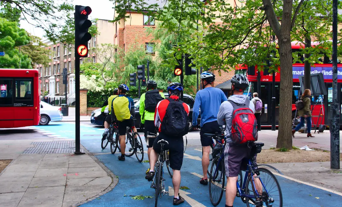
Launched to much fanfare last month, London’s two new cycle superhighways are being touted as safe, fast and more direct journeys into the city centre. However, my recent trip down the CS3 – which links Barking in the east to London’s famous Tower Bridge – raised some questions over the ‘super’ status of these lanes. As the above image shows, the CS3 begins in an understated manner, with its 9 mile route offering moments of perfection and incredible frustration in equal doses.

Dotted along the route are these guides telling you your location and the time required to get to key points along the superhighway. The timescales provided are realistic – I was able to cycle the entire route in 45 minutes, compared to their projected time of 55 minutes.

At its most eastern point, the CS3 runs alongside a motorway, raised at a similar level to the pavement and about 1.5 metres wide. Not the best views or source of fresh air, but much better than sharing the road with cars and lorries.

At points, the CS3 veers away from the motorway, running alongside fields and passing underneath junctions.

The route is intermittently dotted with promotional banners highlighting its corporate sponsor.

Unfortunately, not all junctions can be passed underneath, increasing journey times by leaving cyclists to cross at pedestrian crossings.

And at points, the bright blue lanes stop completely, meaning pedestrians and cyclists have to share the same space for portions of the route, with little visual clues for cyclists as to which direction the route is following.

Whilst the minimum width of 1.5 metres is adequate for most of the route, on corners such as this it is not enough, with the risk of collision between turning cyclists being high.

As the route gets closer to London’s city centre, it becomes sporadic. This pavement, for example, is also the CS3, despite there being no signage illustrating this to either pedestrians or cyclists.

As the pavement comes to an end, white lines appear guiding cyclists back onto the road, where blue squares illustrate that the CS3 is now being shared with a road instead of a pavement.

This shared road then takes a turn into a gated area, where cyclists have to wait for an attendant to raise a barrier before they can continue with their journey.

Once passed the barrier, the CS3 travels through a public courtyard with tiny blue squares painted on it to illustrate to cyclists which route they need to follow.

The CS3 then continues to be shared with a road, albeit a very quiet one in this case.

As the route gets closer to central London, defined cycle lanes at road level begin to emerge.

At this point, road-sharing re-emerges, as do sections of the CS3 raised from road level.

With around 1.5 miles left until the CS3 reaches London’s centre, separate cycle lanes appear consistently.

Road crossing points clearly demonstrate their purpose to cyclists and road-users, although a consistent cycle lane would be ideal.

Over the final mile, the CS3 is raised from the road and wide enough for overtaking. In this form, it is cyclist perfection and a frustrating example of the standard that could have been achieved across the entire route.
Rotterdam and the Bicycle