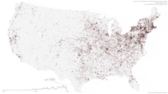
This is a visualization of US expansion in North America from 1700 to 1900, seen through changes in the spatial distribution of post offices.
Data from the USPS Postmaster Finder, with lat/long coordinates extracted from placenames through correlation with the USGS Geographic Names Information System.
Better in HD! Made with Processing. More at blog.dwtkns.com/2011/posted/
Update: I've also uploaded an interactive version of this map at blog.dwtkns.com/2011/posted_interactive/